Ancient World Trade Routes
Begin
14 pages · ~28 min
Ancient World Trade Routes
This training explores the ancient trade routes that interconnected civilizations, examining their cultural, economic, and historical impacts for learners interested in world history.
What you’ll learn
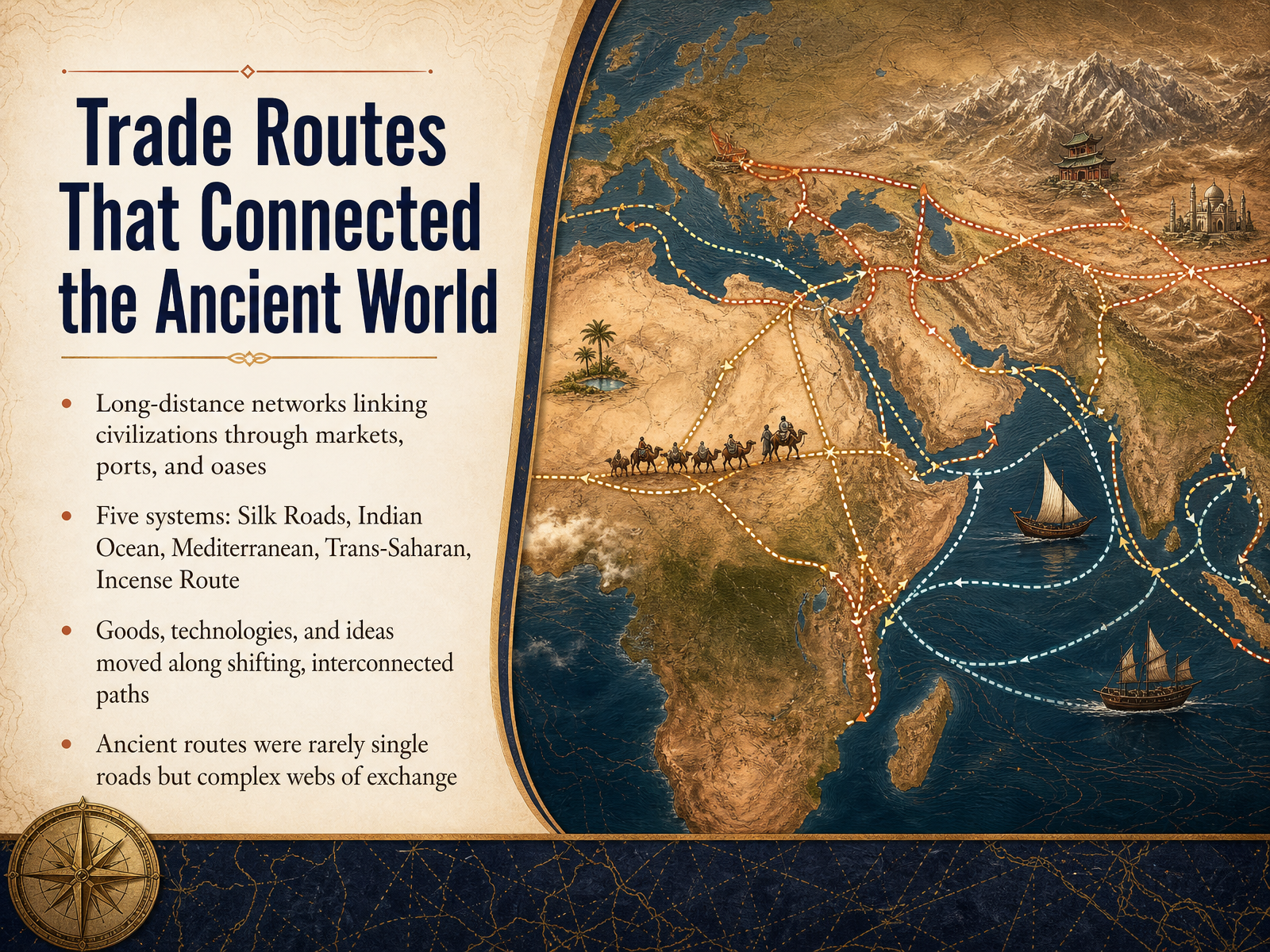
- 01Trade Routes That Connected the Ancient WorldWelcome to this course on the trade routes that connected the ancient world. When we imagine ancient civilizations, we often picture them as separate worlds, each with its own borders, rulers, and stories. But the more we look at the evidence, the clearer it becomes: long before airplanes or shipping containers, people were already moving goods, technologies, and ideas across astonishing distances. These connections followed networks of markets, ports, and desert oases rather than single highways. In this course, we will focus on five major systems: the Silk Roads, the Indian Ocean network, the Mediterranean world, the Trans-Saharan routes, and the Incense Route. Each one worked differently, shaped by winds, camels, rivers, and local merchants. Together they formed what we might call a web of exchange, where a spice from India could end up in a Roman kitchen, or a technology from China could change how people wrote on the other side of the world. So as we begin, I invite you to think of these routes not as lines on a map, but as living channels of human connection. In the next slide, we will look at what actually made a trade route work.cambridge.orgeolss.netannualreviews.org+21 min
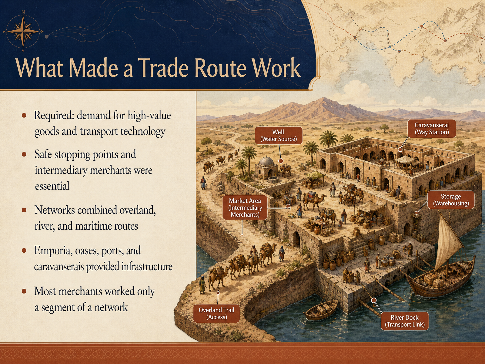
- 02What Made a Trade Route WorkSo what actually made these vast trade routes work? It wasn't just about having a road on a map. Three things had to come together. First, you needed strong demand at both ends for goods that were valuable but easy to carry, like silk, spices, gold, or glass. Second, you needed the technology to move them, whether that meant camel caravans or ships able to read the monsoon winds. And third, you needed safe places to pause along the way. Oasis towns, ports, and fortified inns known as caravanserais gave merchants food, water, and shelter. They also became the places where goods changed hands. Most merchants never traveled the full route. They worked just one segment, selling to the next trusted middleman. This chain of stopping points and intermediaries is what allowed a piece of silk from China, or a lump of salt from the Sahara, to travel thousands of miles. Next, we'll follow one of the most famous of these networks, the Silk Roads and its caravan cities.
 cambridge.orgeolss.netannualreviews.org+21 min
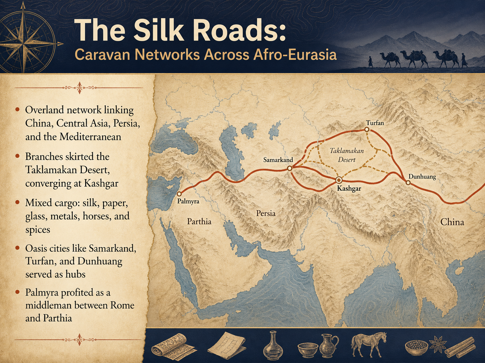
 - 03The Silk Roads: Caravan Networks Across Afro-EurasiaNow let’s turn to the most famous of these ancient highways: the Silk Roads. When we say Silk Roads, plural, that’s important. This wasn’t a single paved road, but a sprawling web of caravan tracks. Camel caravans cut across the heart of Afro-Eurasia, linking the markets of China with Persia, Central Asia, and the Mediterranean world. The geography of these routes was shaped by the brutal Taklamakan Desert. Branches had to skirt its northern and southern edges, following the line of oases that provided water and shelter. These two branches dramatically converged at a major crossroads called Kashgar. Now, despite the name, the cargo was incredibly mixed. Yes, silk was valuable, but so was paper, which China had invented. Caravans also hauled glass, metals, spices, and the powerful horses prized by armies and kings. These goods didn’t travel the whole distance by themselves. They moved from market to market, stopping in bustling oasis hubs like Samarkand, Turfan, and Dunhuang. These cities became cosmopolitan mixing pots, where merchants, monks, and pilgrims exchanged ideas alongside their goods. Further west, in the Syrian desert, the city of Palmyra grew fabulously wealthy by positioning itself as a neutral middleman, facilitating trade between two rival superpowers: Rome and Parthia. The Silk Roads were really a chain of these vibrant markets. Next, we’ll leave the desert sands behind and head out to sea to explore the Indian Ocean Maritime Network and the Monsoon System.
 en.unesco.orgen.unesco.orgdepts.washington.edu+22 min
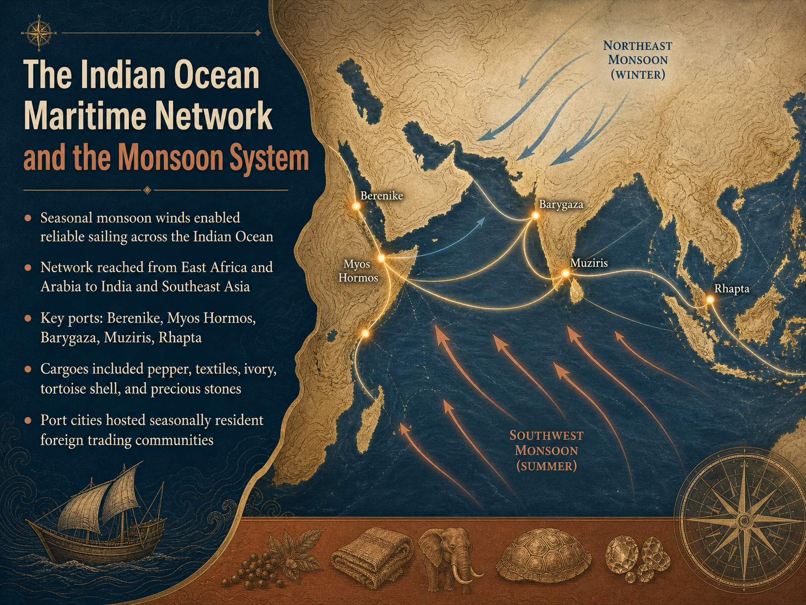
 - 04The Indian Ocean Maritime Network and the Monsoon SystemNow let's turn to one of the most remarkable systems of the ancient world, the Indian Ocean maritime network. What made this vast network possible was something beautifully simple: the monsoon winds. These seasonal winds blew reliably southwest in the summer and northeast in the winter, allowing sailors to plan long voyages with remarkable confidence. Ships departing Egypt in July could ride the winds across open water and reach India by September, then wait for the winds to shift before returning home. This network stretched from the Red Sea ports of Berenike and Myos Hormos in Egypt down the East African coast to Rhapta, and eastward to Barygaza and Muziris on India's western coast. The cargoes were extraordinary: pepper from Kerala, cotton textiles, ivory, tortoise shell, and precious stones like sapphires and beryl. What's especially striking is that port cities became truly cosmopolitan spaces. Excavations at Berenike have uncovered Tamil graffiti, Indian cooking pots, and even a seven and a half kilogram jar of peppercorns, evidence that Indian merchants lived and worked in Egypt for months at a time while waiting for the winds to turn. These seasonal communities of foreign traders represent one of the earliest examples of sustained cultural exchange across the ocean. Next, we'll explore how Rome and Egypt managed this corridor through the remarkable Periplus of the Red Sea.
 cambridge.orgsourcebooks.fordham.eduannualreviews.org+22 min
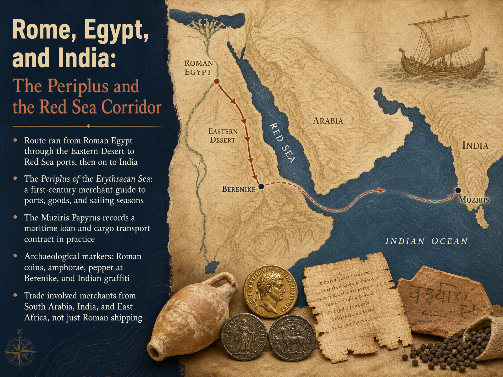
 - 05Rome, Egypt, and India: The Periplus and the Red Sea CorridorNow let's zoom in on one of the most fascinating corridors of the ancient world: the route connecting Rome, Egypt, and India. Imagine a shipment of pepper leaving a port in southern India, crossing the Arabian Sea, and landing at Berenike on Egypt's Red Sea coast. From there, it traveled by camel caravan through the Eastern Desert to the Nile, and finally reached Alexandria. This entire journey is documented in a remarkable text called the Periplus of the Erythraean Sea. Written in the first century, it was essentially a merchant's handbook, listing ports, local goods, and the best sailing seasons. Another key document, the Muziris Papyrus, reveals the business side of this trade. It records a massive maritime loan and a contract for shipping cargo from India back to Egypt. Archaeology supports these texts beautifully. At Berenike, excavators found Roman coins, amphorae, and even a jar holding over seven kilograms of black peppercorns. They also uncovered graffiti written in Tamil, proof that Indian merchants lived and worked in these ports. It is important to remember this was not simply Roman shipping. Merchants from South Arabia, India, and East Africa were all active participants in a truly interconnected network. Next, we will shift our focus to the Mediterranean Sea routes of the Phoenicians, Greeks, and Romans.
 cambridge.organcientportsantiques.comrepository.uwtsd.ac.uk+22 min
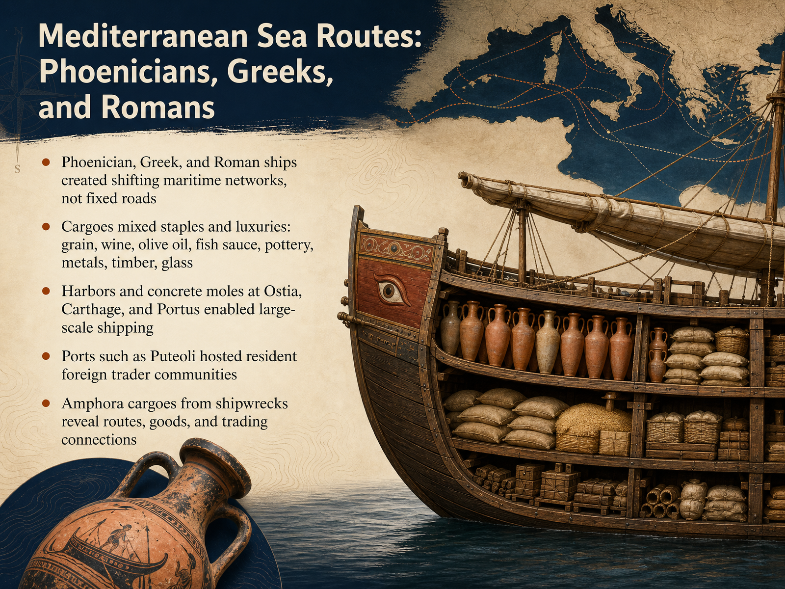
 - 06Mediterranean Sea Routes: Phoenicians, Greeks, and RomansLet's now move from land and river routes to the open water of the Mediterranean. Here, Phoenician, Greek, and Roman ships created not fixed roads, but shifting maritime networks that linked distant shores. Their cargoes were a rich mix of staples and luxuries. Imagine hulls loaded with grain, wine, and olive oil alongside fish sauce, pottery, metals, timber, and glass. To support this scale of shipping, engineers built impressive harbors. At Ostia, Carthage, and Portus, massive concrete moles reached into the sea, allowing large vessels to dock safely. At ports like Puteoli, resident communities of foreign traders grew up, creating a truly cosmopolitan world. And how do we know all this? Shipwrecks. The amphoras, the large ceramic jars found on the seabed, act like time capsules. They reveal the goods, the routes, and the connections of this vibrant ancient economy. Next, we'll journey south to explore the Trans-Saharan trade in gold, salt, and caravans.
 cambridge.orgcambridge.org2 min
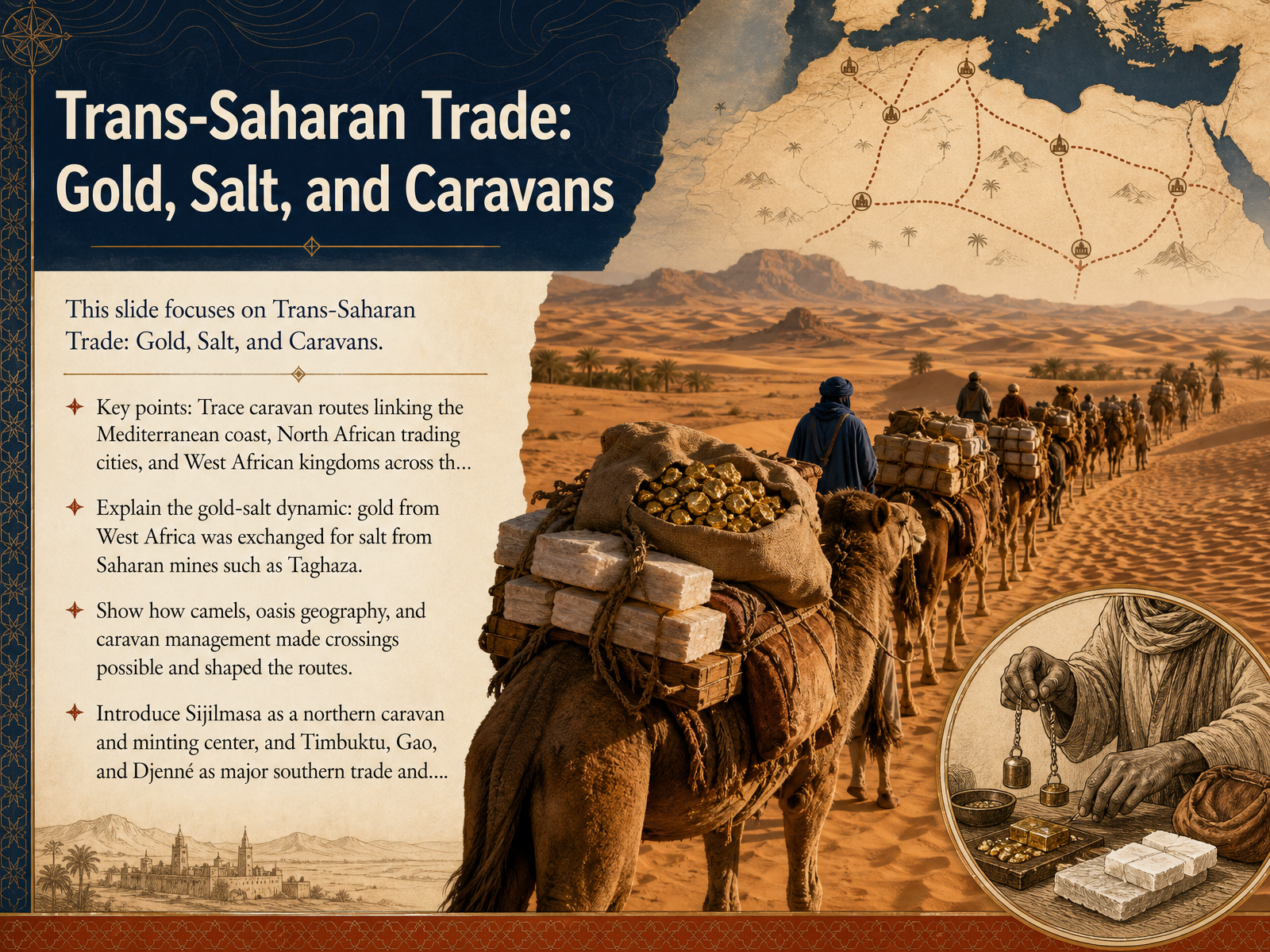
 - 07Trans-Saharan Trade: Gold, Salt, and CaravansNow let's cross one of the most demanding landscapes in human history, the Sahara. The trans-Saharan routes linked the Mediterranean coast and North African cities with the kingdoms of West Africa. At the center of it all was a beautifully simple exchange. West Africa had abundant gold. The Sahara had salt, mined in places like Taghaza. In the markets of Timbuktu, the two were sometimes traded almost weight for weight. Camels made these crossings possible. They could endure the heat and go long stretches without water. But the real key was the oasis. Travelers moved from one water source to the next, while experienced guides and careful planning kept caravans alive. Some caravans numbered a thousand camels or more. At the northern edge, Sijilmasa became a major caravan center and mint. Much of West African gold passed through there before reaching Mediterranean ports. To the south, Timbuktu, Gao, and Djenne grew into major centers of trade and learning. The Sahara was not a barrier. It was a bridge, built on gold, salt, and extraordinary human organization. Next we turn east to explore the Incense Route and the Arabian Trade Network.
 2 min
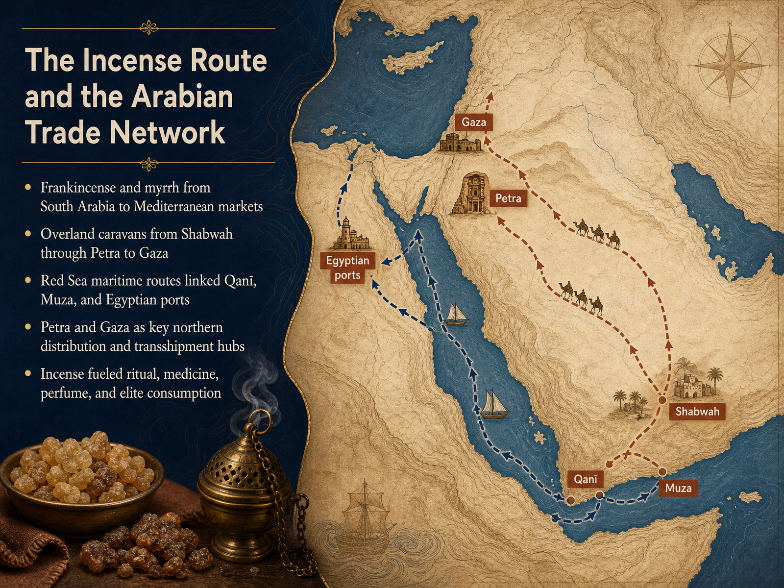
2 min - 08The Incense Route and the Arabian Trade NetworkNow let's turn to one of the most fragrant chapters in ancient trade: the Incense Route and the Arabian network. This system was built around two precious resins, frankincense and myrrh, harvested mainly in southern Arabia and the Horn of Africa. From places like Shabwah, caravans moved north overland through Petra and on to Gaza, a journey that could take months. Petra and Gaza became vital hubs, where goods were sorted, taxed, and reloaded for Mediterranean markets. Along the Red Sea, ports like Qani and Muza connected to Egyptian harbors, offering a faster maritime alternative. These resins were not just pleasant smells. They fueled temple rituals, medicine, perfume making, and the tastes of elites across the ancient world. So the Incense Route was never a single road; it was a living network shaped by demand, geography, and careful logistics. Next, we'll look at what actually moved along these routes: the goods, technologies, and ideas that traveled with the caravans and ships.
 cambridge.orgeolss.netannualreviews.org+22 min
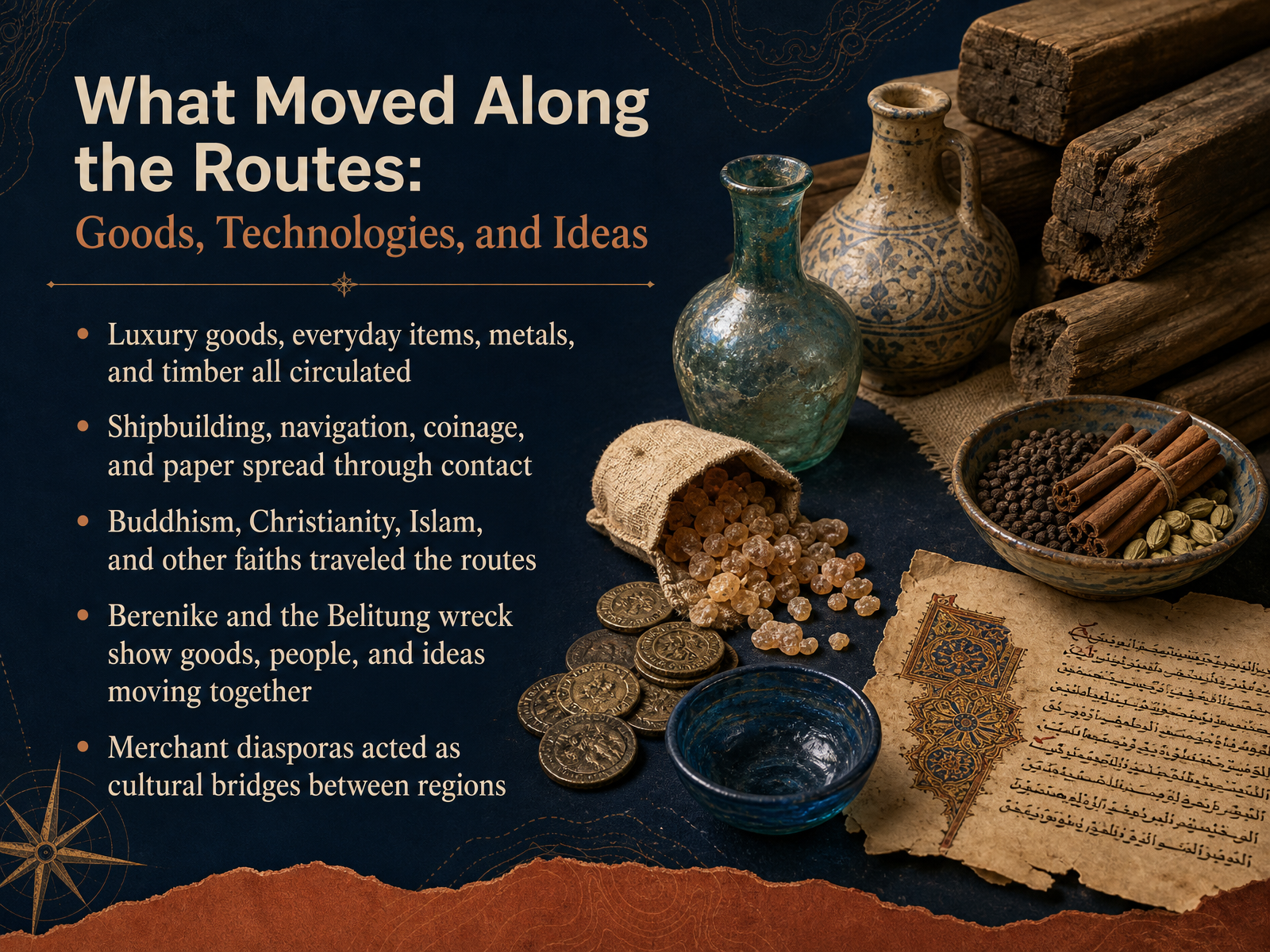
 - 09What Moved Along the Routes: Goods, Technologies, and IdeasNow let us look at what actually moved along these routes. It was never just about silk or spices. Luxury goods traveled beside everyday items, metals, and timber. A single ship could carry Chinese ceramics, Indian pepper, Arabian incense, and Egyptian glassware together. Technologies also spread through contact. Shipbuilding methods, navigation techniques, coinage, and paper all moved from one region to another as people shared what they knew. Ideas traveled just as far. Buddhism moved from India into Central Asia and China. Christianity and Islam spread along both land and sea corridors. Faiths became portable, carried by merchants and pilgrims rather than tied to one temple or city. Two examples bring this alive. At Berenike on the Red Sea, archaeologists found Indian pepper, Tamil writing, and even a Buddha statue. The Belitung shipwreck off Indonesia held a vast cargo of Chinese goods aboard an Arab-built vessel. These finds show goods, people, and ideas moving together as one connected system. Merchant communities themselves became cultural bridges, living in foreign ports, learning local languages, and linking distant regions. Next, we will explore how we know this, through evidence and methods in ancient trade studies.
 cambridge.orgen.unesco.orgen.unesco.org+22 min
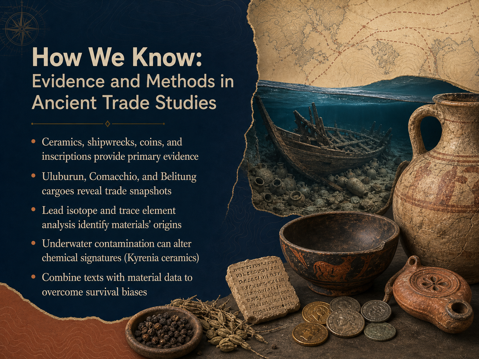
 - 10How We Know: Evidence and Methods in Ancient Trade StudiesSo how do we actually know all of this? The ancient world left us clues, and our methods for reading them have become remarkably sophisticated. Often the evidence is physical. Pottery shards, sunken ships, scattered coins, and carved inscriptions act as primary sources, direct fingerprints of trade in action. Some shipwrecks are like time capsules. The Uluburun, Comacchio, and Belitung cargoes each offer a snapshot of commerce on a specific day, sometimes thousands of years ago. But we read those snapshots with hard science. Lead isotope and trace element analysis lets us match metal objects to the exact mines where their ore was dug. That is how we know Roman lead ingots came from Greece, or Ming Dynasty coins from southern China. Yet science has limits. Underwater contamination can alter chemical signatures over centuries. At the Kyrenia shipwreck, ceramics absorbed lead from the ship's own hull sheathing, confusing their origin story. So the best practice is to combine texts with material data. Written records guide our questions, and physical evidence corrects their biases, giving us a truer picture of ancient connectivity. Next, we will step back and compare these networks side by side, looking at their scale, speed, and geography.
 cambridge.organcientportsantiques.comrepository.uwtsd.ac.uk+21 min
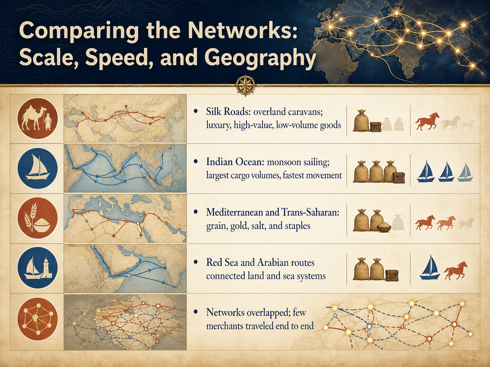
 - 11Comparing the Networks: Scale, Speed, and GeographyNow let's step back and compare these networks side by side. The Silk Roads are perhaps the most famous, with their overland caravans moving high-value, low-volume goods like silk, gems, and spices. But this was a slow, relay-style system, with goods passing through many hands. The Indian Ocean was a very different story. Thanks to the predictable monsoon winds, ships carried the largest cargo volumes and moved them the fastest. Imagine a single ship carrying more grain than a hundred camels. The Mediterranean and Trans-Saharan routes, by contrast, were vital for staples: grain, gold, salt, and everyday goods that kept empires fed and economies running. And the Red Sea and Arabian routes acted as crucial connectors, stitching the land and sea systems together. Here's the big takeaway: these networks overlapped and fed into one another. Very few merchants ever traveled end to end. Instead, goods, ideas, and beliefs moved through a chain of regional specialists. This interconnected system laid the groundwork for wealth and power in key cities. Let's look at some of those trading hubs next.
 cambridge.orgeolss.netannualreviews.org+21 min
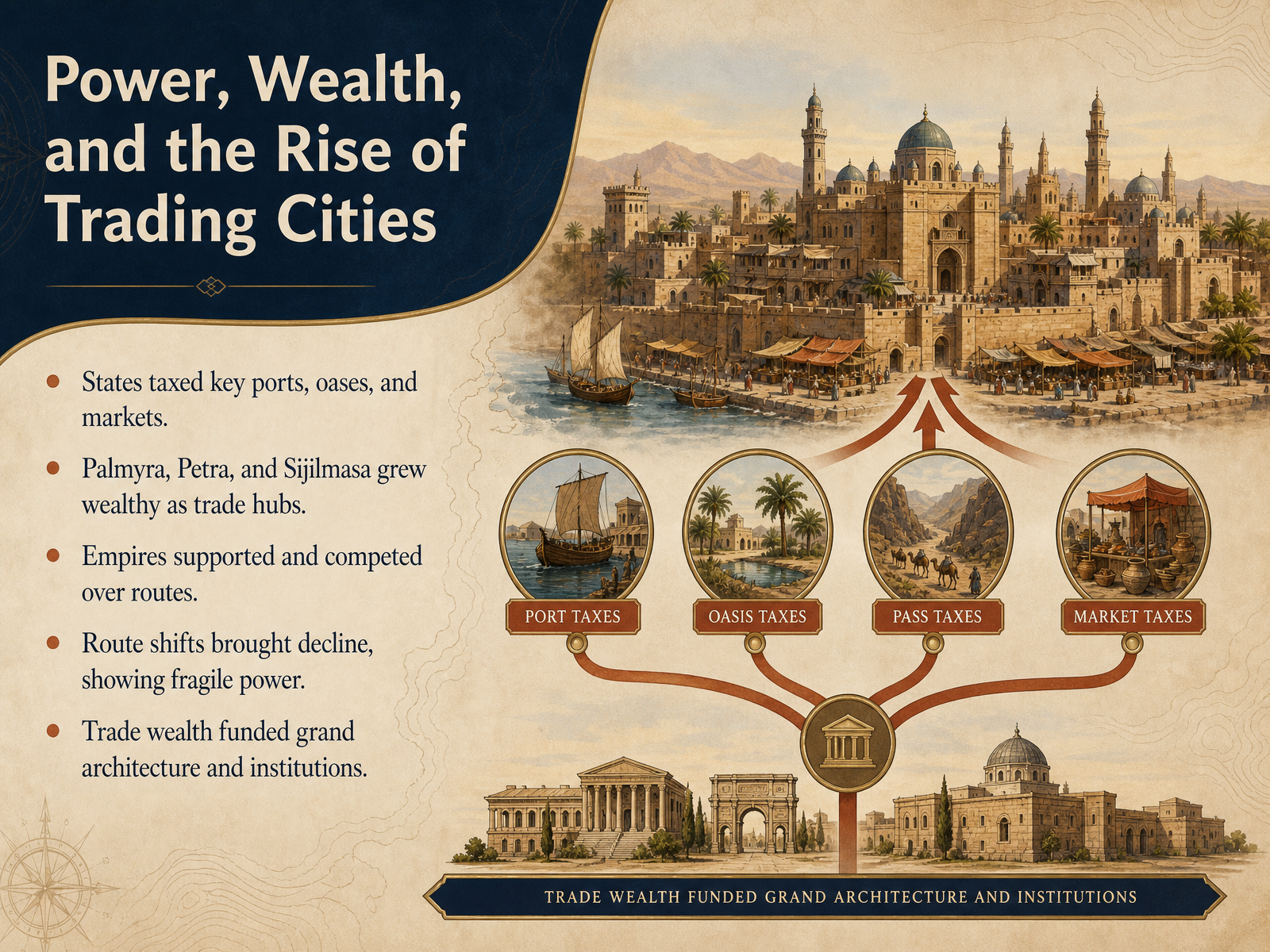
 - 12Power, Wealth, and the Rise of Trading CitiesPower on these routes rarely came from an army alone. More often, it came from controlling a place that merchants could not avoid. States learned this quickly. They taxed key ports, desert oases, and crowded markets. A single caravan or a single ship could bring enough revenue to fund a royal court, a standing garrison, or an entire building campaign. Cities like Palmyra in the Syrian desert, Petra in the rocky valleys of Jordan, and Sijilmasa at the edge of the Sahara were not just stops on a map. They became wealthy because they sat exactly where traveling merchants had to rest, trade, and pay fees. Their fortunes were dazzling, but fragile. When empires shifted their support, or when a rival route became safer or cheaper, the caravans could simply go elsewhere. Palmyra declined when political stability broke down. Sijilmasa faded when trade patterns changed. This is the quieter lesson of ancient trade. Wealth could build grand temples, long colonnades, public baths, and libraries, but the cities themselves often rested on routes that were always moving. And those routes were kept alive by ordinary people, the merchants, sailors, guides, and local families we will meet next.
 en.unesco.orgen.unesco.orgdepts.washington.edu+22 min
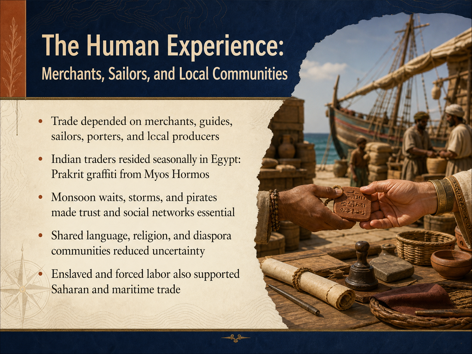
 - 13The Human Experience: Merchants, Sailors, and Local CommunitiesLet's turn our attention from the routes themselves to the people who made them work. For every ship that crossed the Arabian Sea, there were countless merchants, guides, sailors, porters, and local producers whose lives were intertwined with this vast network. At the Egyptian port of Myos Hormos, excavations have uncovered Prakrit graffiti, which tells us that Indian traders lived there seasonally, managing their affairs while waiting for the monsoon winds to shift. These seasonal waits, combined with the ever-present risks of storms and pirates, meant that social networks, trust, and shared connections were not just helpful, they were essential for survival. In many cases, shared language and religion helped reduce uncertainty, as communities of expatriate merchants formed lasting ties in foreign ports. However, we must also remember that this world was not supported by free labor alone. Enslaved and forced labor played a major and often unacknowledged role, whether on Saharan caravans or aboard the ships of the Indian Ocean trade. In the next and final slide, we will look at the legacy of these routes and why their history still resonates with us today.
 cambridge.orgsourcebooks.fordham.eduannualreviews.org+21 min
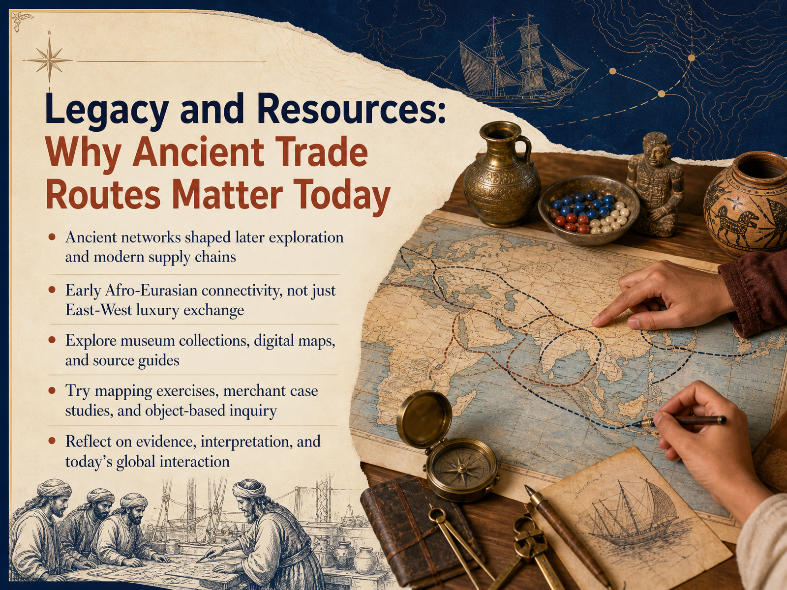
 - 14Legacy and Resources: Why Ancient Trade Routes Matter TodaySo we end where we began, with a simple but powerful realization. The trade routes of the ancient world were never just about moving silk, pepper, or gold. They were about connection. Picture a merchant in Palmyra or a sailor catching the monsoon winds toward India. Each journey wove a thread into a vast Afro-Eurasian network, one that shaped languages, religions, technologies, and even the food on our tables today. In fact, the global supply chains we rely on now are direct descendants of those early networks. But here is the exciting part. You do not have to stop with this course. You can explore museum collections, interactive digital maps, and source guides to keep tracing these connections yourself. Try a mapping exercise that plots an ancient route. Follow a merchant case study. Or sit with a single object, a coin, a jar, a scrap of textile, and ask what it reveals about human exchange. As you do, reflect on a question that still matters deeply today. How do we interpret evidence of long-distance contact, and what does our own global interaction owe to these ancient foundations? Thank you for joining this journey through the routes that first brought our world together. Keep exploring, because the map is far from finished.
 cambridge.orgeolss.netannualreviews.org+22 min
Take the deck with you
Download this course as a file — free, no sign-up needed.
- PDF handoutEvery slide page, ready to print or share.15 pages · 6.9 MBDownload
- Narrated PowerPointThe deck that presents itself — every slide carries the digital human's narration video.15 pages · 20.0 MBDownload
- PowerPoint slidesThe full deck as a .pptx — open it in PowerPoint, Keynote, or Google Slides.15 pages · 6.9 MBDownload
Free to use in your own training — please keep the PersonWise credit page at the end.
Have your own deck? Turn it into a course
Sources consulted
Web sources consulted while building this course.
- Trade and Civilisation — cambridge.org
- The Silk Roads: Afro-Eurasian Connectivity Across the Ages — eolss.net
- Recent Developments in the Archaeology of Long-Distance Connections Across the Ancient Indian Ocean | Annual Reviews — annualreviews.org
- Trade between the Romans and the Empires of Asia - The Metropolitan Museum of Art — metmuseum.org
- AP® World History Review: Comparison of Economic ... — albert.io
- The Silk Road: A New History — en.unesco.org
- Palmyra | Silk Roads Programme — en.unesco.org
- Essay.html — depts.washington.edu
- Palmyra as a Caravan City — depts.washington.edu
- Behind gold for pepper: The players and the game of Indo-Mediterranean trade — cambridge.org
- Internet History Sourcebooks Project: Ancient History — sourcebooks.fordham.edu
- The Muziris Papyrus and the Eastern Maritime Trade in High Roman Empire Economy — teajcs.com
- Connected Hinterlands — art.torvergata.it
- Indo-Roman trade: the ceramic evidence from Egypt | Antiquity | Cambridge Core — cambridge.org
- https://www.ancientportsantiques.com/wp-content/uploads/Documents/PLACES/RedSea/RedSea-Tomber2012.pdf — ancientportsantiques.com
- BALANCING THE TRADE: ROMAN CARGO SHIPMENTS TO INDIA — repository.uwtsd.ac.uk
- The Chronology of Roman Trade in the Indian Ocean from — repository.uwtsd.ac.uk
- THE SHIPS AND SHIPPING OF INDO-ROMAN TRADE — eprints.soton.ac.uk
- Maritime Networks, Connectivity, and Mobility in the Ancient Mediterranean (Chapter One) - Maritime Networks in the Ancient Mediterranean World — cambridge.org
- Maritime Networks in the Ancient Mediterranean World — cambridge.org