Begin
14 pages · ~28 min
Groundwater and Aquifers Fundamentals
Learn how groundwater moves through and is stored in aquifers, and why these hidden water resources matter for sustainable water management.
A digital instructor presents all 14 pages. Hold “Ask” at any point and ask out loud — the answer comes from this course. No sign-up needed.
What you’ll learn
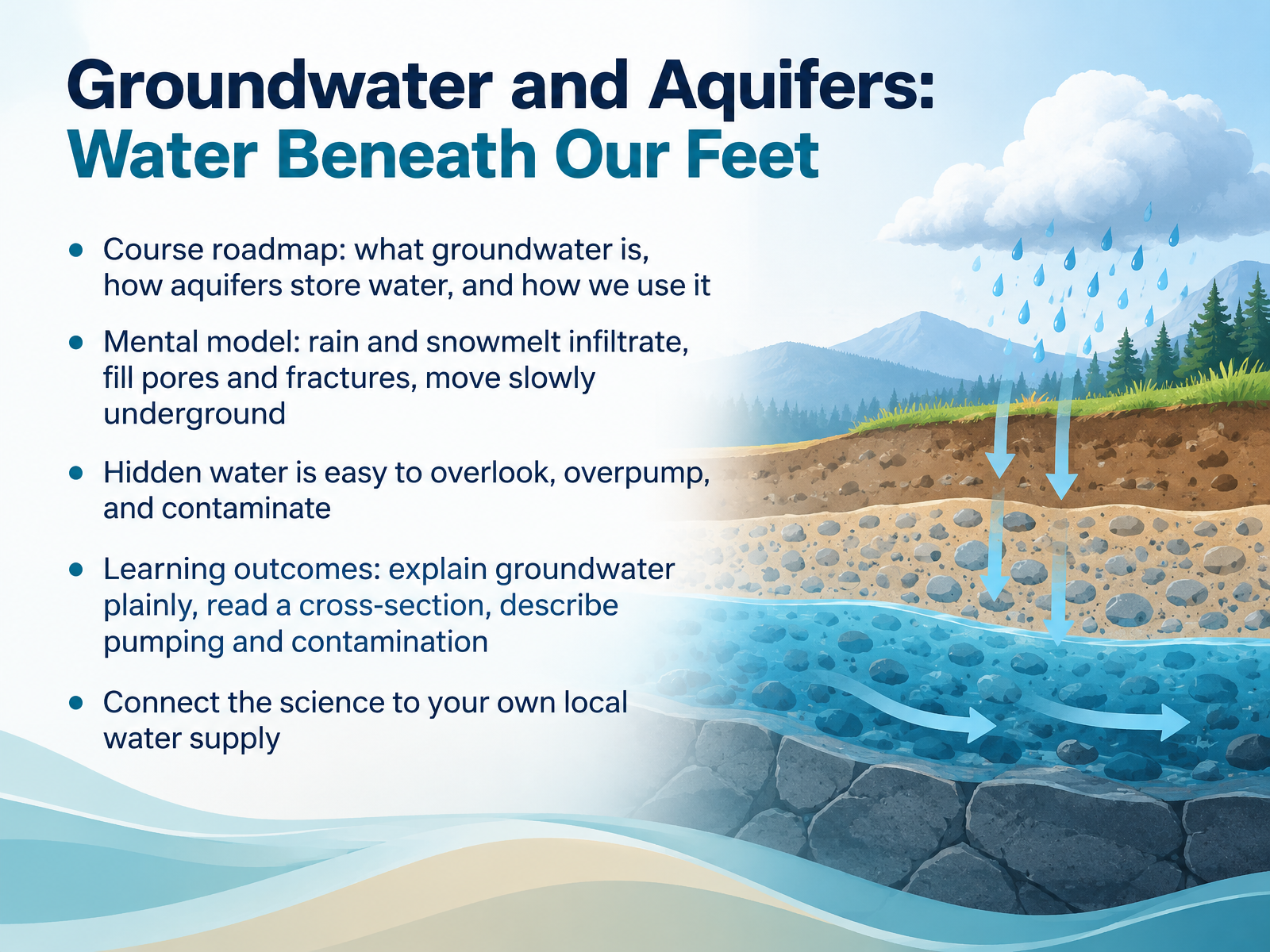
- 01Groundwater and Aquifers: Water Beneath Our FeetWelcome. I'm glad you're here. Today we're exploring groundwater and aquifers, the water beneath our feet. Here's our roadmap. We'll learn what groundwater is, how aquifers store it, and how we use it every day. Picture this mental model. Rain and snowmelt soak into the ground, filling tiny pores and cracks in soil and rock, then move slowly underground. Because that water is hidden, it's easy to overlook, overpump, and contaminate. By the end, you'll be able to explain groundwater plainly, read a cross section, and describe pumping and contamination. You'll also connect the science to your own local water supply, so think about where your tap water comes from. Next, let's look at the invisible reservoir in the water cycle.usgs.govusgs.govusgs.gov+21 min
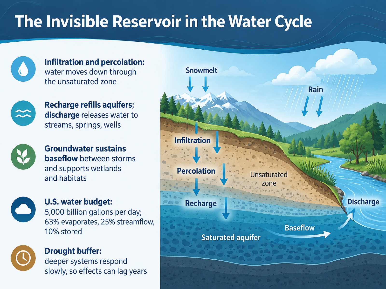
- 02The Invisible Reservoir in the Water CycleNow let's look at where groundwater fits within the water cycle. Water at the surface soaks into the ground through infiltration and moves downward through the unsaturated zone, a process called percolation. When that water refills an aquifer, we call it recharge. And when aquifers release water, we call that discharge, which feeds streams, springs, and wells.
Here's why that matters. Groundwater keeps rivers flowing between storms, sustaining what we call baseflow, and it supports wetlands and habitats. Across the United States, about five thousand billion gallons of water enter as precipitation each day. Roughly sixty three percent evaporates, twenty five percent becomes streamflow, and about ten percent is stored in surface water or groundwater.
Think of groundwater as a drought buffer. Deeper systems respond slowly, so the effects of drought can lag by years. That means what you see today may reflect conditions from long ago.
 usgs.govusgs.govusgs.gov+22 min
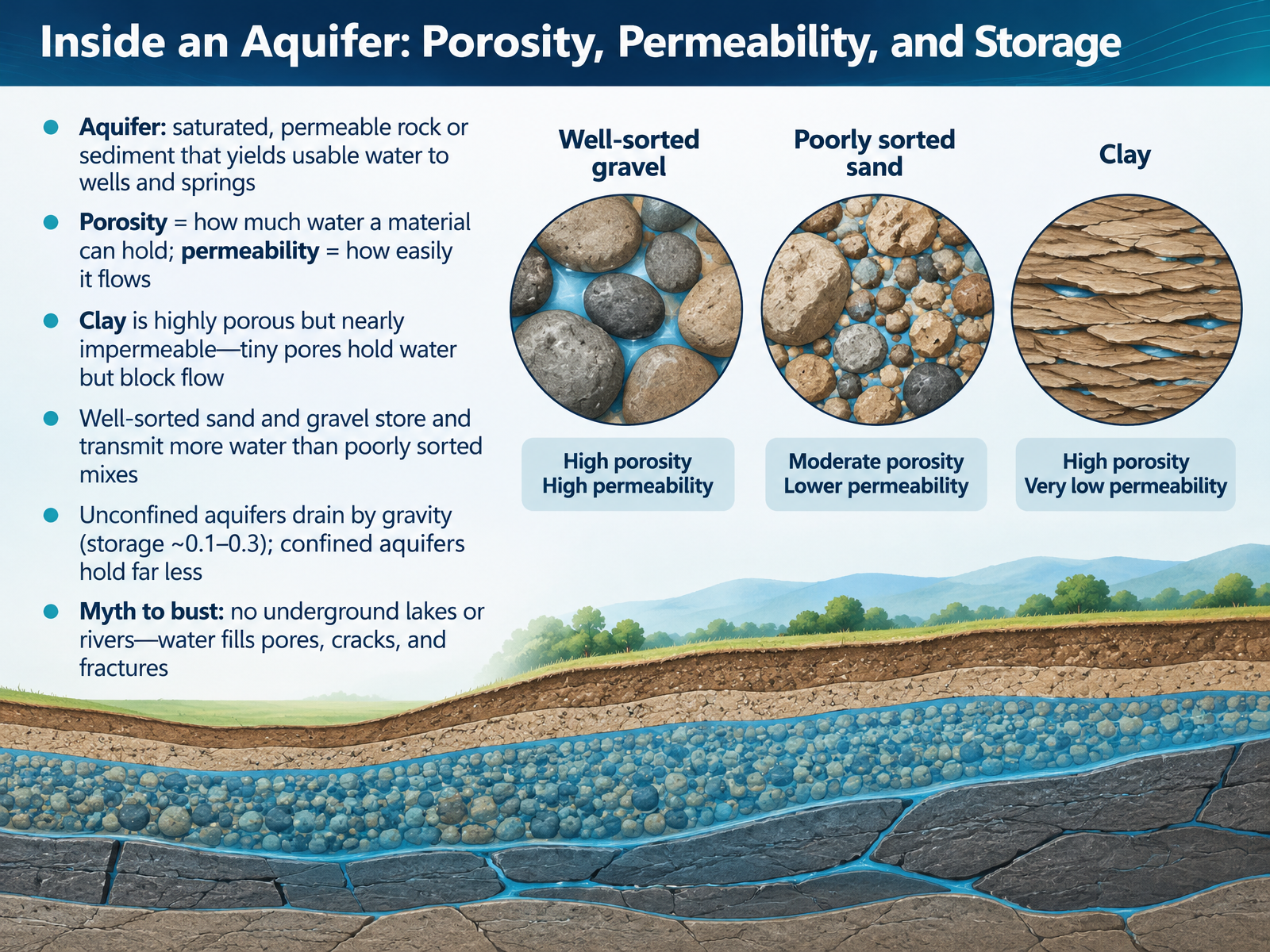
- 03Inside an Aquifer: Porosity, Permeability, and StorageLet's go inside an aquifer and see what actually holds and moves the water. An aquifer is saturated, permeable rock or sediment that yields usable water to wells and springs. Two properties do most of the work here. Porosity is how much water a material can hold. Permeability is how easily water flows through it. Here's a helpful contrast: clay is highly porous but nearly impermeable. Its tiny pores hold water, but they block flow. Now picture well-sorted sand and gravel, where the grains are similar in size. They store and transmit more water than poorly sorted mixes, where small grains fill the gaps. Storage also differs by type. Unconfined aquifers drain by gravity, with storage around one tenth to three tenths. Confined aquifers hold far less. And one myth to bust: there are no underground lakes or rivers. Water fills pores, cracks, and fractures. Next, we'll compare unconfined versus confined aquifers and the water table.
 usgs.govusgs.govusgs.gov+21 min
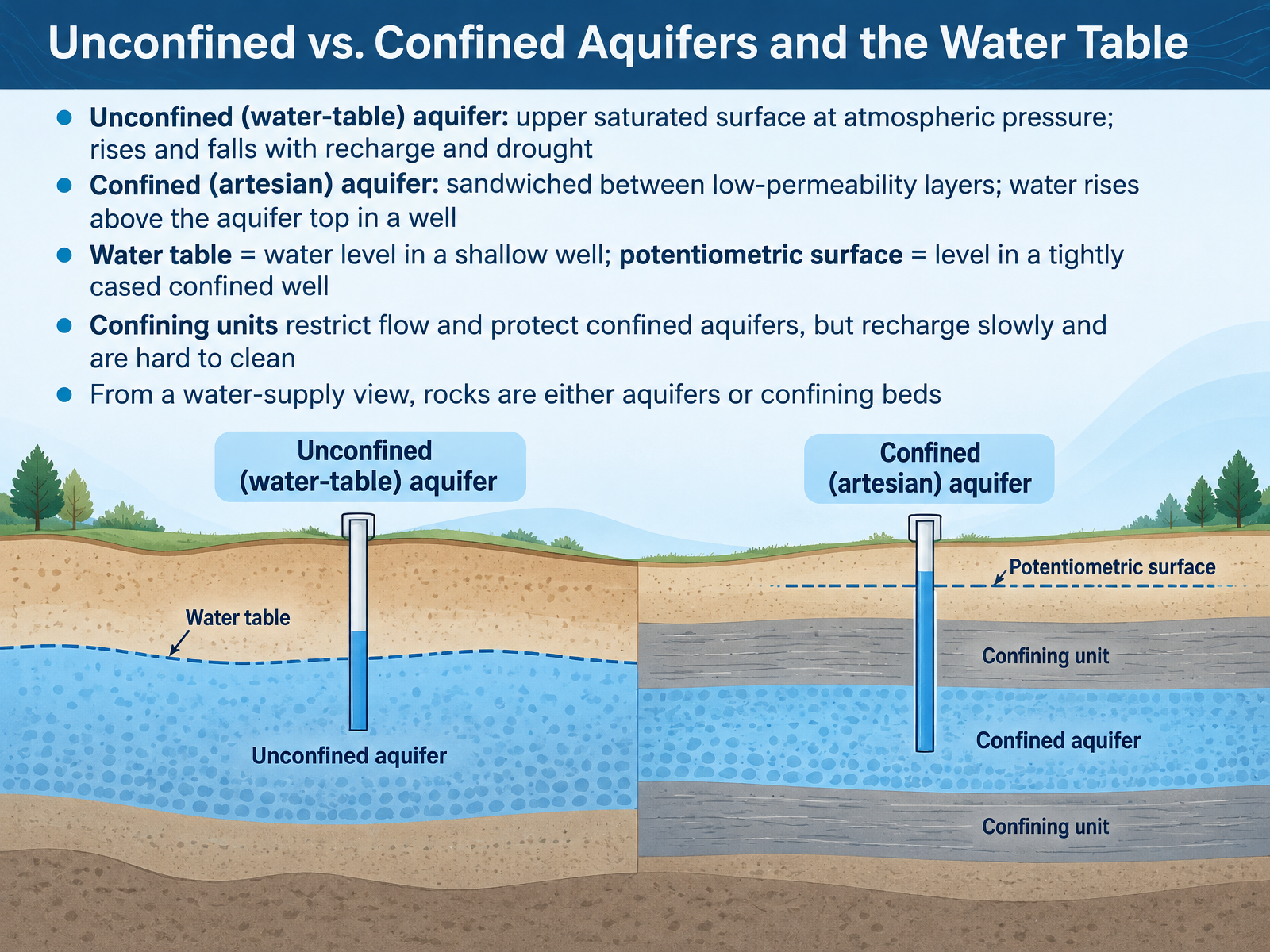
- 04Unconfined vs. Confined Aquifers and the Water TableNow let's look at how groundwater is stored below the surface. Think of two kinds of aquifers. An unconfined aquifer, also called a water-table aquifer, has an upper surface open to the atmosphere. That surface is the water table, and it rises and falls with rain and drought. A confined, or artesian, aquifer is sandwiched between low-permeability layers. Water there is under pressure, so in a well it rises above the top of the aquifer. The water level in a shallow well shows the water table. In a tightly cased confined well, it shows the potentiometric surface. Confining units slow flow and help protect confined aquifers, but recharge is slow and cleanup is hard. From a water-supply view, rocks are either aquifers or confining beds. Next, we'll look at wells, springs, and how water moves underground.
 usgs.govusgs.govusgs.gov+21 min
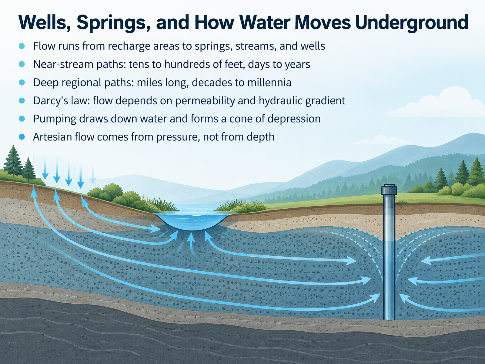
- 05Wells, Springs, and How Water Moves UndergroundNow let's follow that water to the places where we actually meet it. Groundwater flows from recharge areas, where it enters the ground, toward springs, streams, and wells. Near a stream, flow paths are often just tens to hundreds of feet long, with travel times of days to a few years. Deep regional paths can run for miles and take decades to millennia. How fast does it move? Darcy's law tells us flow depends on permeability, how easily water passes through the material, and on the hydraulic gradient, the change in water level over distance. When you pump a well, you lower the water level around it and create a cone of depression. And here is a common misconception. Artesian flow comes from pressure in a confined aquifer, not simply from depth. Deep water is not automatically artesian. So, remember the big idea. Paths are short and fast near streams, long and slow deep down, and pumping changes the picture locally. Next, we look at how geology shapes where aquifers exist, in Aquifers Across the Landscape: Geology Shapes Availability.
 usgs.govpubs.usgs.govpubs.usgs.gov+22 min
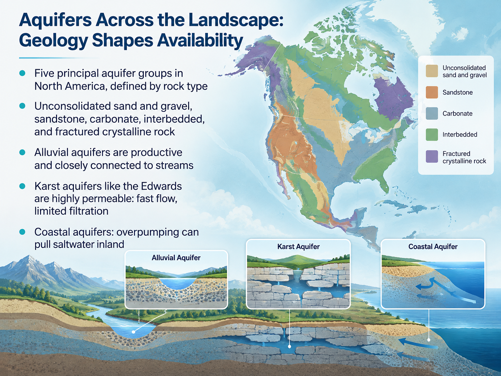
- 06Aquifers Across the Landscape: Geology Shapes AvailabilityNow let's look at how geology shapes where groundwater is available. Across North America, scientists group the principal aquifers into five main types, based on the kind of rock that holds the water: unconsolidated sand and gravel, sandstone, carbonate rock, interbedded sandstone and carbonate, and fractured crystalline rock such as granite. Think of it this way. The rock type decides how much water an aquifer can hold and how fast it moves. Alluvial aquifers, made of loose sand and gravel, are among the most productive, and they stay closely connected to streams. Karst aquifers, like the Edwards in Texas, are highly permeable, so water travels fast through dissolved cracks and caves, and that means less natural filtration. And along the coast, overpumping can pull saltwater inland. So geology sets the rules. Next, let's turn to what we actually use groundwater for.
 usgs.govusgs.govusgs.gov+22 min
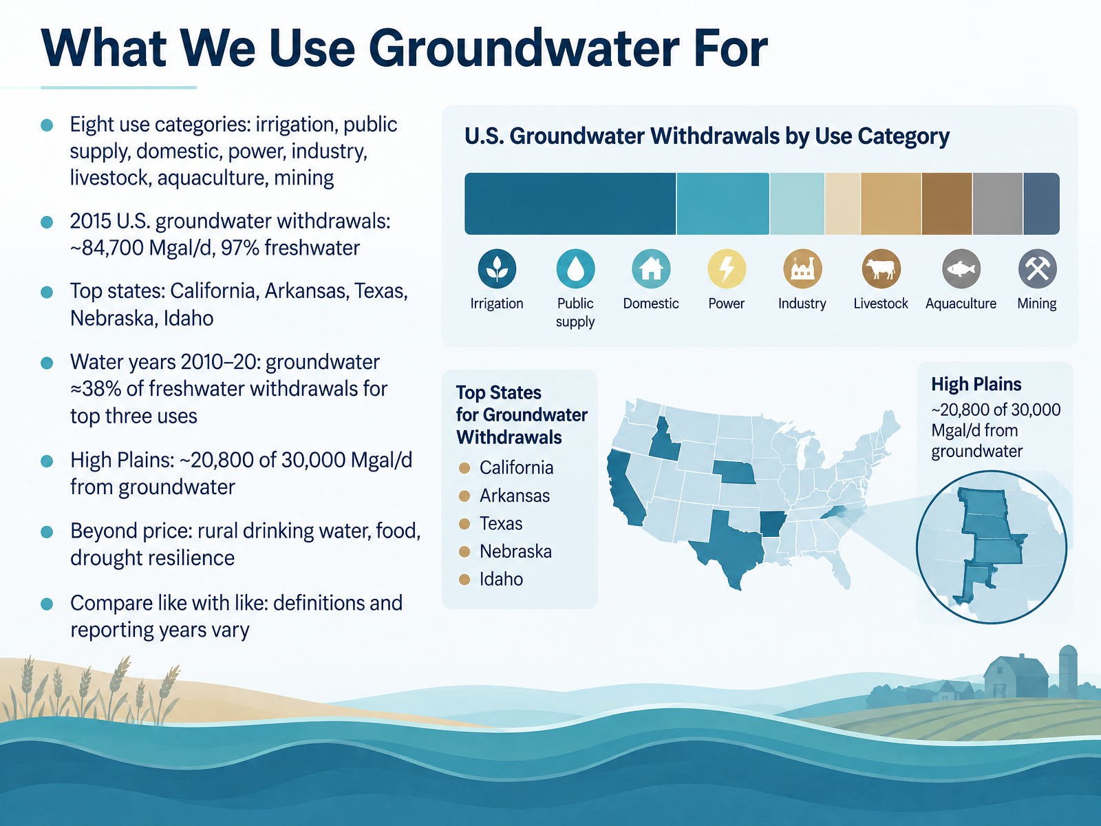
- 07What We Use Groundwater ForNow let's look at what we actually use groundwater for. The U.S. Geological Survey tracks eight categories, including irrigation, public supply, domestic wells, power, industry, livestock, aquaculture, and mining. In 2015, total groundwater withdrawals were about eighty-four thousand seven hundred million gallons per day, and ninety-seven percent of that was freshwater. California, Arkansas, Texas, Nebraska, and Idaho led the nation in groundwater withdrawals. Of the three largest use categories during water years 2010 through 2020, groundwater made up about thirty-eight percent of freshwater withdrawals. And in the High Plains, roughly twenty thousand eight hundred of thirty thousand million gallons per day came from groundwater. Beyond the numbers, groundwater supports rural drinking water, food production, and drought resilience. Just remember to compare like with like, because definitions and reporting years vary. Next, we'll see what happens when groundwater is withdrawn too fast.
 2 min
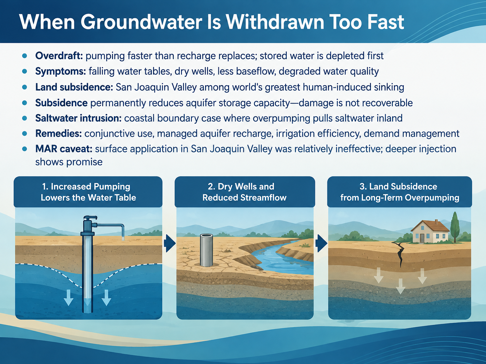
- 08When Groundwater Is Withdrawn Too FastNow let's look at what happens when groundwater is withdrawn too fast. We call that overdraft. Pumping outpaces recharge, so the stored water gets depleted first. What are the symptoms? Water tables fall, wells run dry, streams lose baseflow, and water quality can degrade. In some places, the ground itself sinks. Land subsidence in California's San Joaquin Valley is among the greatest human-induced sinking in the world. And here's the hard part. Subsidence permanently reduces an aquifer's storage capacity. That damage is not recoverable. Along coasts, overpumping can also pull saltwater inland, called saltwater intrusion. So what can we do? Common remedies include conjunctive use, managed aquifer recharge, irrigation efficiency, and demand management. One caveat from the San Joaquin Valley: spreading water on the surface was relatively ineffective, but deeper injection shows real promise. Next, we turn to keeping groundwater clean.
 2 min
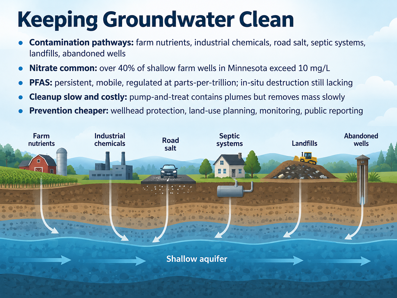
- 09Keeping Groundwater CleanNow let's look at keeping groundwater clean. Contaminants reach aquifers through many pathways: farm nutrients, industrial chemicals, road salt, septic systems, landfills, and even abandoned wells. Nitrate is one of the most common. In Minnesota, more than forty percent of shallow farm wells exceed ten milligrams per liter, the health limit. PFAS are another concern. These chemicals are persistent and mobile, regulated at parts per trillion, and we still lack reliable ways to destroy them in place. Cleanup is slow and costly. Pump and treat can contain a plume, but it removes mass slowly. Prevention is far cheaper: wellhead protection, careful land use planning, monitoring, and public reporting. Those steps keep contamination from ever reaching the water you drink. Next, we turn to managing a shared, invisible resource.
 usgs.govusgs.govusgs.gov+22 min
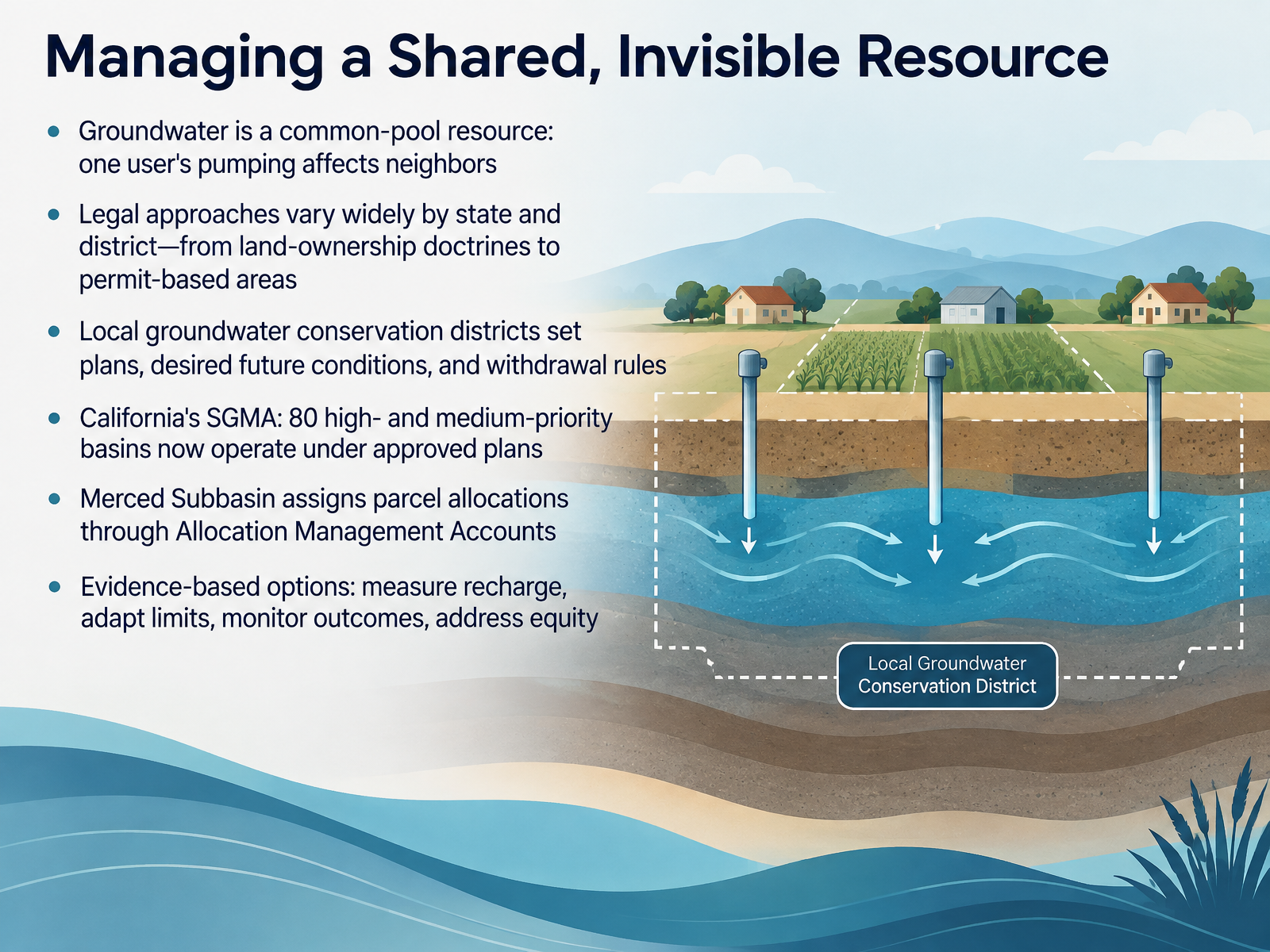
- 10Managing a Shared, Invisible ResourceNow let's talk about managing a shared, invisible resource. Groundwater is what economists call a common-pool resource. That means one user's pumping can lower the water table for everyone nearby. So how do we manage it? Legal approaches vary widely by state and district, from land-ownership doctrines to permit-based areas. Local groundwater conservation districts set plans, desired future conditions, and withdrawal rules. In California, the Sustainable Groundwater Management Act now has eighty high- and medium-priority basins operating under approved plans. The Merced Subbasin, for example, assigns parcel allocations through Allocation Management Accounts. And what makes management work? Evidence-based options: measure recharge, adapt limits, monitor outcomes, and address equity. Keep that in mind, because next we'll pull together the five core ideas worth taking away in Teachable Takeaways: Five Core Ideas.
 1 min
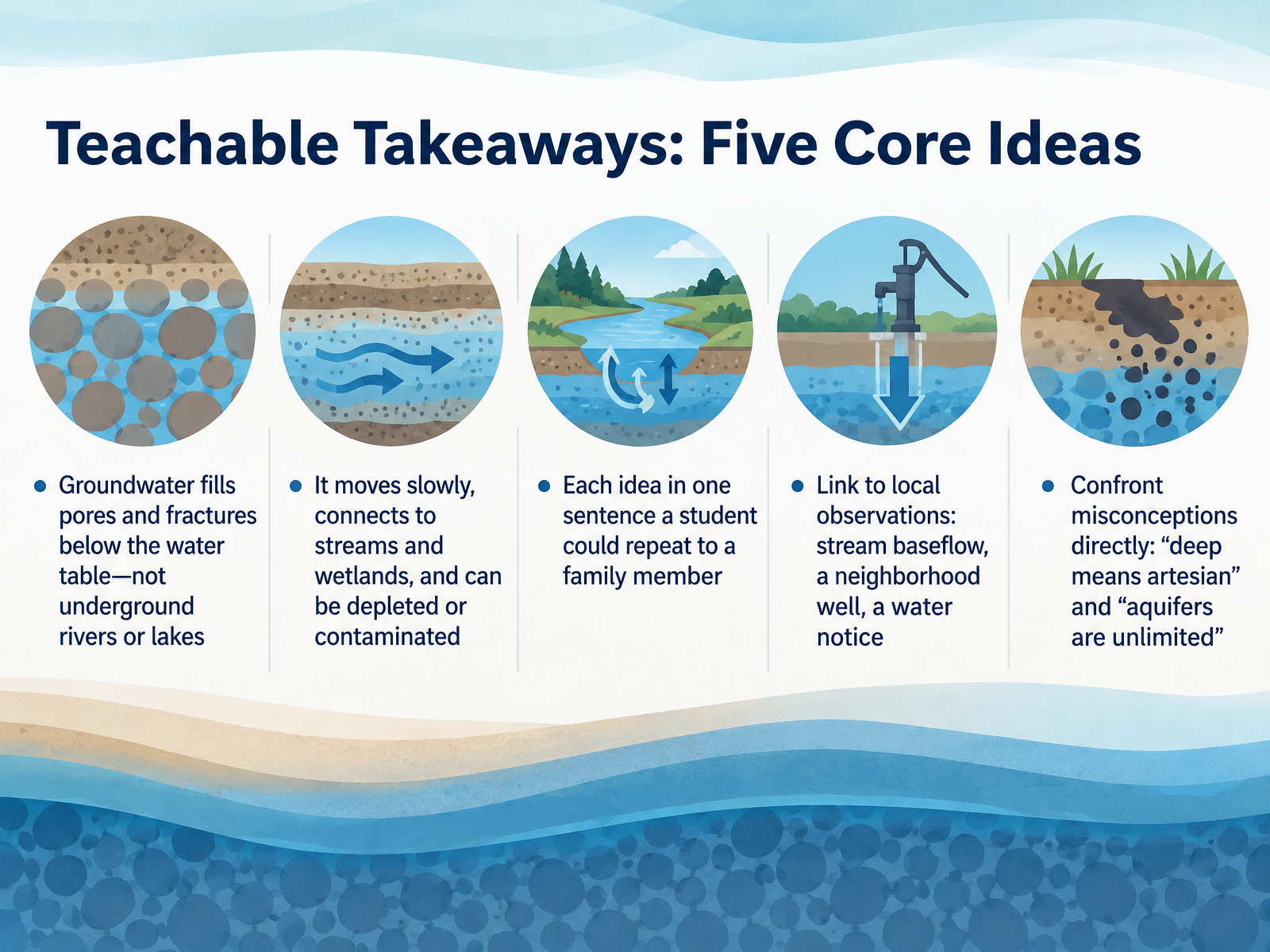
- 11Teachable Takeaways: Five Core IdeasLet's pull this together with five teachable takeaways you can use with any audience. First, groundwater fills the pores and fractures below the water table. It is not an underground river or lake. Picture water held in a sponge. Second, groundwater moves slowly, connects to streams and wetlands, and can be depleted or contaminated. Third, try stating each idea in one sentence a student could repeat to a family member. Fourth, tie it to local observations: stream baseflow in a dry spell, a neighborhood well, or a boil-water notice. Finally, confront two misconceptions directly. Deep does not mean artesian. Artesian means confined under pressure. And aquifers are not unlimited; pumping faster than recharge can lower the water table and dry up wells. Next, we will make these ideas visible with hands-on models: Aquifer in a Cup and Flow Tanks.
 usgs.govusgs.govusgs.gov+21 min
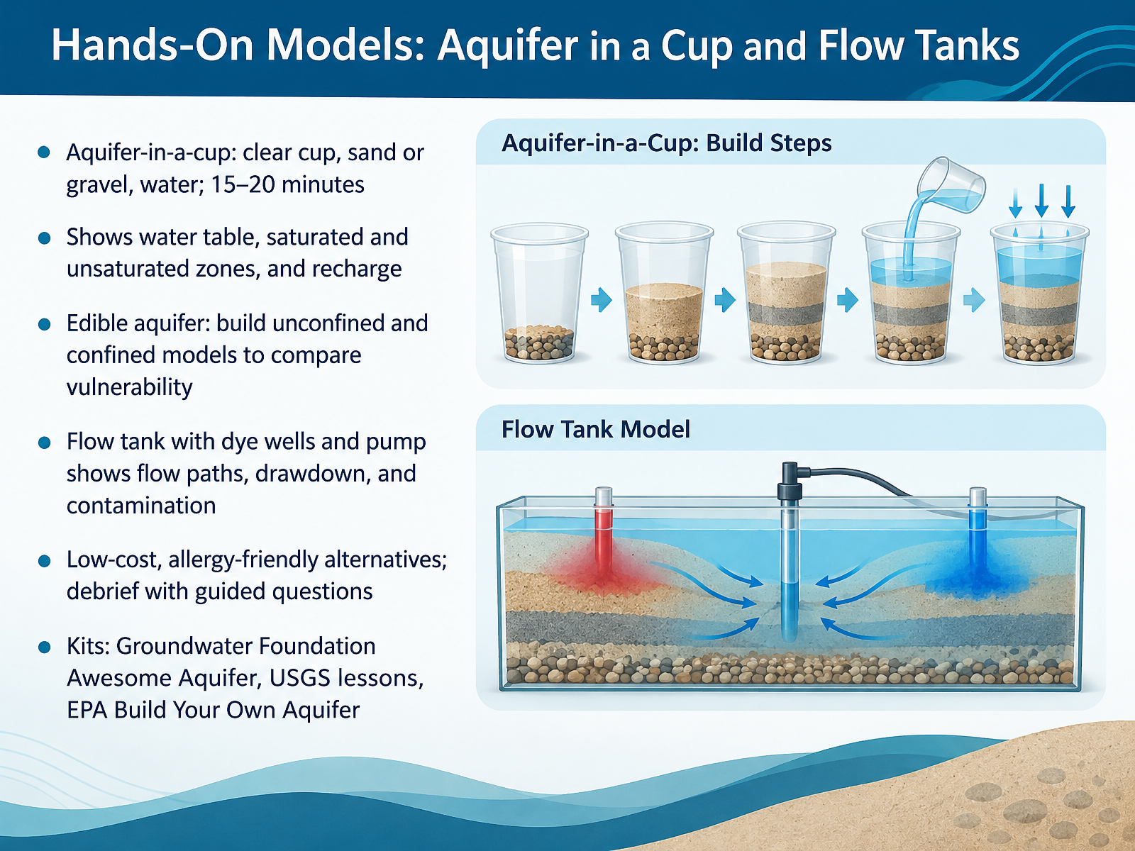
- 12Hands-On Models: Aquifer in a Cup and Flow TanksLet's bring these ideas into your hands with two simple models. The aquifer in a cup takes about fifteen to twenty minutes. You fill a clear cup with sand or gravel, then add water until half of it is saturated. The water settles in the spaces between the particles. That is your groundwater. The line where the water stops is the water table. Below it is the saturated zone, and above it is the unsaturated zone. Add more water to simulate rain, and watch the water table rise. That is recharge. You can also build an edible aquifer, making one unconfined model and one confined model, then comparing how easily contamination reaches the water. A flow tank with dye wells and a hand pump lets you trace flow paths, watch the water level drop from pumping, and see how a contaminant near a well spreads. If food is a concern, non food versions work well, and you can debrief with guided questions. Ready made support includes the Groundwater Foundation Awesome Aquifer kit, USGS lesson plans, and the EPA Build Your Own Aquifer activity. Next, let's look at Everyday Actions and Local Investigation.
 usgs.govusgs.govusgs.gov+22 min
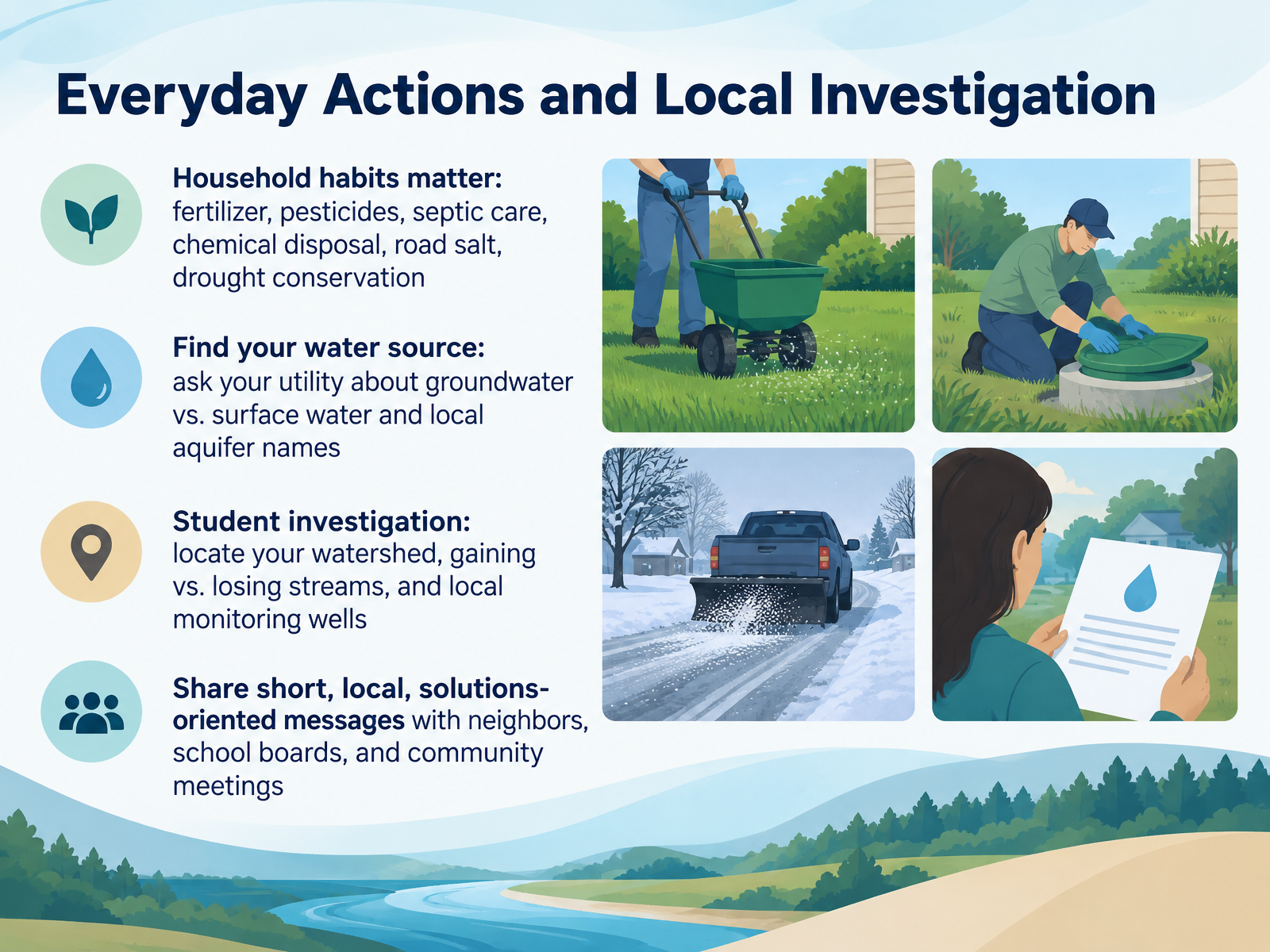
- 13Everyday Actions and Local InvestigationLet's bring all of this home, because what happens above ground shapes the water beneath your feet. Household habits matter. Think about how much fertilizer or pesticide you spread, having your septic tank pumped every few years, taking old chemicals to a disposal site instead of pouring them out, going easy on road salt, and conserving water during a drought. Each choice can send something into the ground. Next, find your water source. Ask your utility whether your drinking water comes from groundwater or from surface water, and ask for the local aquifer names. Then investigate. Students can locate their watershed, identify streams that gain from or lose water to groundwater, and find nearby monitoring wells. Finally, share what you learn. Short, local, solutions-oriented messages land well with neighbors, school boards, and community meetings. Small habit changes plus a little local curiosity add up to real protection for the water beneath you. Next, we'll look at assessment and discussion prompts for three audiences.
 usgs.govusgs.govusgs.gov+21 min
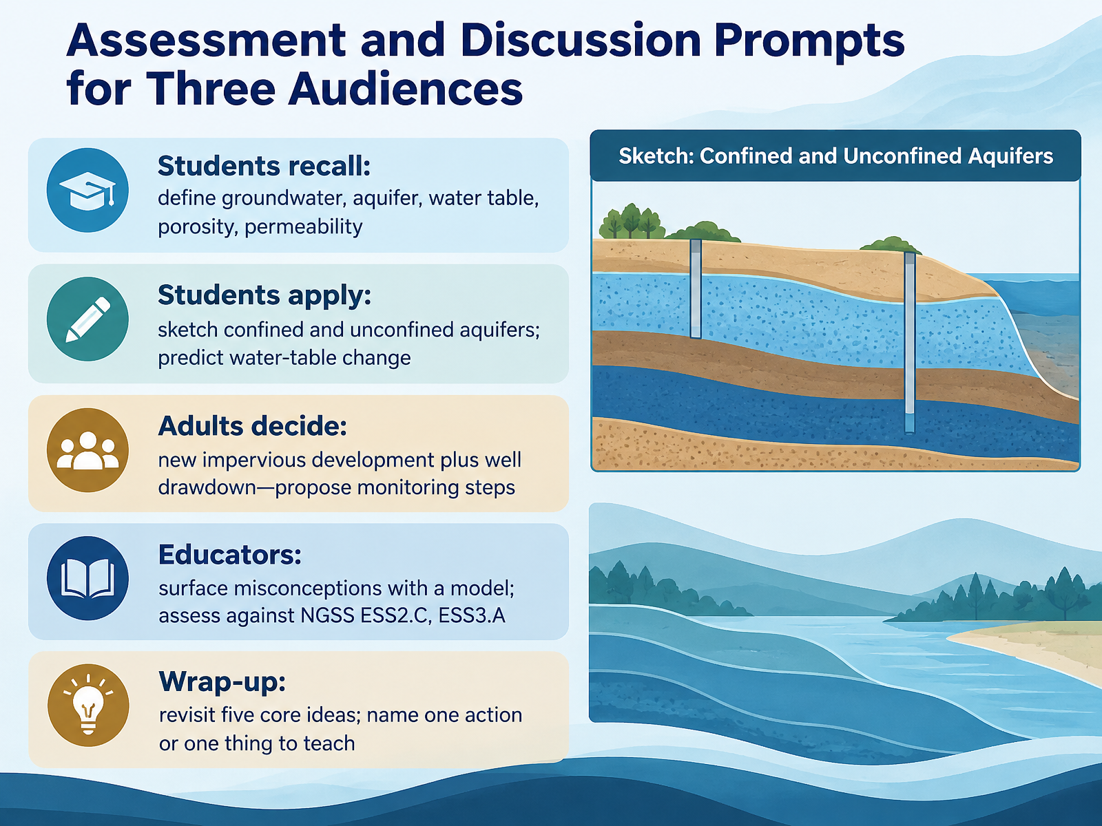
- 14Assessment and Discussion Prompts for Three AudiencesLet's bring everything together with a quick check and some discussion prompts for three audiences. Students, can you recall and define groundwater, aquifer, water table, porosity, and permeability? Then apply it: sketch a confined and an unconfined aquifer, and predict how the water table changes after heavy pumping or new pavement. Adults, here's a decision scenario. A new impervious development goes in near a pumping well, and drawdown is increasing. What monitoring steps would you propose? Think water-level measurements, a cone of depression check, and tracking recharge. Educators, try surfacing misconceptions with a model aquifer, then assess learning against ESS2.C, the roles of water, and ESS3.A, natural resources. Before we close, revisit the five core ideas we covered: groundwater, aquifers, the water table, porosity, and permeability. Now name one action you'll take, or one thing you'll teach. You've built a solid understanding of the water beneath our feet. Thank you for learning with me, and keep asking good questions about the world underground.
 usgs.govusgs.govusgs.gov+22 min
Take the deck with you
Download this course as a file — free, no sign-up needed.
- PDF handoutEvery slide page, ready to print or share.15 pages · 4.7 MBDownload
- Narrated PowerPointThe deck that presents itself — every slide carries the digital human's narration video.15 pages · 14.8 MBDownload
- PowerPoint slidesThe full deck as a .pptx — open it in PowerPoint, Keynote, or Google Slides.15 pages · 4.7 MBDownload
Free to use in your own training — please keep the PersonWise credit page at the end.
Have your own deck? Turn it into a course
Sources consulted
Web sources consulted while building this course.
- Aquifers and Groundwater | U.S. Geological Survey — usgs.gov
- Principal Aquifers of the United States | U.S. Geological Survey — usgs.gov
- Groundwater, Aquifers, Wells, and Springs | U.S. Geological Survey — usgs.gov
- Water Resources - Education | U.S. Geological Survey — usgs.gov
- Lesson plans | U.S. Geological Survey — usgs.gov
- Groundwater recharge and discharge | U.S. Geological Survey — usgs.gov
- Quantifying groundwater recharge and discharge dynamics in the Upper Colorado River Basin | U.S. Geological Survey — usgs.gov
- Groundwater Flow and the Water Cycle | U.S. Geological Survey — usgs.gov
- Rivers Contain Groundwater | U.S. Geological Survey — usgs.gov
- Estimates of Baseflow, Runoff, and Groundwater Recharge Based on Streamflow-Hydrograph Methods: Pennsylvania | U.S. Geological Survey — usgs.gov
- What is the difference between a confined and an unconfined (water table) aquifer? | U.S. Geological Survey — usgs.gov
- Water Science Glossary | U.S. Geological Survey — usgs.gov
- How Ground Water Occurs — pubs.usgs.gov
- Ground-Water Hydraulics — pubs.usgs.gov
- Artesian Water and Artesian Wells | U.S. Geological Survey — usgs.gov
- Basic ground-water hydrology — pubs.usgs.gov
- How Ground Water Occurs — pubs.usgs.gov
- STUDY GUIDE FOR A BEGINNIN-G COURSE IN GROUND-WATER HYDROLOGY: PART I -- COURSE PARTICIPANTS — pubs.usgs.gov
- Principal Aquifers of the United States — usgs.gov
- Aquifers of the United States Printable Map with Explanation — usgs.gov