Volcanoes: Magma, Eruptions, Landforms
Begin
13 pages · ~26 min
Volcanoes: Magma, Eruptions, Landforms
This training provides an overview of volcanoes, covering magma, eruption types, and the landforms they create for geology enthusiasts.
What you’ll learn
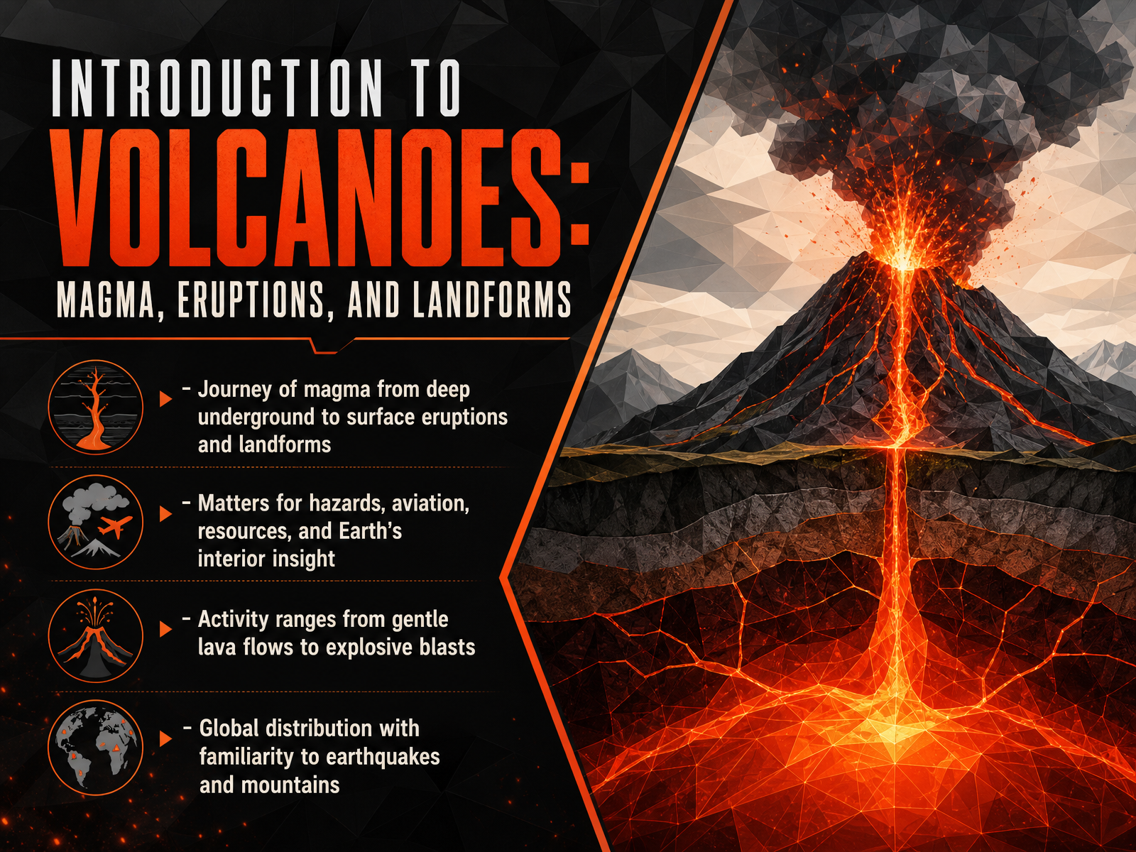
- 01Introduction to Volcanoes: Magma, Eruptions, and LandformsWelcome. In this course, we explore the journey of magma from deep underground to the surface, where it produces eruptions and shapes the land. Understanding this process matters. It helps us assess hazards, protect aviation, locate geothermal resources, and even glimpse Earth's deep interior. Volcanic activity ranges widely. Some events produce gentle lava flows, like the ongoing episodic fountaining at Kīlauea, where lava rises from two vents, builds pressure in cycles, and then erupts in bursts. Other eruptions are explosive blasts that send ash and gases high into the stratosphere. Think of the 2022 Hunga Tonga eruption, which injected an unprecedented amount of water vapor and sulfate aerosols, affecting global atmospheric temperatures for years. Volcanoes are not randomly scattered. Their global distribution mirrors the patterns of earthquakes and mountain belts, a clue to the forces at work inside our planet. Let's begin with the source of it all: what magma is and where it comes from.pnas.orgnature.comacp.copernicus.org+22 min
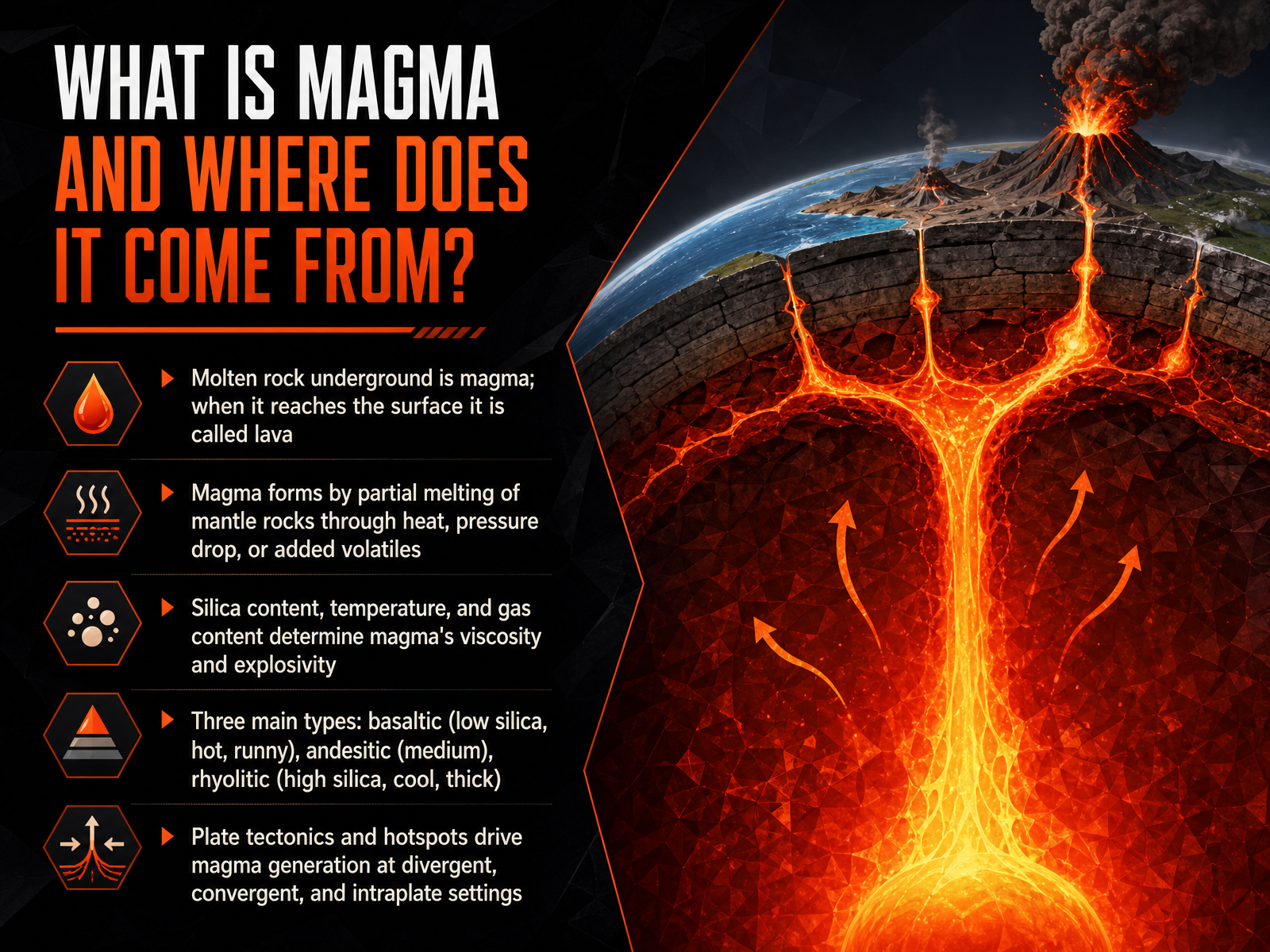
- 02What is Magma and Where Does It Come From?Now let's dig into the very heart of the matter: what exactly is magma, and where does it come from? Simply put, magma is molten rock that exists underground. The moment it breaks through to the surface during an eruption, we call it lava. This transformation happens deep in the Earth, where the mantle partially melts due to intense heat, a sudden drop in pressure, or the addition of volatiles like water. The resulting magma isn't all the same. Its character is defined by three key factors: its silica content, its temperature, and the amount of dissolved gas it holds. These properties dictate the magma’s viscosity, which is essentially its resistance to flow, and ultimately, how explosive an eruption can be. We broadly classify magma into three main types. First is basaltic, which has low silica, is very hot, and tends to be runny, often fueling spectacular lava fountains like the ongoing episodic activity we've seen at Kilauea. Next is andesitic, with a medium composition and behavior. And finally, rhyolitic magma, which is high in silica, cooler, and extremely thick, often leading to the most powerful explosive events. But what drives this deep melting in the first place? It all ties back to plate tectonics and hotspots. Magma is generated at divergent boundaries where plates pull apart, at convergent boundaries where one plate slides under another, and at intraplate hotspots like the one beneath Hawaii. This sets the stage for our next topic: Magma Chambers and the Volcanic Plumbing System.
 doi.orglink.springer.comicao.int+22 min
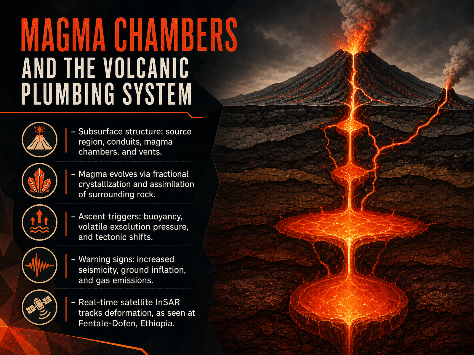
 - 03Magma Chambers and the Volcanic Plumbing SystemNow let's explore the plumbing system that feeds a volcano. Deep beneath the surface, the journey begins in a source region where rock melts into magma. This molten material collects in a magma chamber, a reservoir that connects to the surface through a network of conduits and vents. But the magma doesn’t simply sit there. Its composition evolves through two key processes: fractional crystallization, where heavier minerals sink and change the remaining melt, and assimilation, where rising magma melts and absorbs the surrounding rock. As pressure builds, the magma seeks a path upward. Three main triggers drive this ascent. First, the magma is buoyant, lighter than the solid rock above it. Second, dissolved gases exsolve, creating intense pressure that forces fractures open. Third, tectonic shifts can unlock new pathways. On the surface, we detect these movements through warning signs. Sensitive instruments record increased seismicity as rock breaks, ground inflation as the chamber swells, and gas emissions that spike before an eruption. A powerful tool for tracking this is satellite InSAR, which maps ground deformation. For example, real-time satellite data from the Fentale-Dofen event in Ethiopia revealed a fifty-kilometer-long dyke and meters of surface displacement, helping scientists and officials monitor the crisis as it unfolded. In the next section, we will move from these underground signals to the dramatic moment of an eruption itself, discussing how gas expansion drives explosions.
 uisjournal.comnature.comlink.springer.com+22 min
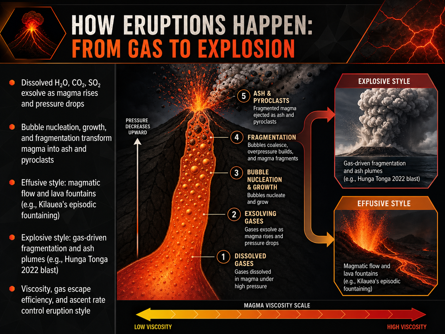
 - 04How Eruptions Happen: From Gas to ExplosionNow that we understand magma's composition, let's look at how that magma actually becomes an eruption. It all comes down to gas. Think of a bottle of soda: when it's sealed, the carbon dioxide stays dissolved. But as you open it, the pressure drops, and the gas rushes out of solution. The same principle applies deep underground. As magma rises, the pressure decreases, and dissolved gases like water vapor, carbon dioxide, and sulfur dioxide exsolve, or come out of solution. This process creates bubbles, a stage we call nucleation. These bubbles then grow. If the gas escapes more slowly than the magma rises, pressure inside the bubbles builds dramatically. Eventually, the bubble walls shatter, fragmenting the magma into a mixture of hot gas, ash, and pyroclasts. We see the final result in two contrasting eruption styles. An effusive style happens when gas can escape easily. This produces steady lava flows and spectacular lava fountains, like the episodic fountaining we've been observing at Kīlauea since late 2024. An explosive style is driven by rapid, violent gas fragmentation, generating towering ash plumes, like the massive 2022 Hunga Tonga blast, which sent material high into the atmosphere. So, three key factors dictate which style we get: the magma's viscosity, its gas escape efficiency, and its ascent rate. High viscosity and a fast ascent rate trap gas, often leading to an explosive result. Next, we'll build on this by examining the major types of volcanic eruptions that these processes produce.
 pnas.orgnature.comacp.copernicus.org+22 min
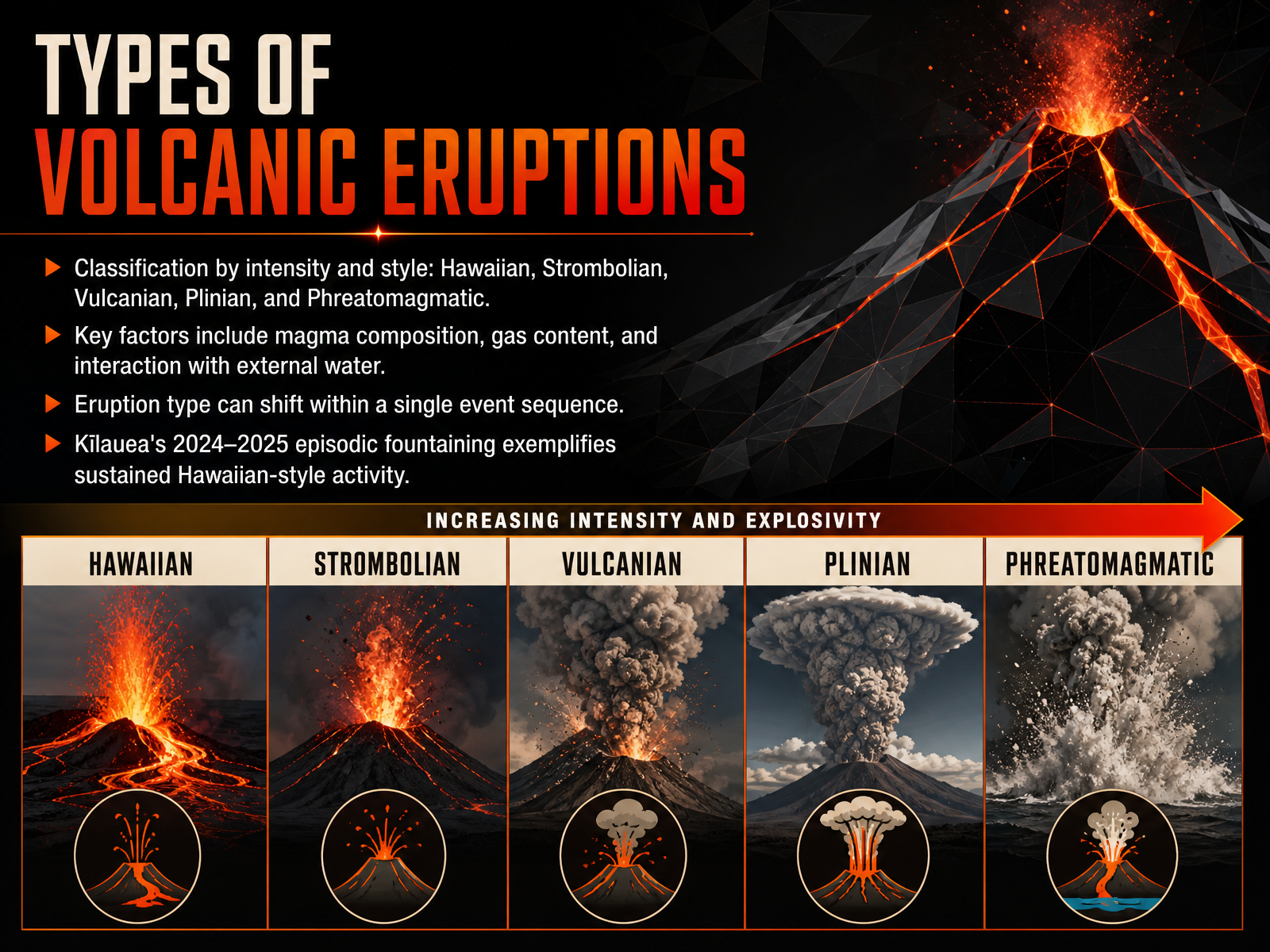
 - 05Types of Volcanic EruptionsNow let's look at how we classify different types of volcanic eruptions. Volcanologists group eruptions by their intensity and style. The main categories are Hawaiian, Strombolian, Vulcanian, Plinian, and Phreatomagmatic. The key factors that determine which style we see include the magma's composition, how much gas it contains, and whether it interacts with external water. It's also important to know that an eruption's style can shift during a single event sequence. For example, Kīlauea's ongoing episodic fountaining from late 2024 into 2025 is a classic example of sustained Hawaiian-style activity. This eruption has produced spectacular lava fountains hundreds of meters high, but generally remains less explosive than the other styles. Next, we'll explore the landforms these eruptions build, including shield volcanoes, stratovolcanoes, and cinder cones.
 doi.orglink.springer.comicao.int+21 min
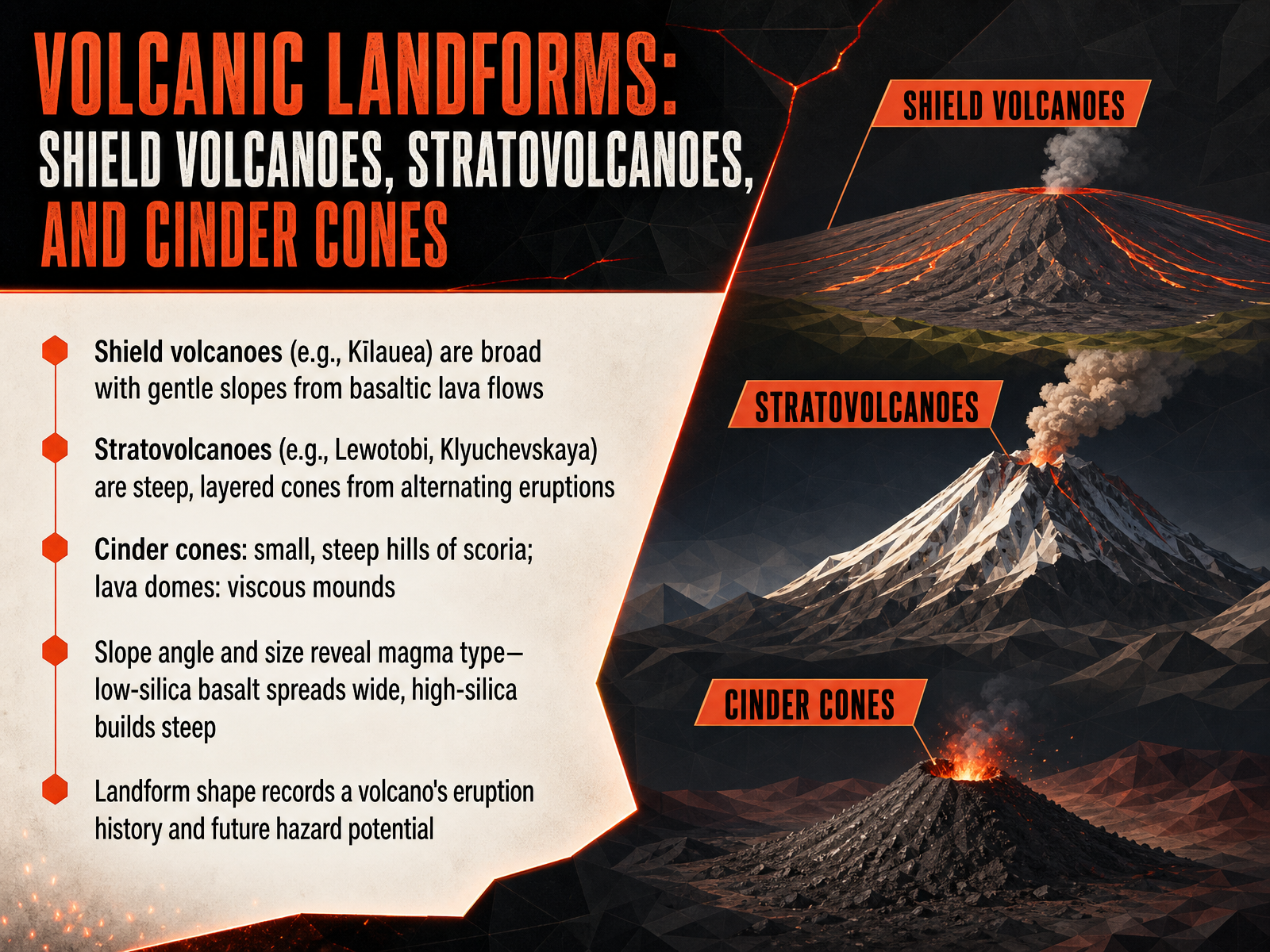
 - 06Volcanic Landforms: Shield Volcanoes, Stratovolcanoes, and Cinder ConesLet’s look at how those different eruption styles build distinct volcanic landforms. Shield volcanoes—Hawaiʻi’s Kīlauea is a perfect example—are broad with very gentle slopes. They form from hot, low‑silica basaltic lava that travels long distances before cooling, creating wide, rounded mountains. Stratovolcanoes, on the other hand, are steep, layered cones like Indonesia’s Lewotobi or Russia’s Klyuchevskaya. Their alternating explosive ash falls and thick lava flows build tall, sharp profiles. Where shield volcanoes spread out, stratovolcanoes stack up. At the smaller end of the spectrum we find cinder cones—steep hills made of loose scoria ejected by gas‑rich fire‑fountaining—and lava domes, which are viscous mounds that pile up nearly over the vent because the high‑silica magma can’t flow far. The key takeaway is that slope angle and size are not random; they directly reflect magma composition. Low‑silica basalt spreads wide, while high‑silica andesite or rhyolite builds steep, unstable slopes. Put simply, a volcano’s shape is its autobiography—it records eruption history and, just as importantly, signals its future hazard potential. Let’s explore that contrast further when we compare landforms from effusive and explosive activity.
 doi.orglink.springer.comicao.int+22 min
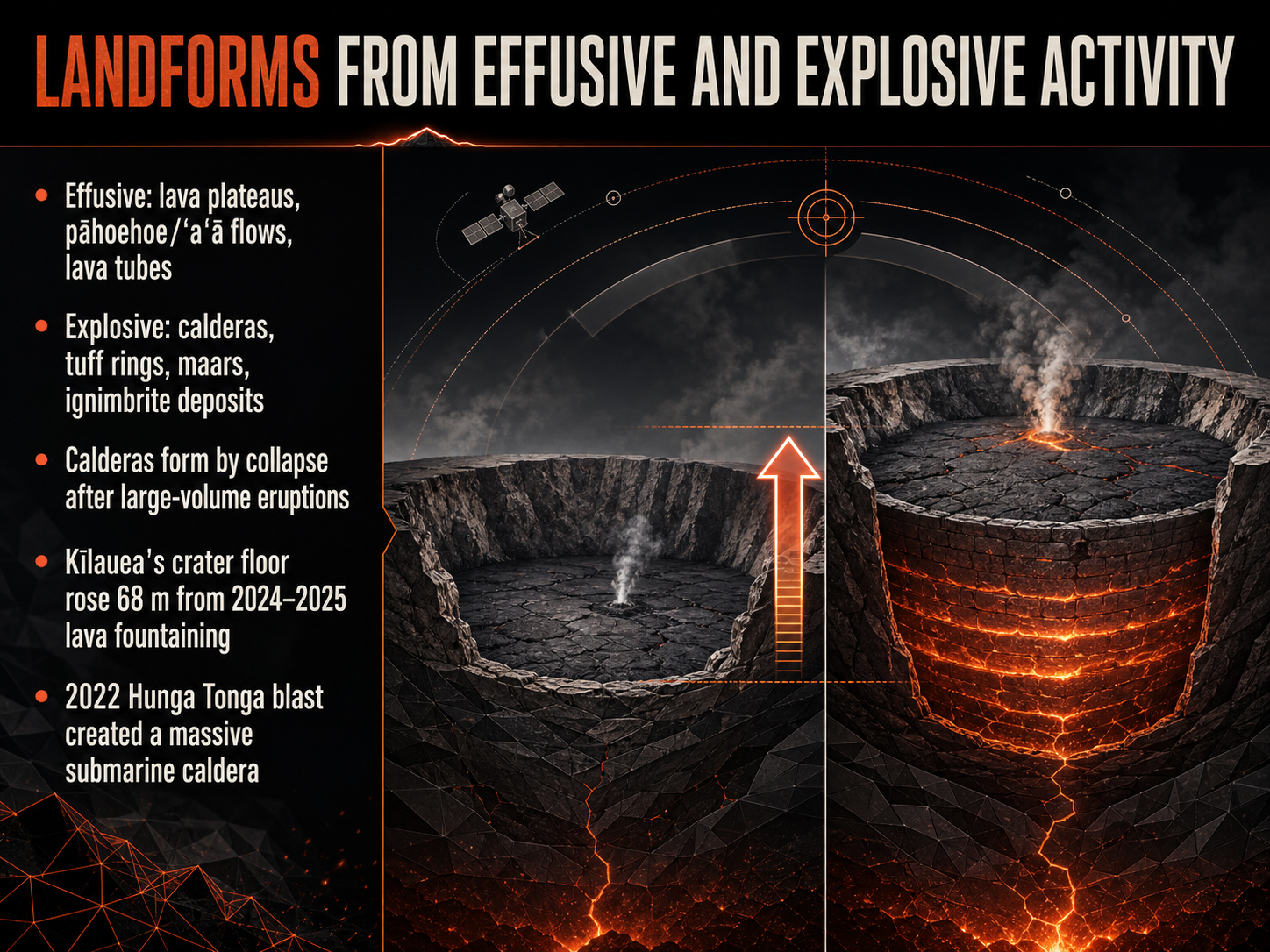
 - 07Landforms from Effusive and Explosive ActivityNow, let's explore how both gentle and violent eruptions sculpt the Earth's surface. Effusive eruptions produce vast lava plateaus and familiar Hawaiian landforms like the ropey pāhoehoe and the rough, clinkery ʻaʻā flows. As lava channels cool and crust over, they can form hollow lava tubes that serve as insulated pathways for molten rock. In contrast, explosive activity creates dramatic features such as calderas. These large depressions form when the ground collapses after a massive volume of magma empties from the chamber below. Powerful eruptions also build tuff rings, generate steam-blasted maars, and blanket the landscape with dense sheets of hot ash called ignimbrite deposits. For a real-world example, at Kīlauea in Hawaiʻi, repeated lava fountaining episodes from 2024 through 2025 raised the summit crater floor by 68 meters. On a much larger scale, the explosive 2022 Hunga Tonga blast carved a massive submarine caldera. Next, we will examine the volcanic hazards and their direct impacts.
 pnas.orgnature.comacp.copernicus.org+21 min
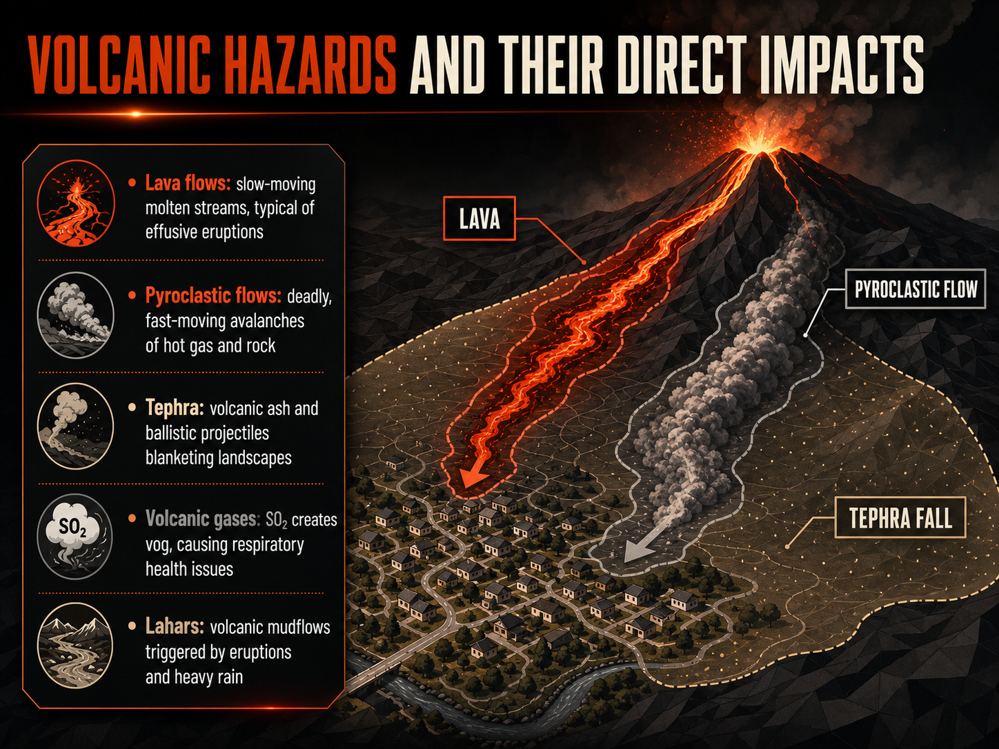
 - 08Volcanic Hazards and Their Direct ImpactsLet’s look now at volcanic hazards and their direct impacts. We’ll start with lava flows—these are slow-moving molten streams, typical of effusive eruptions like those at Kīlauea. While they rarely threaten life directly, they can bury roads and structures. In contrast, pyroclastic flows are among the deadliest hazards. They’re fast-moving avalanches of hot gas and rock, racing down slopes at hundreds of kilometers per hour, as seen during the 2024 eruptions of Mount Lewotobi Laki-Laki. When we talk about tephra, we mean volcanic ash and larger ballistic projectiles that blanket the landscape. Ash can collapse roofs, damage aircraft engines, and force widespread airspace closures, disrupting flights far from the volcano. Volcanic gases present a different danger. For example, sulfur dioxide reacts in the atmosphere to create vog, or volcanic smog, causing respiratory issues downwind of Kīlauea’s summit. Finally, we have lahars. These are volcanic mudflows triggered when eruptions or heavy rain mix with loose ash and debris. Lahars can rush down river valleys long after an eruption ends. These five hazards illustrate how directly an eruption can reshape the human and natural environment. Up next, we’ll explore the indirect hazards and global impact of volcanic eruptions.
 doi.orglink.springer.comicao.int+22 min
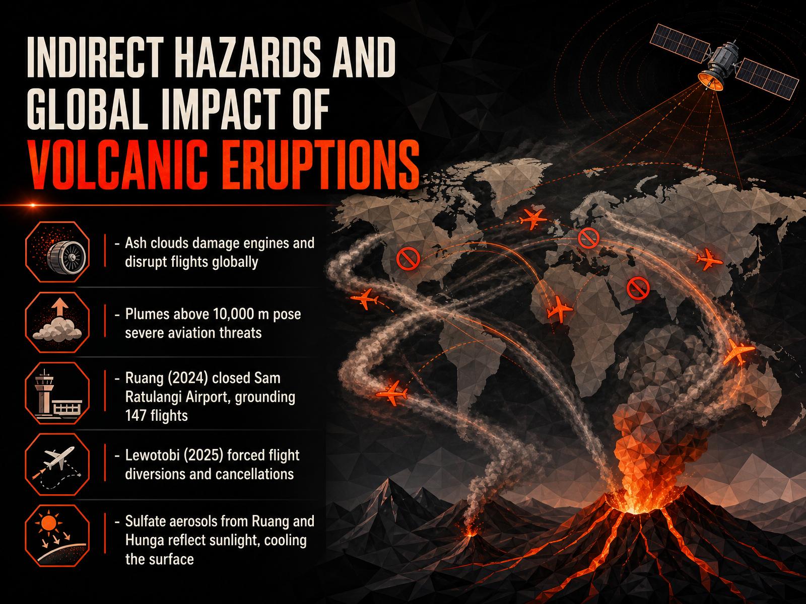
 - 09Indirect Hazards and Global Impact of Volcanic EruptionsMoving beyond the immediate dangers of lava and pyroclastic flows, we now turn to the far-reaching hazards that can disrupt global systems. Volcanic ash clouds are a serious threat to aviation. These fine, jagged particles can damage aircraft engines, reduce visibility, and force widespread airspace closures. Plumes that rise above ten thousand meters are especially dangerous, as this is the cruising altitude for most commercial jets. Recent eruptions demonstrate just how disruptive this can be. In April 2024, the eruption of Mount Ruang in Indonesia forced the closure of Sam Ratulangi International Airport, grounding 147 flights. The following year, the eruption of Indonesia’s Lewotobi volcano caused significant flight diversions and cancellations for the region. But the impacts are not just mechanical. Volcanic sulfate aerosols injected into the stratosphere can reflect sunlight, leading to a temporary cooling of the Earth’s surface. For instance, data shows that aerosols from Ruang and the 2022 Hunga eruption created a measurable cooling effect. These events remind us that a single eruption can cascade into a global event. Next, we will explore the techniques used to anticipate these events, in Monitoring Volcanoes: Observation Networks and Techniques.
 doi.orglink.springer.comicao.int+22 min
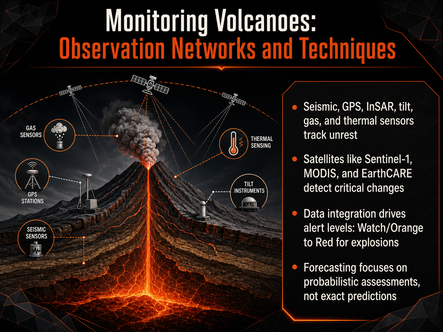
 - 10Monitoring Volcanoes: Observation Networks and TechniquesNow let's bring all these monitoring pieces together. Seismic stations, GPS, tiltmeters, and gas sensors feed into observation networks around the clock. Satellites like Sentinel-1, MODIS, and EarthCARE add critical broad-scale views, tracking subtle ground deformation and thermal changes from orbit. When data streams converge, observatories raise alert levels, often moving from Watch or Orange through to Red for imminent explosions. But here is an important distinction: we are not making exact predictions. Forecasting focuses on probabilistic assessments, weighing the evidence to communicate likelihood and uncertainty. This integrated approach gives decision-makers the best possible information to protect lives and infrastructure. Next, we will explore how these capabilities translate into real-world results, in 'Success Stories in Volcanic Early Warning.'
 uisjournal.comnature.comlink.springer.com+21 min
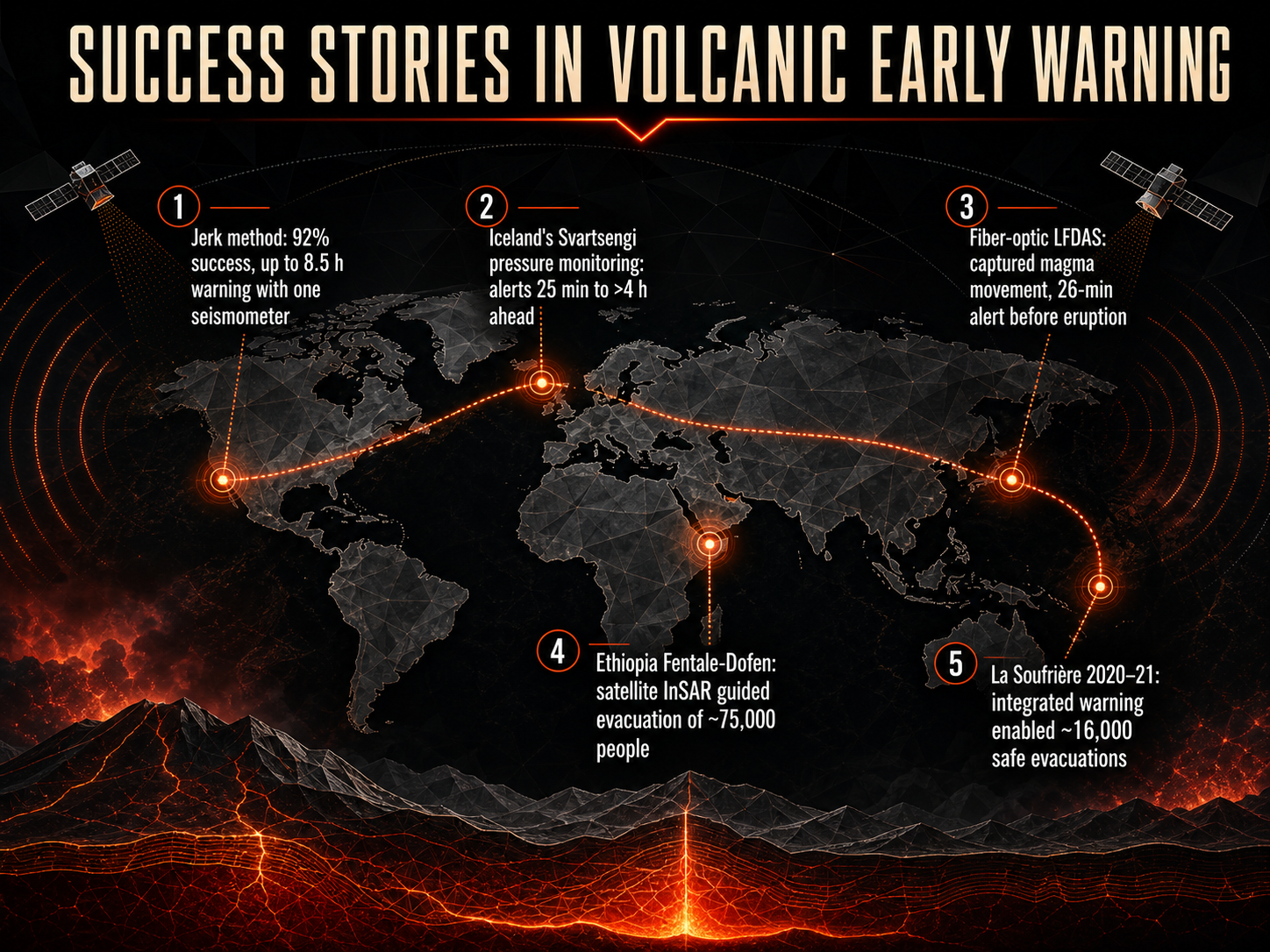
 - 11Success Stories in Volcanic Early WarningMoving from the physics of eruptions to their detection, let's examine some real-world success stories where early warning systems saved lives. The Jerk method, a seismic technique, has achieved a ninety-two percent success rate by detecting subtle ground movements from magma injections. Using just one broadband seismometer, it has provided warnings up to eight and a half hours before an eruption. In Iceland, a different approach monitoring pressure changes at the Svartsengi geothermal system has triggered alerts ranging from twenty-five minutes to over four hours in advance. Another innovation there used fiber-optic cables for distributed acoustic sensing, known as L F D A S, to capture magma movement and issue a twenty-six minute warning. Satellite technology has also proven critical. In Ethiopia, satellite InSAR data guided the evacuation of roughly seventy-five thousand people from the Fentale-Dofen region. And during the La Soufrière eruption in twenty twenty and twenty-one, an integrated warning system enabled sixteen thousand safe evacuations. These cases demonstrate that combining different monitoring tools is key to effective volcanic risk reduction. Next, we will shift our focus to the beneficial side of these systems by exploring volcanoes as geological resources.
 uisjournal.comnature.comlink.springer.com+22 min
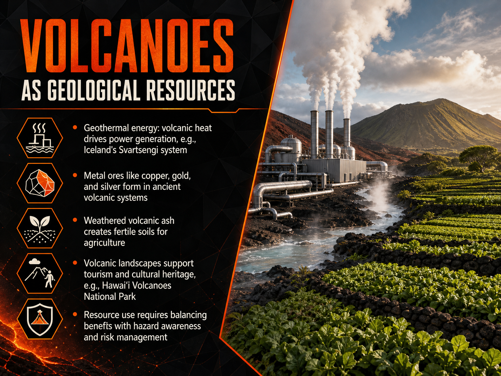
 - 12Volcanoes as Geological ResourcesNow, let's shift our focus from the hazards of eruptions to the remarkable benefits that volcanic systems provide. Volcanoes are not just destructive forces; they are fundamental geological resources that human societies have depended on for millennia. First, consider geothermal energy. The immense heat from magma near the surface drives power generation. A prime example is the Svartsengi system in Iceland, where volcanic heat is harnessed to provide sustainable electricity and hot water. Second, ancient volcanic systems are treasure troves of metal ores. As magma cools and interacts with groundwater, it can concentrate valuable metals like copper, gold, and silver into economically viable deposits. Third, volcanic ash, despite its immediate dangers, weathers over time into some of the most fertile soils on Earth, creating rich agricultural regions that feed millions of people. Finally, volcanic landscapes themselves are a resource. The stunning drama of places like Hawaiʻi Volcanoes National Park supports tourism, local economies, and preserves irreplaceable cultural heritage. Of course, the key is balance. We must use these resources wisely, integrating our geological understanding with constant hazard awareness and careful risk management. Next, we will bring all these threads together in our final synthesis, connecting magma, eruptions, and landforms.
 uisjournal.comnature.comlink.springer.com+22 min
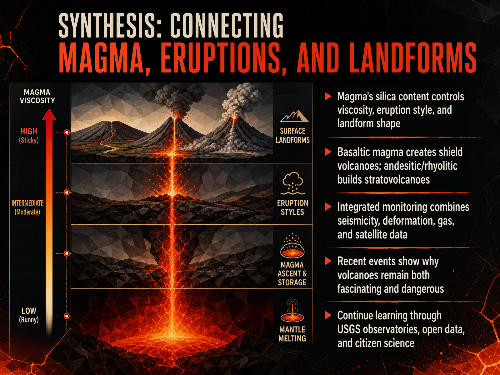
 - 13Synthesis: Connecting Magma, Eruptions, and LandformsLet's bring everything together. Magma's silica content is the master control: it determines viscosity, which in turn shapes both the eruption style and the final landform. Low-silica, basaltic magma flows easily, building broad shield volcanoes and producing spectacular but less explosive lava fountains—exactly like Kīlauea’s ongoing summit episodes. In contrast, high-silica, andesitic and rhyolitic magmas trap gas and build pressure, leading to explosive eruptions that construct steep stratovolcanoes and lava domes. We track these threats through integrated monitoring—combining seismicity, ground deformation, gas emissions, and satellite data. Events like the Hunga Tonga eruption and recent aviation disruptions from Lewotobi and Ruang remind us why volcanoes remain both scientifically fascinating and deeply dangerous. I encourage you to continue exploring through USGS observatories, open data platforms, and even citizen science projects. Thank you for joining me on this journey into magma, eruptions, and the landscapes they create.
 pnas.orgnature.comacp.copernicus.org+22 min
Take the deck with you
Download this course as a file — free, no sign-up needed.
- PDF handoutEvery slide page, ready to print or share.14 pages · 5.1 MBDownload
- Narrated PowerPointThe deck that presents itself — every slide carries the digital human's narration video.14 pages · 29.1 MBDownload
- PowerPoint slidesThe full deck as a .pptx — open it in PowerPoint, Keynote, or Google Slides.14 pages · 5.1 MBDownload
Free to use in your own training — please keep the PersonWise credit page at the end.
Have your own deck? Turn it into a course
Sources consulted
Web sources consulted while building this course.
- Detectable global temperature responses to wildfires and volcanic eruptions | PNAS — pnas.org
- Residence time of Hunga stratospheric water vapour perturbation quantified at 9 years | Communications Earth & Environment — nature.com
- ACP - Global transport of stratospheric aerosol produced by Ruang eruption from EarthCARE ATLID, limb-viewing satellites and ground-based lidar observations — acp.copernicus.org
- Indirect climate impacts of the Hunga eruption — acp.copernicus.org
- ACP - Cross-hemispheric transport of the Hunga aerosol plume: in situ evidence and radiative effects from the northern hemisphere — acp.copernicus.org
- Spatial Patterns of Volcanic Ash Advisories: How the Relationship Between Eruption Characteristics, Ash Cloud Extent and Airport Location Drive Global Aviation Disruption — doi.org
- An investigation of changes to commercial aircraft flight paths ... — link.springer.com
- 1.1 The Asia/Pacific region hosts a significant number of active volcanoes, and volcanic eruptions continue to pose a serious threat to aviation safety and operational continuity. The eruption of the Lewotobi Volcano in East Nusa Tenggara, Indonesia, in early 2025, significantly impacted air traffic — icao.int
- Contingency Plan for Volcanic Ash at Mount Ruang - Indonesia Rev.1 — icao.int
- An investigation of changes to commercial aircraft flight paths during volcanic eruptions — doi.org
- How Etnas works, the early alert system that anticipates the eruptions of Etna — uisjournal.com
- Jerk, a promising tool for early warning of volcanic eruptions — nature.com
- Jerk, a promising tool for early warning of volcanic eruptions | Nature Communications | Springer Nature Link — link.springer.com
- An Early Warning System for Volcanic Eruptions — pangea.stanford.edu
- The Contribution of Meteosat Third Generation–Flexible Combined Imager (MTG-FCI) Observations to the Monitoring of Thermal Volcanic Activity: The Mount Etna (Italy) February–March 2025 Eruption — mdpi.com