Cloud Formation Fundamentals
Begin
15 pages · ~30 min
Cloud Formation Fundamentals
Learn how clouds form through water vapor, cooling, and condensation processes. Ideal for weather enthusiasts and students seeking a clear, concise foundation in basic atmospheric science.
What you’ll learn
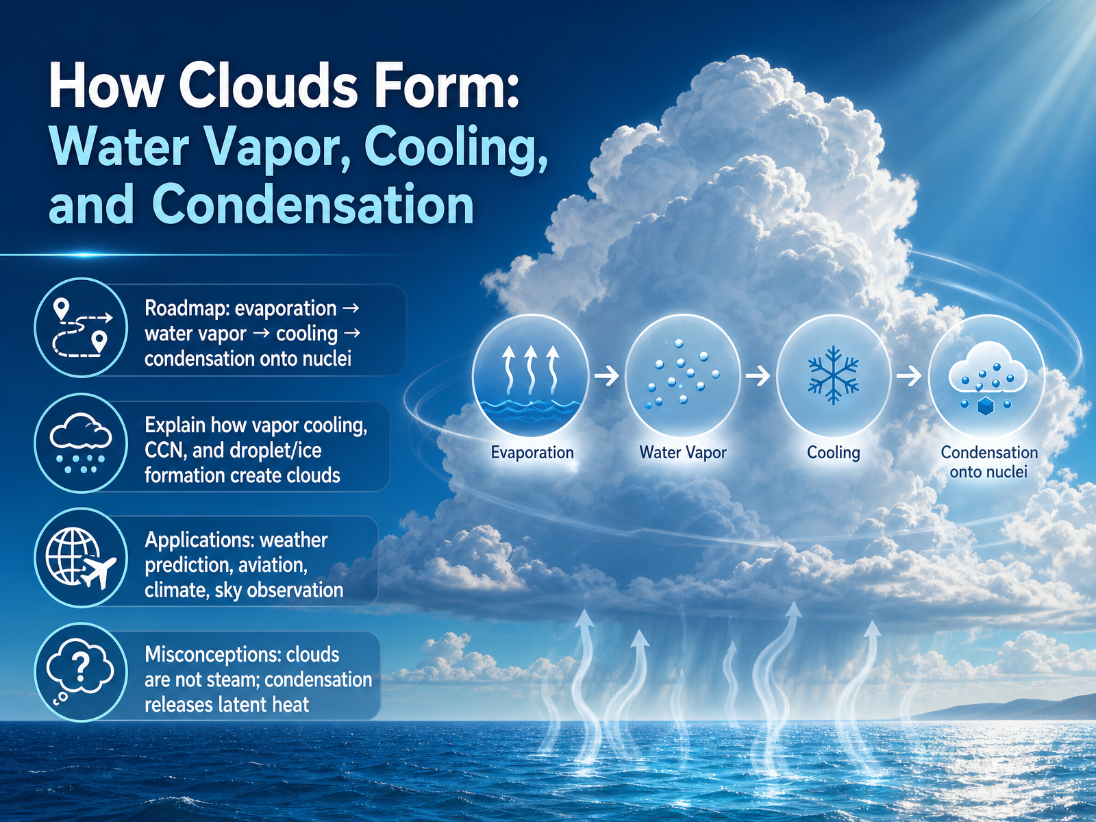
- 01How Clouds Form: Water Vapor, Cooling, and CondensationWelcome. Today we are going to explore how clouds form, step by step. Our goal is to understand how water vapor rises, cools, and condenses to create the clouds we see every day. Here is our roadmap. First, water evaporates into invisible water vapor. Then that vapor rises and cools. Finally, it condenses onto tiny particles called condensation nuclei. Those particles are just microscopic specks like dust, salt, or smoke. Along the way we will see why this matters, for weather prediction, aviation, climate, and even just reading the sky. We will also clear up a common misunderstanding. Clouds are not steam. And when condensation happens, it actually releases heat, something scientists call latent heat. By the end you will be able to explain the whole chain from vapor to cloud. Up next, let us start with the invisible fuel behind it all: water vapor in the atmosphere.2 min
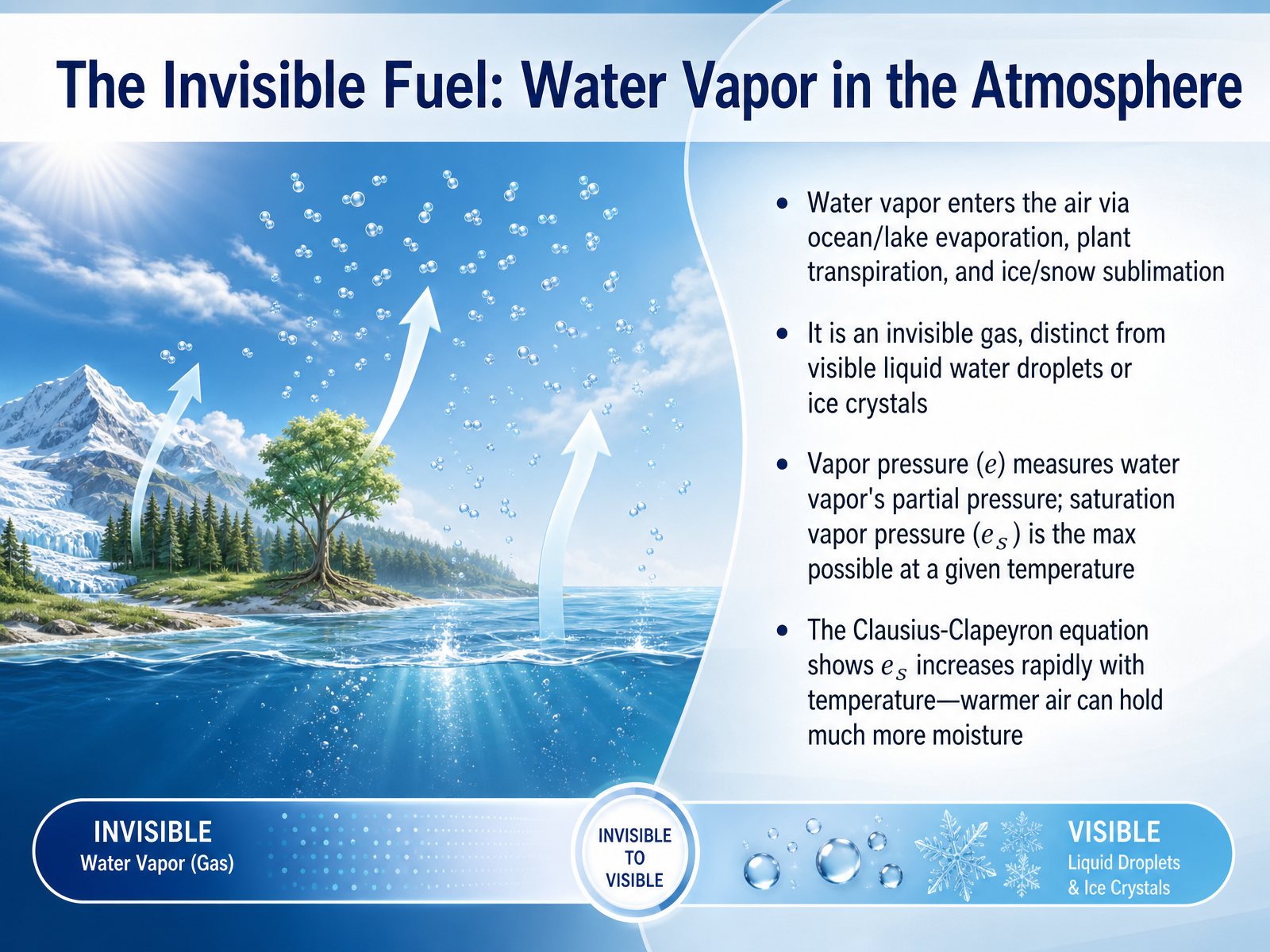
- 02The Invisible Fuel: Water Vapor in the AtmosphereNow let's look at the invisible fuel driving cloud formation: water vapor in the atmosphere. Water vapor enters the air from three main sources. It evaporates from oceans and lakes, it's released by plants through transpiration, and it can even turn directly from ice and snow into a gas through sublimation. This water vapor is an invisible gas. It's not the same as the liquid droplets or ice crystals we see in a cloud. To understand how much water vapor is present, we use the idea of vapor pressure. Think of it as the tiny share of total air pressure created just by the water vapor molecules. There’s also a concept called saturation vapor pressure. That's the maximum vapor pressure the air can hold at a given temperature. The key relationship comes from the Clausius-Clapeyron equation. This equation shows us that saturation vapor pressure rises very rapidly as temperature increases. Simply put, warmer air can hold much more moisture before it becomes saturated. Up next, we'll explore how we measure that moisture with humidity and dew point.
 itia.ntua.gratoc.colorado.edugeo.libretexts.org+21 min
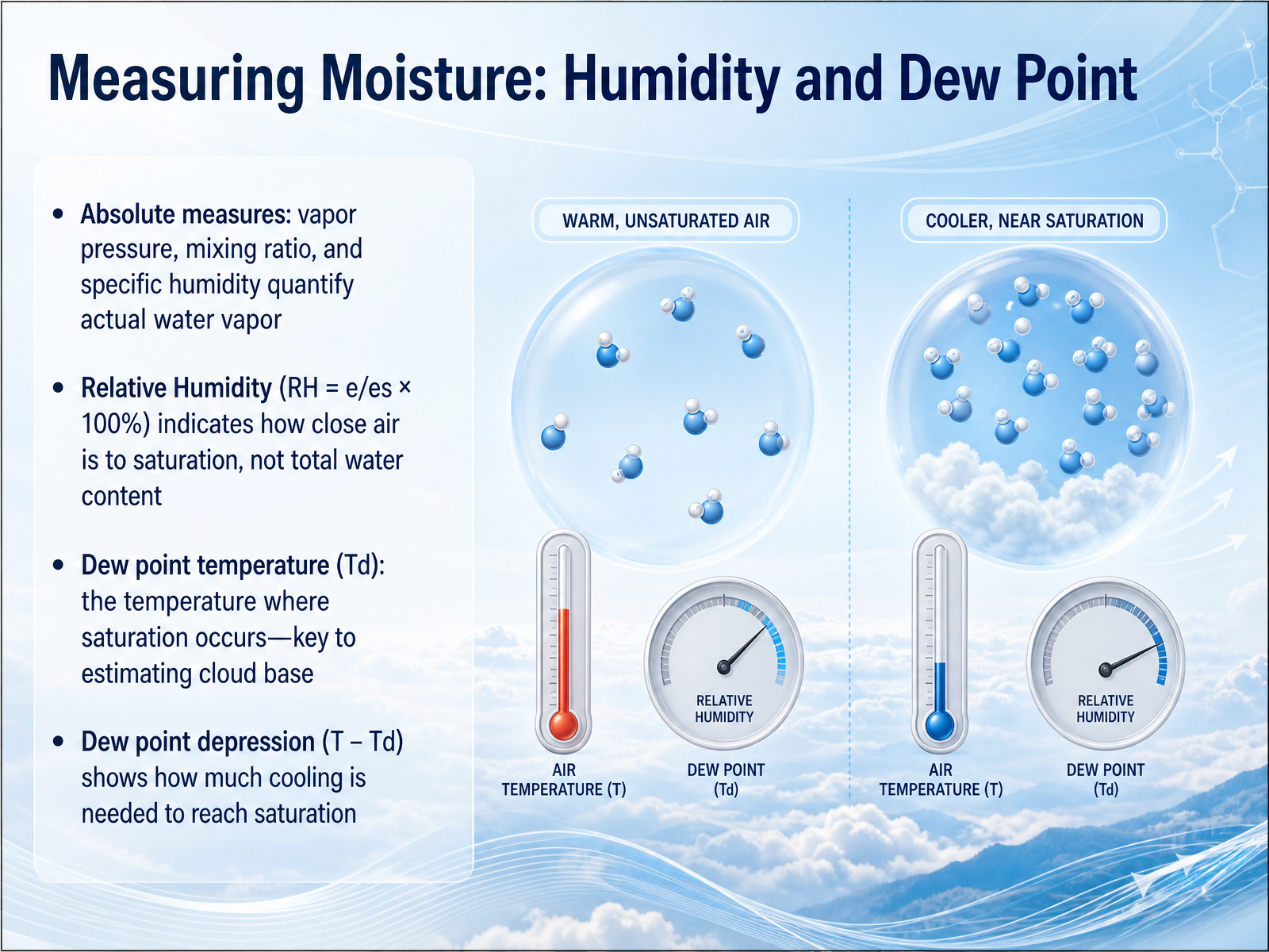
 - 03Measuring Moisture: Humidity and Dew PointNow let's look at how we measure moisture. We have two main ways. First, there are absolute measures that tell us how much water vapor is actually in the air. Think of vapor pressure as the pressure from just the water vapor molecules. Then you have the mixing ratio, which is the mass of water vapor compared to the mass of dry air. Second, we have relative humidity. This is the ratio of actual vapor pressure to saturation vapor pressure, shown as a percentage. Relative humidity doesn't tell you the total water content, it tells you how close the air is to being saturated. A key idea here is the dew point temperature. That's the temperature the air must cool to for saturation to occur. The dew point is an absolute measure, so it directly reflects the actual moisture in the air. The difference between the air temperature and the dew point is the dew point depression. A small depression means the air is already close to saturation and clouds can form with just a little more cooling. Let's explore what actually makes the air cool to that point next.
 itia.ntua.gratoc.colorado.edugeo.libretexts.org+21 min
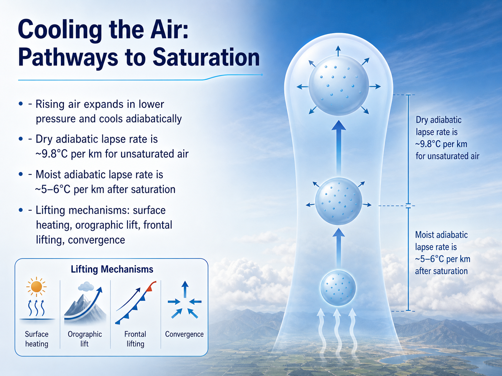
 - 04Cooling the Air: Pathways to SaturationNow let's focus on what happens when air is forced to rise. Rising air moves into regions of lower pressure, so it expands. This expansion causes the air to cool, even though no heat is actually removed. We call that adiabatic cooling. For unsaturated air, the cooling happens at a steady rate: roughly nine point eight degrees Celsius for every kilometer of lift. Once the air cools enough to reach saturation, water starts to condense. After that, the cooling slows down. Because condensation releases a bit of heat, the moist adiabatic lapse rate drops to around five or six degrees per kilometer. What pushes the air upward in the first place? Several lifting mechanisms do the work. Intense sunlight can heat the surface and send warm bubbles of air rising. Mountain ranges force air to climb their slopes, a process called orographic lift. Weather fronts act like wedges, pushing warmer air upward. And when winds meet and pile up near the surface, convergence forces the air to go up. All these pathways cool the rising air and bring it closer to the point where clouds begin. Next, we will use this cooling idea to find the exact height where the cloud base forms: the lifting condensation level.
 redalyc.orgeoas.ubc.caweatherclasses.com+22 min
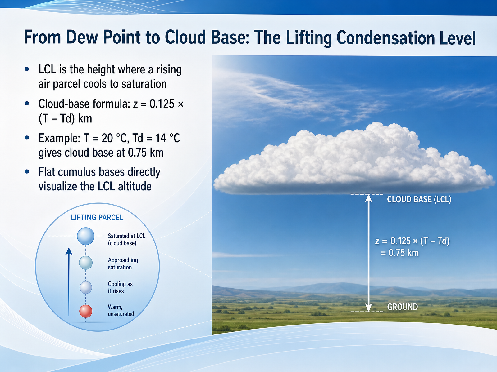
 - 05From Dew Point to Cloud Base: The Lifting Condensation LevelWe have a simple formula that connects surface measurements directly to the height where clouds start to form. That height is called the lifting condensation level, or LCL. The LCL is the altitude where a rising parcel of air has cooled enough to become saturated. And a quick way to estimate it is this: cloud base in kilometers equals 0.125 times the surface temperature minus the surface dew point temperature, both in degrees Celsius. For example, if the surface temperature is 20 degrees and the dew point is 14 degrees, the difference is 6. 0.125 times 6 gives 0.75. So the cloud base sits at about 0.75 kilometers above the ground. You can actually see this formula at work when you look at a sky full of cumulus clouds. All those flat, uniform bottoms are marking the exact same lifting condensation level across the area. Each cloud base visualizes the altitude where rising air finally reached saturation. Now that we know where and when saturation happens, let's look at a surprising obstacle: even at one hundred percent humidity, water vapor often refuses to form droplets on its own. We'll explore the nucleation problem next.
 redalyc.orgeoas.ubc.caweatherclasses.com+22 min
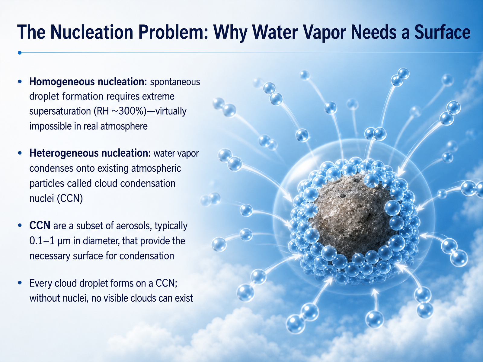
 - 06The Nucleation Problem: Why Water Vapor Needs a SurfaceNow let's look at a fundamental challenge: water vapor needs a surface to become a liquid. This is what scientists call the nucleation problem. In perfectly clean air, water molecules would have to cluster together on their own. This is called homogeneous nucleation. But here's the catch. For that to work, the air would need a relative humidity of around 300 percent. That essentially never happens in our real atmosphere. So homogeneous nucleation is not how clouds form. Instead, nature relies on a much easier path called heterogeneous nucleation. This means water vapor condenses onto existing tiny particles floating in the air. These particles are called cloud condensation nuclei, or C C N for short. Think of them as cloud seeds. C C N are a special subset of aerosols, typically between 0.1 and 1 micrometer in diameter. They provide the necessary surface where water molecules can cling and start building a droplet. Without these nuclei, visible clouds simply could not exist. Every single cloud droplet you see has a C C N at its very core. Next, we will explore the types and sources of these essential cloud condensation nuclei.
 geo.libretexts.orgcourses.ems.psu.eduen.wikipedia.org+22 min
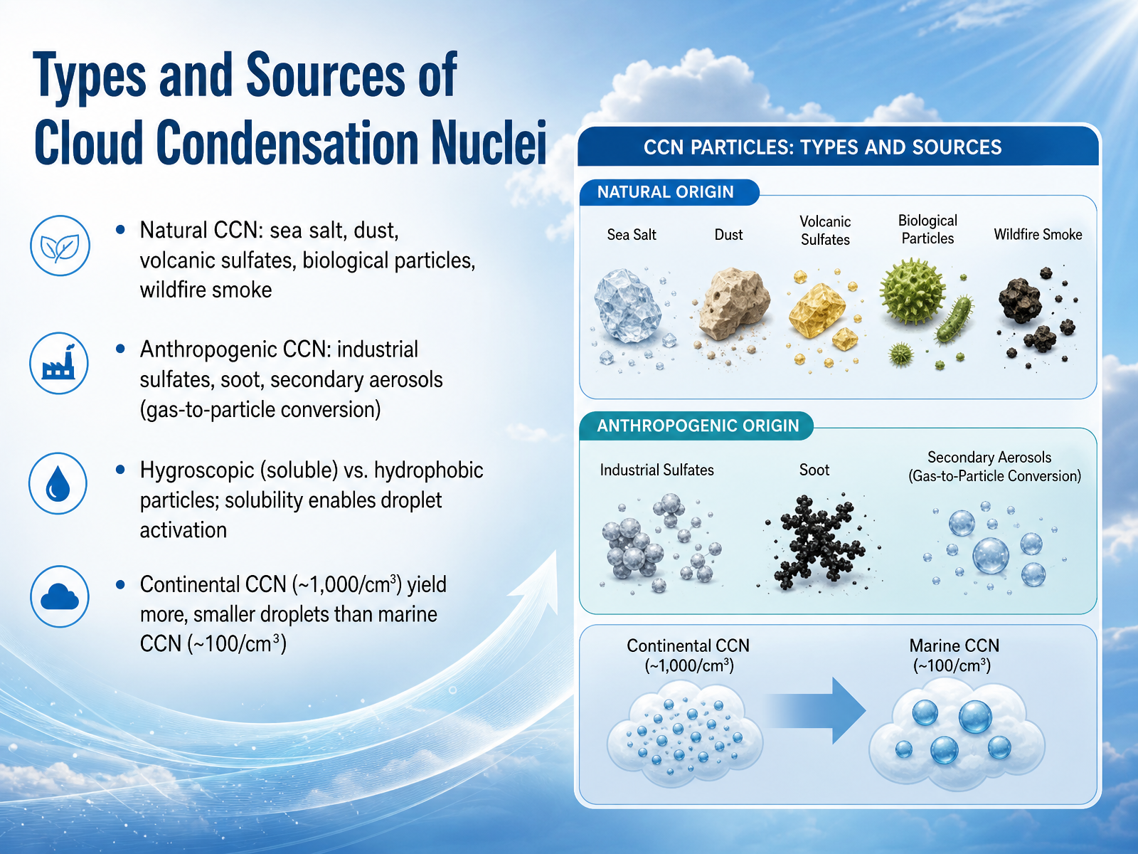
 - 07Types and Sources of Cloud Condensation NucleiNow, let's look at where these crucial cloud seeds come from. Cloud condensation nuclei, or C C N, are tiny particles that give water vapor a surface to cling to. They arrive from many sources, both natural and human-made. Think of sea salt whipped up by ocean waves, fine dust blown from deserts, or sulfates and ash from volcanic eruptions. Even smoke from wildfires and biological particles like pollen play a role. On the human side, we add industrial sulfates, soot from combustion, and secondary aerosols, which form when gases convert to particles in the atmosphere. The most effective nuclei are hygroscopic—simply meaning they love water. These soluble particles, like certain salts, dissolve and make it much easier for a droplet to form and grow. The source of the air mass matters too. Continental air, rich with land-based particles, can hold around a thousand nuclei per cubic centimeter, leading to many small cloud droplets. In contrast, clean marine air might have only about a hundred, producing fewer, larger droplets. Up next, we’ll explore how these soluble particles interact with water on a molecular level to activate into droplets, a process described by Köhler theory.
 geo.libretexts.orgcourses.ems.psu.eduen.wikipedia.org+22 min
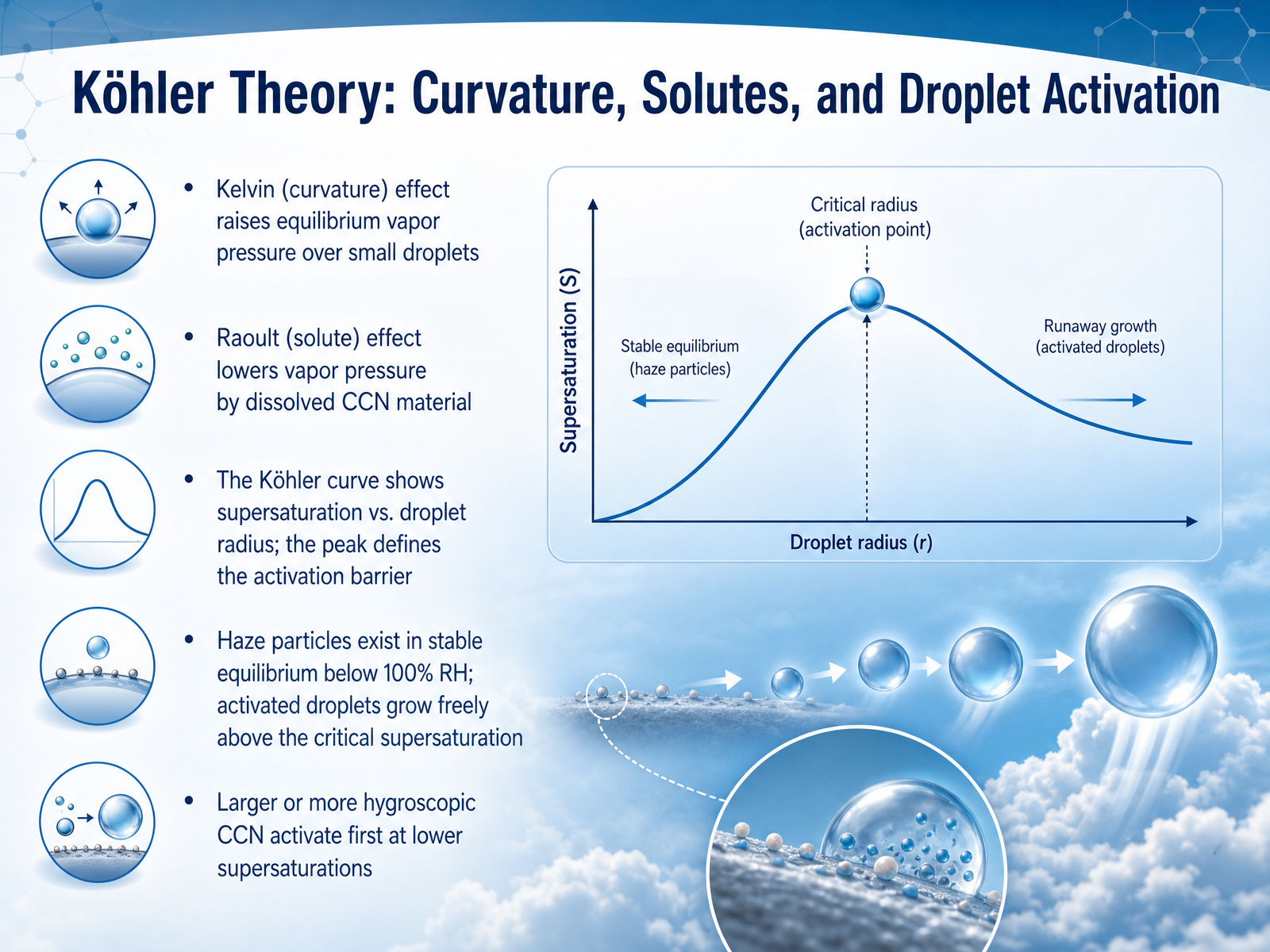
 - 08Köhler Theory: Curvature, Solutes, and Droplet ActivationNow we come to a key idea that explains why some tiny particles become cloud droplets while others just hang around as haze. This is known as Koehler theory. It combines two competing effects. The first is the curvature effect. A very small droplet has a strongly curved surface, which makes water molecules escape more easily. In other words, the tiny drop needs a higher humidity just to stay the same size. The second is the solute effect. When a particle dissolves, like sea salt or sulfate, it lowers the water's ability to evaporate. So the droplet can hold onto water at a lower humidity. A Koehler curve plots these two forces against droplet size. At the peak of the curve, we find a critical supersaturation. Below that peak, particles sit in stable equilibrium as haze, even in slightly humid air. But once the air's humidity pushes past that critical point, the droplet activates. It passes the barrier and can grow freely into a full cloud droplet. Larger or more hygroscopic nuclei activate first, at lower supersaturations, because they need less of a humidity boost. This explains why not all particles become clouds. Next, we will watch how a droplet actually builds up, step by step, in 'From Vapor to Droplet: The Condensation Process Step by Step.'
 geo.libretexts.orgcourses.ems.psu.eduen.wikipedia.org+22 min
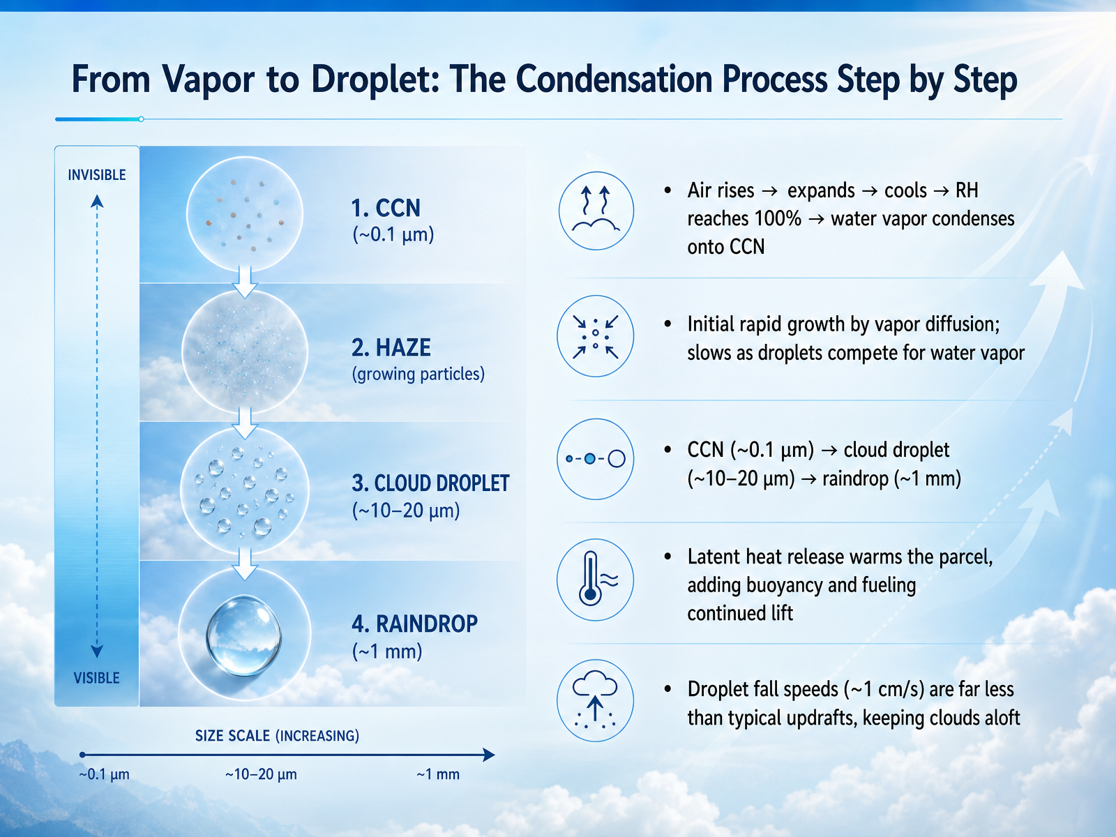
 - 09From Vapor to Droplet: The Condensation Process Step by StepNow let's trace the entire condensation process, step by step. It starts when a parcel of air rises. As it goes up, it expands, and that expansion causes it to cool. The cooling continues until the relative humidity reaches one hundred percent. At that point, the air is saturated, and water vapor is ready to change phase. But it can't condense on its own. The vapor needs a surface, so it latches onto those tiny cloud condensation nuclei we just discussed. This is called heterogeneous nucleation, and it's the birth of every cloud droplet. The initial growth is rapid. Vapor molecules diffuse through the air and stick to the nucleus. But as more droplets form, they start competing for the remaining water vapor, so the growth slows down. To give you a sense of scale, a typical condensation nucleus is about zero point one micrometers wide. The cloud droplet that forms on it grows to roughly ten or twenty micrometers. A full-sized raindrop is much larger, around one millimeter. During this process, something else happens. When vapor turns to liquid, it releases latent heat. This heat warms the air parcel, making it more buoyant and fueling its continued rise. Even though these droplets are now liquid, they fall incredibly slowly, at about one centimeter per second. That speed is far less than a typical updraft, which is why clouds stay suspended in the sky. Next, we'll explore what happens when the temperature drops below freezing, entering the world of supercooled water and ice nuclei.
 itia.ntua.gratoc.colorado.edugeo.libretexts.org+22 min
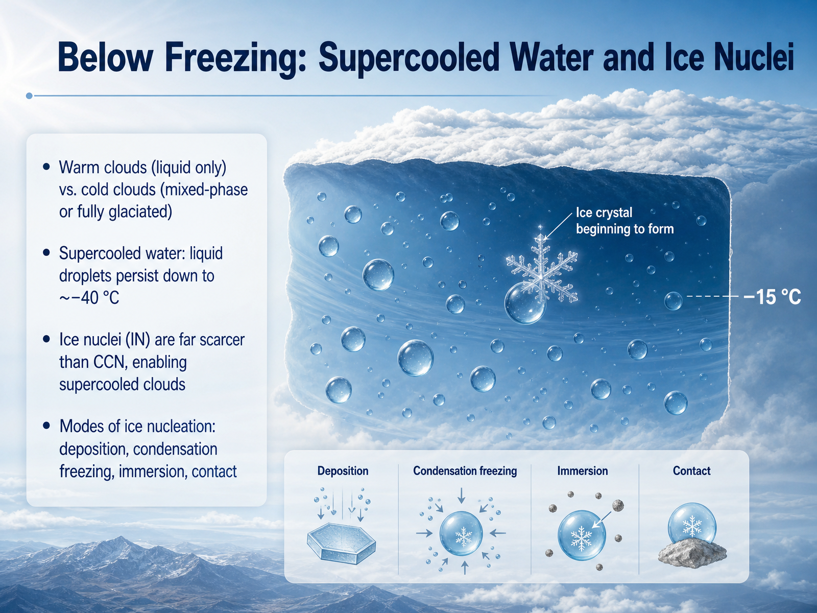
 - 10Below Freezing: Supercooled Water and Ice NucleiNow let's look at what happens when temperatures drop below freezing. Clouds in this range aren't always frozen. Some are warm clouds made entirely of liquid droplets, but cold clouds can be mixed-phase, with both liquid and ice, or fully glaciated, meaning completely frozen. The surprising part is that the liquid droplets in these cold clouds don't necessarily freeze at zero degrees Celsius. Water can exist in a supercooled liquid state all the way down to about negative forty degrees. This happens because droplets need a special type of particle to freeze, called an ice nucleus. Ice nuclei are much, much scarcer than the particles that form cloud droplets. Because they're so rare, supercooled clouds can persist for a long time. Ice can begin to form through several modes. Deposition happens when vapor turns directly into ice on a particle. Condensation freezing first turns vapor to liquid, which then freezes. Immersion freezing occurs when an ice nucleus already inside a droplet causes it to freeze from within, and contact freezing happens when a nucleus collides with a supercooled droplet. These are the key ways ice gets started in a cold cloud. Next, we'll see how once ice forms, it can grow rapidly through the Wegener–Bergeron–Findeisen process.
 en.wikipedia.orgjournals.ametsoc.orgacp.copernicus.org+22 min
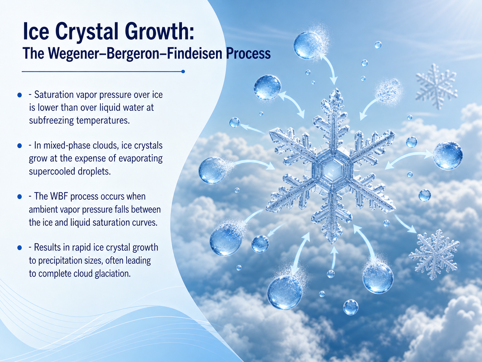
 - 11Ice Crystal Growth: The Wegener–Bergeron–Findeisen ProcessNow let's look at a key growth mechanism for ice crystals in mixed-phase clouds. It's called the Wegener–Bergeron–Findeisen process, or W B F for short. At subfreezing temperatures, the saturation vapor pressure over an ice surface is lower than over a liquid water surface. Think of it this way: water molecules escape more easily from a supercooled droplet than from an ice crystal. When the ambient vapor pressure sits between these two values, the air is supersaturated for ice but sub-saturated for liquid water. The droplets evaporate, and those freed water molecules rush to deposit onto ice crystals. The ice crystals grow rapidly while the droplets shrink. Because cloud droplets usually outnumber ice crystals by a wide margin, each crystal can feast on the vapor from many evaporating droplets. This lets the crystals quickly reach precipitation sizes and can eventually turn the entire cloud to ice, a process called glaciation. The W B F process is a primary way nature creates rain and snow in middle and high latitudes.
 en.wikipedia.orgjournals.ametsoc.orgacp.copernicus.org+22 min
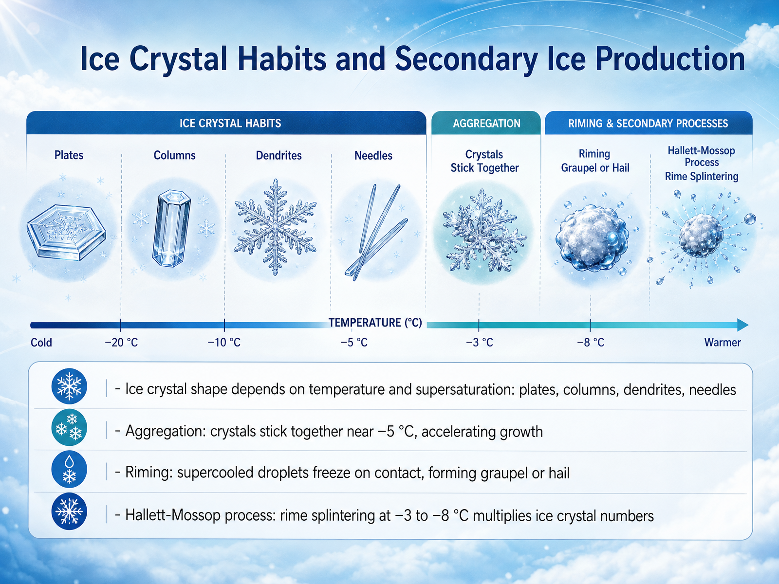
 - 12Ice Crystal Habits and Secondary Ice ProductionNext, let's look at how ice crystals grow and multiply inside a cloud. The shape an ice crystal takes depends on temperature and how much water vapor is available. We see thin plates, solid columns, feathery dendrites, or slender needles, each forming under slightly different conditions. As these crystals drift around, they can bump into each other and stick together, especially near minus five degrees Celsius, where their surfaces become a bit sticky. This clumping, called aggregation, speeds up their growth. Ice crystals also collect supercooled water droplets that freeze on contact, building a frosty coating known as rime. With enough riming, the crystal turns into graupel or even hail. There is also a fascinating process that multiplies ice crystals. When rime forms on a crystal between minus three and minus eight degrees Celsius, tiny splinters of ice can break off. Those splinters act as new seeds, each growing into a full crystal. This is the Hallett-Mossop process, and it can dramatically increase the number of ice crystals in a cloud, which brings us to the bigger picture of what clouds tell us.
 en.wikipedia.orgjournals.ametsoc.orgacp.copernicus.org+22 min
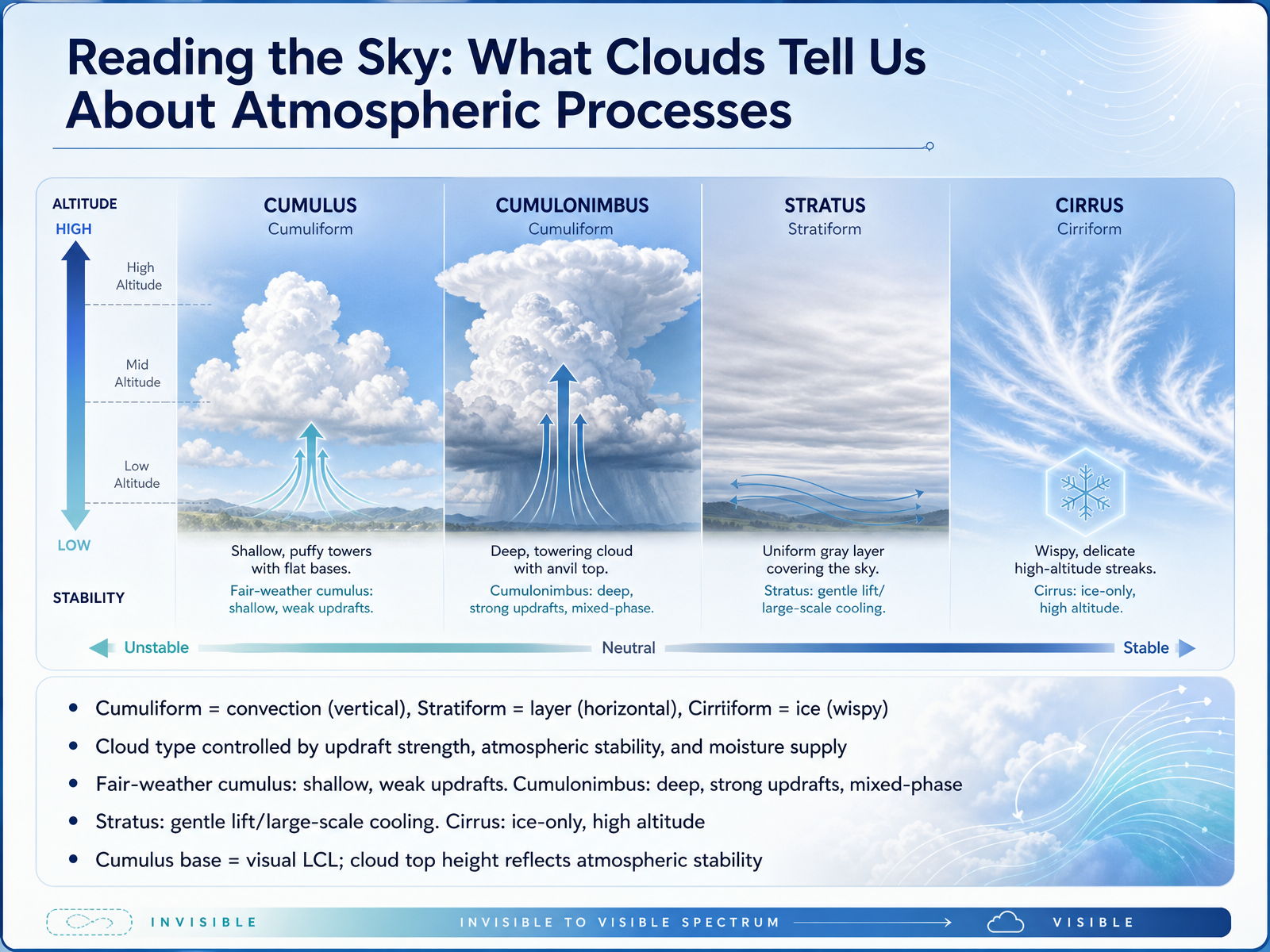
 - 13Reading the Sky: What Clouds Tell Us About Atmospheric ProcessesNow let’s read the sky and see what different cloud shapes tell us about what the atmosphere is doing. When you look up, you’re actually seeing three big families of motion and temperature. Cumuliform clouds look puffy and piled high—those are built by convection, meaning strong vertical updrafts. Stratiform clouds lie in flat layers, pushed up gently by large-scale lifting and stable air. And cirriform clouds are thin, wispy, and made entirely of ice crystals up where it’s very cold. The exact type you get depends on updraft strength, atmospheric stability, and how much moisture is available. For example, a fair-weather cumulus means shallow updrafts and limited moisture. But when the updrafts deepen and punch through stability, that same cumulus can grow into a cumulonimbus—a tall, mixed-phase giant with both liquid drops and ice. Stratus forms from broad, slow cooling, while cirrus tells you the cloud is ice-only at high altitude. You can also read the cumulus base as the visual lifting condensation level, and the cloud top height reflects the atmosphere’s stability cap. In the next slide, we’ll pull it all together in 'The Full Chain: Linking Vapor, Cooling, Nuclei, and Cloud Types.'
 itia.ntua.gratoc.colorado.edugeo.libretexts.org+22 min
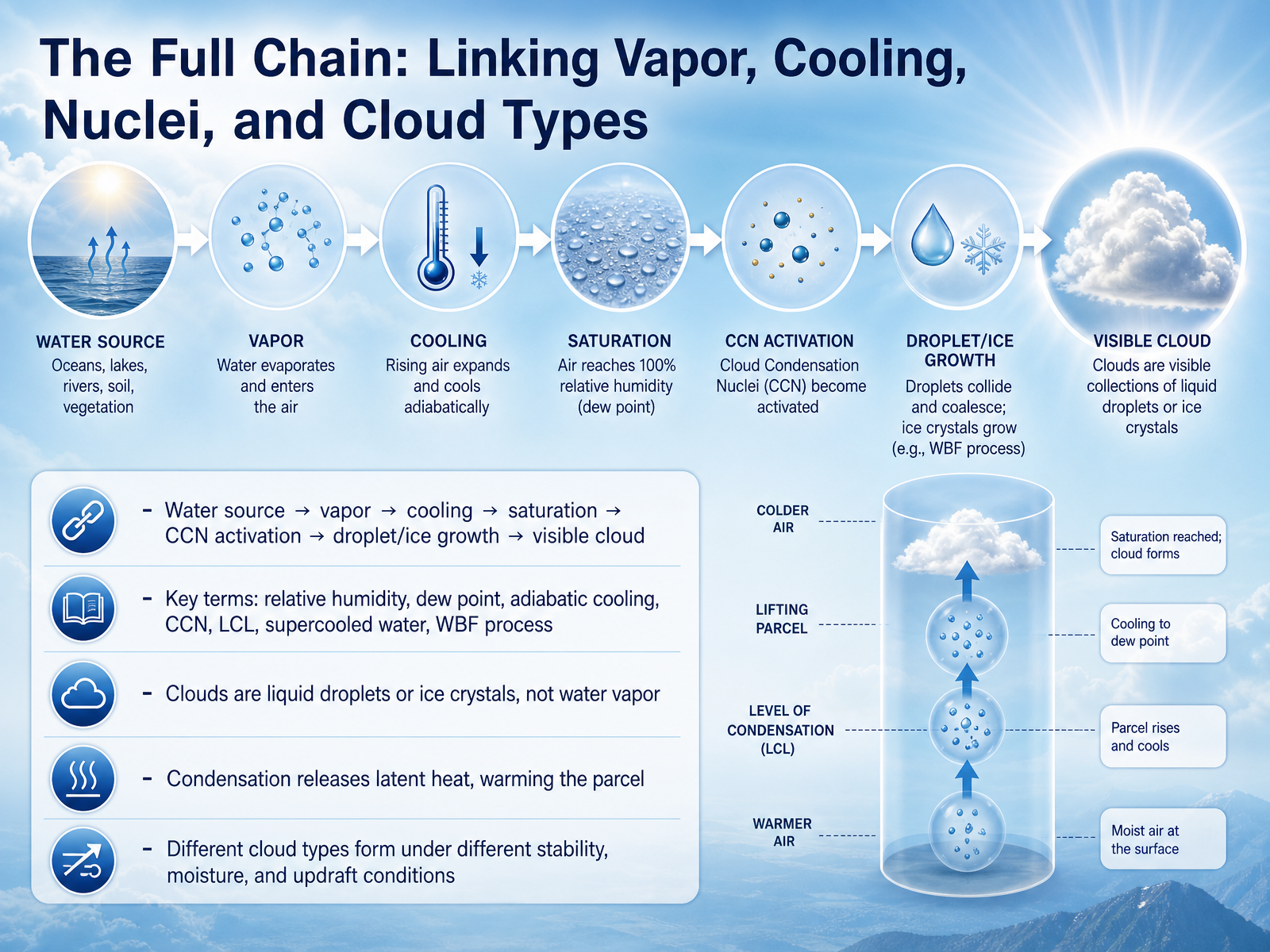
 - 14The Full Chain: Linking Vapor, Cooling, Nuclei, and Cloud TypesNow let's pull the whole chain together. It starts with a water source, like an ocean or a lake, that feeds water vapor into the air. As the air parcel rises, it expands and cools—this is adiabatic cooling. The temperature drops toward the dew point, and relative humidity climbs. Once saturation is reached, the lifting condensation level marks the cloud base. At that point, the vapor needs a surface, so it condenses onto cloud condensation nuclei. Those tiny particles—sea salt, dust, or smoke—activate and grow into liquid droplets or, if it's cold enough, ice crystals. Remember, the visible cloud is not water vapor; it is liquid droplets or ice. One more important piece: when vapor condenses, it releases latent heat, which warms the parcel and can fuel further uplift. Different cloud types emerge depending on stability, moisture, and the strength of the updraft. For cold clouds, supercooled water can coexist with ice, and the Wegener-Bergeron-Findeisen process lets ice crystals grow at the expense of liquid droplets because saturation vapor pressure is lower over ice. This full chain—vapor, cooling, nuclei, and growth—is the heart of cloud formation. Next, we'll step back and connect these ideas to weather in "Summary and Beyond: From Clouds to Weather."
 itia.ntua.gratoc.colorado.edugeo.libretexts.org+22 min
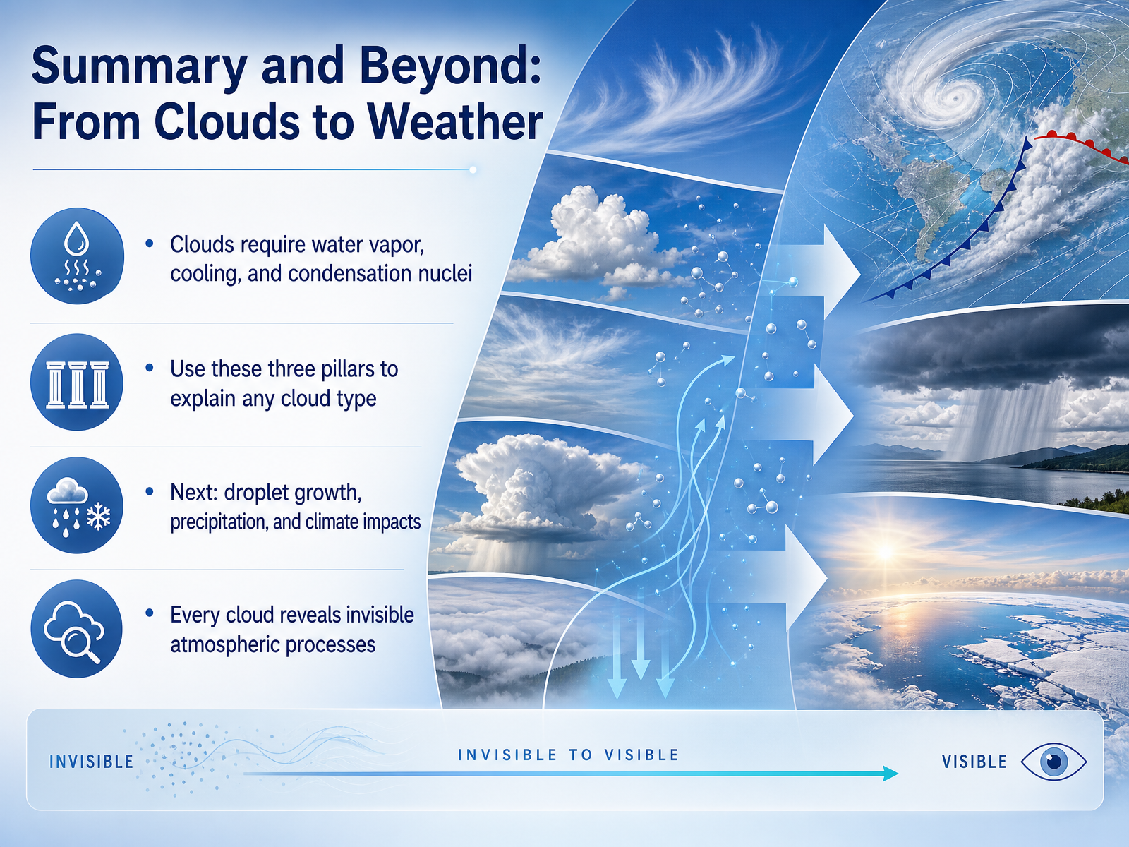
 - 15Summary and Beyond: From Clouds to WeatherLet's bring everything together. In this course, we built a simple but powerful foundation: every cloud you see needs three things. First, water vapor in the air. Second, cooling, which usually happens as air rises. And third, condensation nuclei—those tiny dust or salt particles that water can cling to. If you remember these three pillars, you can explain how any cloud type begins to form. In our next lesson, we'll move forward and explore how tiny droplets grow into raindrops, what makes precipitation fall, and how clouds shape our climate. Every cloud is a visible clue, showing us invisible processes happening in the atmosphere. Thanks for joining, and I look forward to seeing you in the next session.
 1 min
1 min
Take the deck with you
Download this course as a file — free, no sign-up needed.
- PDF handoutEvery slide page, ready to print or share.16 pages · 4.4 MBDownload
- Narrated PowerPointThe deck that presents itself — every slide carries the digital human's narration video.16 pages · 16.4 MBDownload
- PowerPoint slidesThe full deck as a .pptx — open it in PowerPoint, Keynote, or Google Slides.16 pages · 4.4 MBDownload
Free to use in your own training — please keep the PersonWise credit page at the end.
Have your own deck? Turn it into a course
Sources consulted
Web sources consulted while building this course.
- Clausius-Clapeyron equation and saturation vapour pressure: Typical hydrometeorological calculations — itia.ntua.gr
- Chapter 4 Water Vapor — atoc.colorado.edu
- 4: Water Vapor - Geosciences LibreTexts — geo.libretexts.org
- 4.2: Saturation - Geosciences LibreTexts — geo.libretexts.org
- NOAA - Air Resources Laboratory - FAQ - What is atmospheric humidity and how is it measured? — web.archive.org
- A Simplified Analytical Method to Calculate the Lifting Condensation Level from a Skew-T Log-P Chart — redalyc.org
- Estimating Cloud Height — eoas.ubc.ca
- Estimation of the Lifting Condensation Level — weatherclasses.com
- lifted_condensation_level — metview documentation — metview.readthedocs.io
- Lifting condensation level — en.wikipedia.org
- 7.2: Nucleation of Liquid Droplets — geo.libretexts.org
- 4.6 Where do cloud condensation nuclei (CCN) come from? — courses.ems.psu.edu
- Köhler theory — en.wikipedia.org
- 6.2: Cloud Condensation Nuclei - Geosciences LibreTexts — geo.libretexts.org
- Cloud condensation nuclei — en.wikipedia.org
- Wegener–Bergeron–Findeisen process — en.wikipedia.org
- Limitations of the Wegener–Bergeron–Findeisen Mechanism in the Evolution of Mixed-Phase Clouds — journals.ametsoc.org
- ACP - Evaluating the Wegener–Bergeron–Findeisen process in ICON in large-eddy mode with in situ observations from the CLOUDLAB project — acp.copernicus.org
- Journal list menu — rmets.onlinelibrary.wiley.com
- How Are Mixed‐Phase Clouds Mixed? — pmc.ncbi.nlm.nih.gov