Introduction to Archaeology
Begin
16 pages · ~32 min
Introduction to Archaeology
Explore the fundamentals of archaeology, including its methods, goals, and how it uncovers the human past.
What you’ll learn
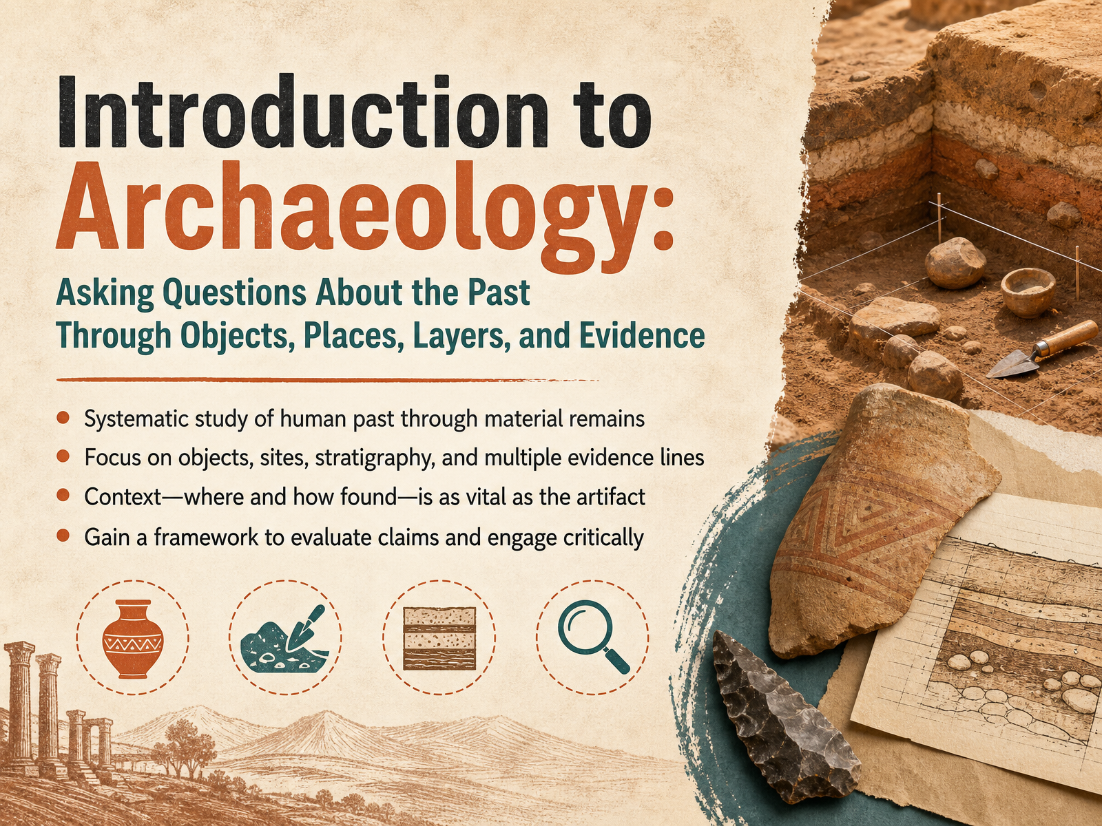
- 01Introduction to Archaeology: Asking Questions About the Past Through Objects, Places, Layers, and EvidenceWelcome to Introduction to Archaeology. In this course, we're going to explore how archaeologists investigate the human past. It's a discipline grounded in careful observation and systematic thinking. We don't just look for old things; we use those things to ask meaningful questions. At its core, archaeology is the systematic study of the human past through material remains. You'll learn to focus on four key categories of evidence: objects, sites, stratigraphy—that is, the study of soil and occupation layers—and multiple lines of evidence that work together. A central principle we'll return to is context. Where an object was found and what it was found with is often as vital as the object itself. By the end, you will gain a practical framework. One that helps you evaluate historical claims and engage critically with the stories material culture can tell. Let's get started by laying the disciplinary foundations. We'll move now into our next part: What Is Archaeology? Disciplinary Foundations and Core Aims.2 min
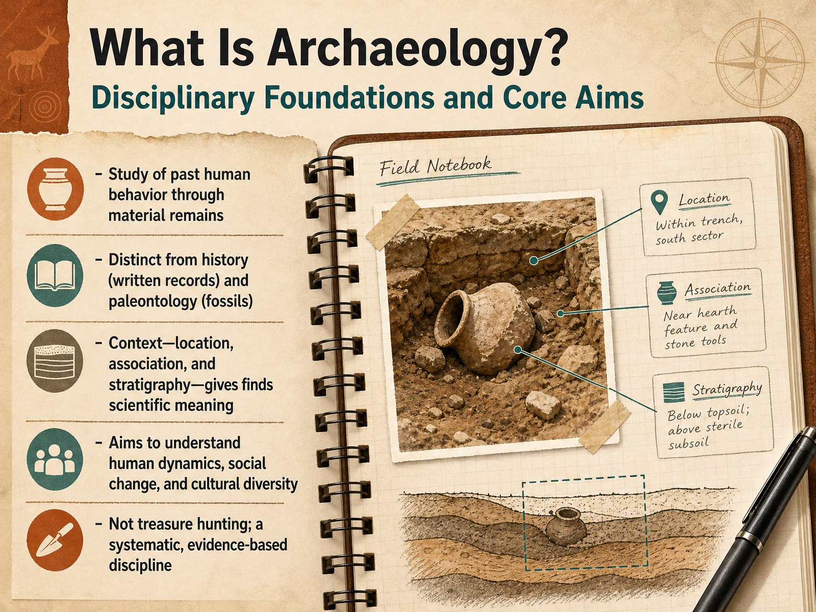
- 02What Is Archaeology? Disciplinary Foundations and Core AimsBuilding on that introduction, let's define what archaeology actually is. At its core, archaeology is the study of past human behavior through the material remains left behind. That means we study objects like tools, pottery, and building foundations, not written documents. This is one key distinction: history relies primarily on written records, while paleontology focuses on much older fossilized plants and animals. Archaeology sits in between, focused on people and their things. But a single object alone doesn't tell us much. What gives an artifact its scientific meaning is its context. We carefully record its exact location, its association with other finds, and its position within layers of soil, a principle we call stratigraphy. These layers act like a timeline, with older materials generally found deeper down. This systematic approach reveals archaeology's real aims. We seek to understand long-term human dynamics, how societies changed, and the incredible diversity of cultural solutions across time. So, this is never about treasure hunting. It is a meticulous, evidence-based discipline that builds questions from the ground up. Next, let's look closer at that raw material by examining the archaeological record, including artifacts, ecofacts, and features.
 2 min
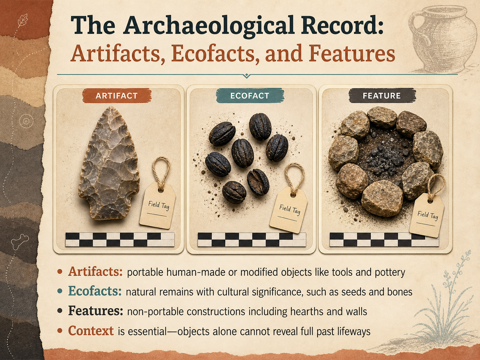
2 min - 03The Archaeological Record: Artifacts, Ecofacts, and FeaturesNow let's take a closer look at the kinds of evidence that make up the archaeological record. We can group this evidence into three main categories. First, there are artifacts. These are portable objects that people made or modified. Think of a stone arrowhead or a broken piece of pottery. Next are ecofacts. These are natural remains that have cultural meaning. A pile of charred seeds in an ancient cooking pot, for example, or animal bones left behind after a meal. The third category is features. Features are human-made constructions you cannot easily carry away. A stone hearth used for a fire or the mud brick wall of a house are both features. What ties all of these together is context. An artifact tells us very little by itself. Its true story emerges from where it sat in the ground, what it sat beside, and how deeply it was buried. These relationships let us ask meaningful questions about daily life in the past. Let's move on and see how these clusters of evidence fit into larger places and spaces.
 2 min
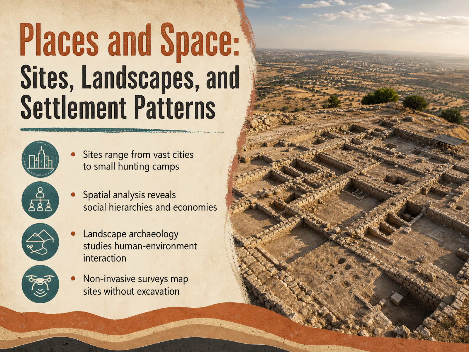
2 min - 04Places and Space: Sites, Landscapes, and Settlement PatternsNow, let's think about where archaeology happens. Places and space are fundamental to our questions. An archaeological site can be anything from a sprawling ancient city to a tiny, temporary hunting camp where people stopped for just a few days. The scale varies enormously, but our approach to understanding them shares a common thread: spatial analysis. By carefully mapping where artifacts and features are found, we can start to see social hierarchies and ancient economies. For example, the distribution of large, ornate houses versus smaller, simpler ones across a settlement can suggest class divisions. The location of workshops and imported goods can trace trade networks. Beyond a single site, landscape archaeology broadens our view to study the deep relationship between people and their environment over centuries. We ask how communities shaped the land through farming or water management, and how the environment, in turn, shaped their lives. Often, the first step in this work doesn't involve digging at all. Non-invasive surveys, like walking across a freshly plowed field to collect surface artifacts or using ground-penetrating radar, allow us to map entire sites and landscapes without disturbing them. This careful planning preserves the site and guides our questions. Next, we will explore a revolutionary technology taking this non-invasive approach to incredible new heights, as we look at seeing beneath the canopy with LiDAR.
 2 min
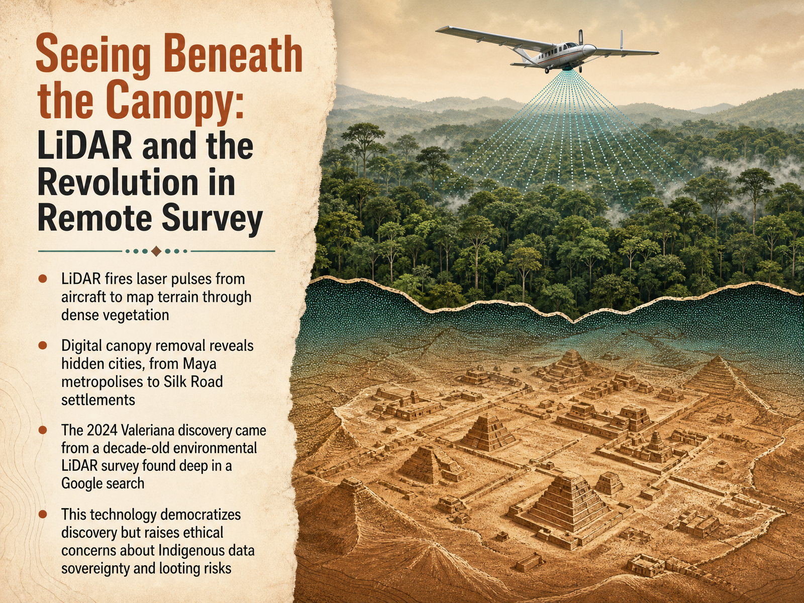
2 min - 05Seeing Beneath the Canopy: LiDAR and the Revolution in Remote SurveyLet's turn now to one of the most transformative tools in modern archaeology, a technology that lets us quite literally see beneath the forest canopy. It is called LiDAR, which stands for Light Detection and Ranging. Picture an aircraft flying over dense jungle, firing rapid pulses of laser light toward the ground. Most of those pulses hit leaves and branches, but some slip through tiny gaps and reach the surface below. By digitally stripping away the vegetation returns, researchers create a bare-earth model that reveals walls, plazas, and even entire cities hidden for centuries. This approach has rewritten our maps of the ancient Maya world, uncovering sprawling metropolises across Mexico and Guatemala. It also revealed a major Silk Road settlement high in the mountains of Uzbekistan, reshaping what we thought about trade routes and high-altitude urban life. The most striking example came in twenty twenty-four, when a Tulane University graduate student named Luke Auld-Thomas made a discovery without leaving his desk. He found a decade-old environmental LiDAR survey deep in a Google search, ran it through archaeological processing software, and uncovered a lost Maya capital now called Valeriana, complete with more than sixty-five hundred structures. That story captures both the promise and the caution of this technology. LiDAR democratizes discovery by letting researchers reuse existing data in powerful new ways. But it also raises urgent ethical questions about data sovereignty for Indigenous communities and the risk of revealing site locations to looters before protection plans are in place. As we continue, keep that tension between visibility and responsibility in mind. Next, we will go underground, exploring how archaeologists read layers of time through stratigraphy and relative dating.
 smithsonianmag.comtheartnewspaper.comspacedaily.com+22 min
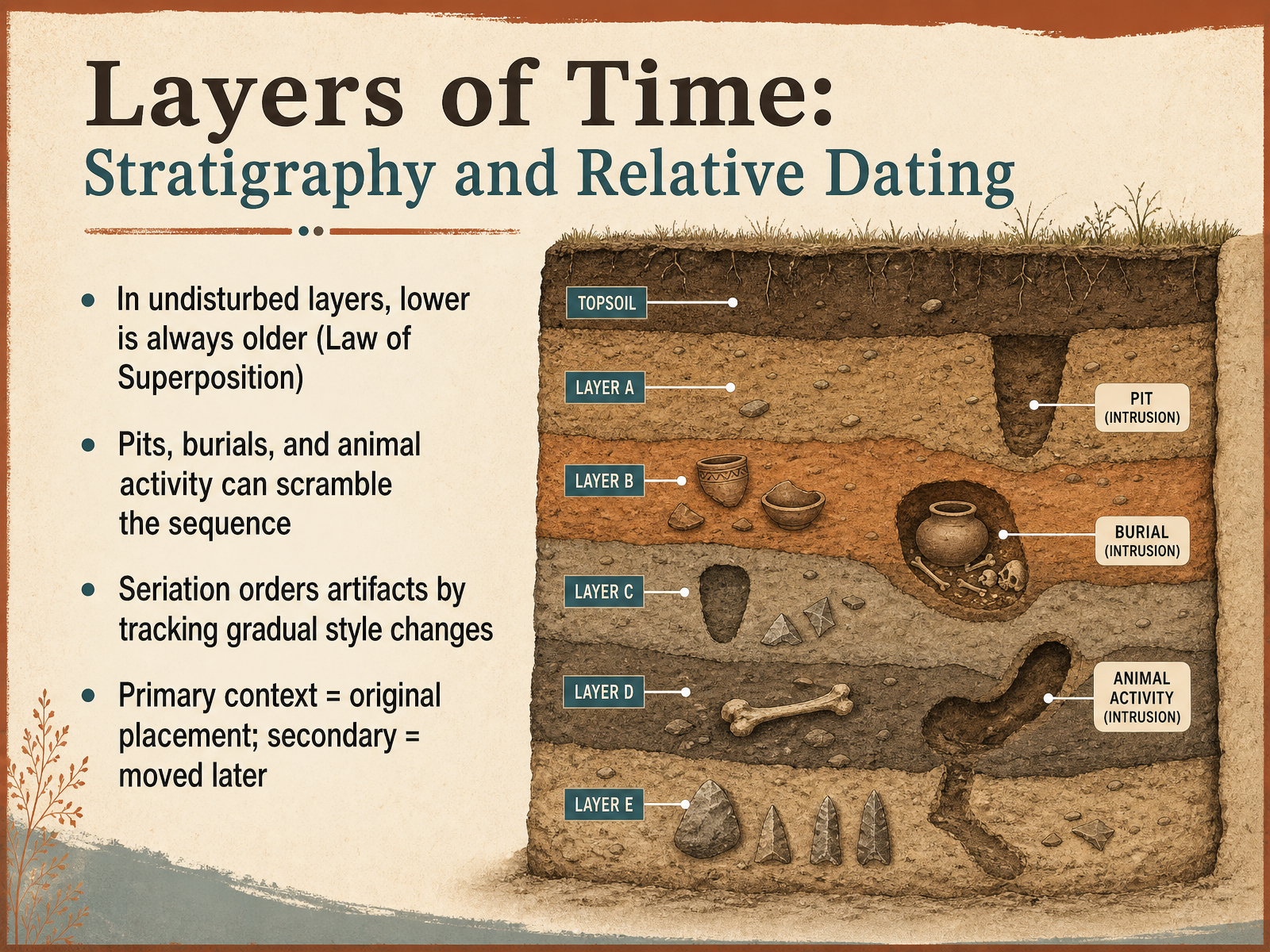
 - 06Layers of Time: Stratigraphy and Relative DatingNow, let's look at how archaeologists read time in the ground itself. This is called stratigraphy. The most basic rule is the Law of Superposition. Think of a stack of newspapers on your front porch; the one that arrived earliest is at the bottom. In the same way, within an undisturbed sequence of soil layers, the lowest layer is always the oldest. But the ground is rarely a simple, tidy stack. Human actions and natural forces constantly disturb it. A rubbish pit dug in the past will cut through older layers, pushing newer material deep down. A burrowing animal can drag an ancient bone up to the surface. These intrusions scramble the sequence, which is why context is everything. Archaeologists also track the things they find through a method called seriation. By observing how the style of pottery, for example, gradually shifted over time, we can arrange artifacts in a relative order from earlier to later designs. Finally, we distinguish between primary and secondary context. Primary context means an object is found exactly where it was last used or placed, perhaps a pot left on a buried house floor. Secondary context means it was moved later, like that pot shard kicked into a trash pile. Understanding this difference is critical for asking the right questions. Next, we will move from relative sequences to another tool, as we explore building absolute timelines with radiocarbon and other dating methods.
 2 min
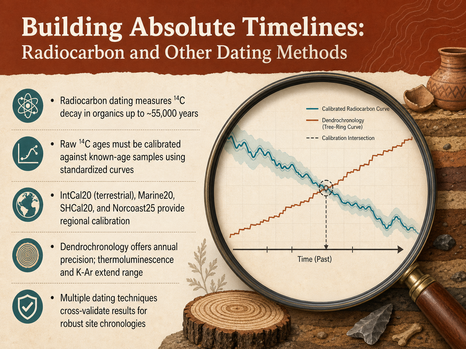
2 min - 07Building Absolute Timelines: Radiocarbon and Other Dating MethodsNow we move from thinking in relative terms to building absolute timelines. The most famous tool here is radiocarbon dating, which measures the decay of carbon fourteen in organic remains, anything that was once alive, like wood, bone, or seeds. This method can typically reach back about fifty-five thousand years. But here is a crucial detail. The raw radiocarbon age is not a calendar date. You must calibrate it. Because the amount of carbon fourteen in the atmosphere has fluctuated over time, we compare the sample’s measurement to a calibration curve built from materials of known age, like ancient tree rings. The current standard for the Northern Hemisphere is a curve called Int Cal twenty. We also have specific curves for marine samples and for the Southern Hemisphere. Some even provide local adjustment data, like Norcoast twenty-five for the Norwegian coast. To build these long records, archaeology also relies on other methods. Dendrochronology, the study of tree ring patterns, can give us precision down to a single year. For much older sites, beyond the reach of radiocarbon, we use techniques like thermoluminescence and potassium-argon dating. And here is a key principle. No single date is final. We look for multiple chronological anchors, cross-validating different dating techniques to build a robust and reliable timeline for a site. Next, we will explore how we move from this hard-won evidence to interpretation, focusing on the logic of archaeological reasoning.
 maarten14c.r-universe.devcambridge.orgcambridge.org+22 min
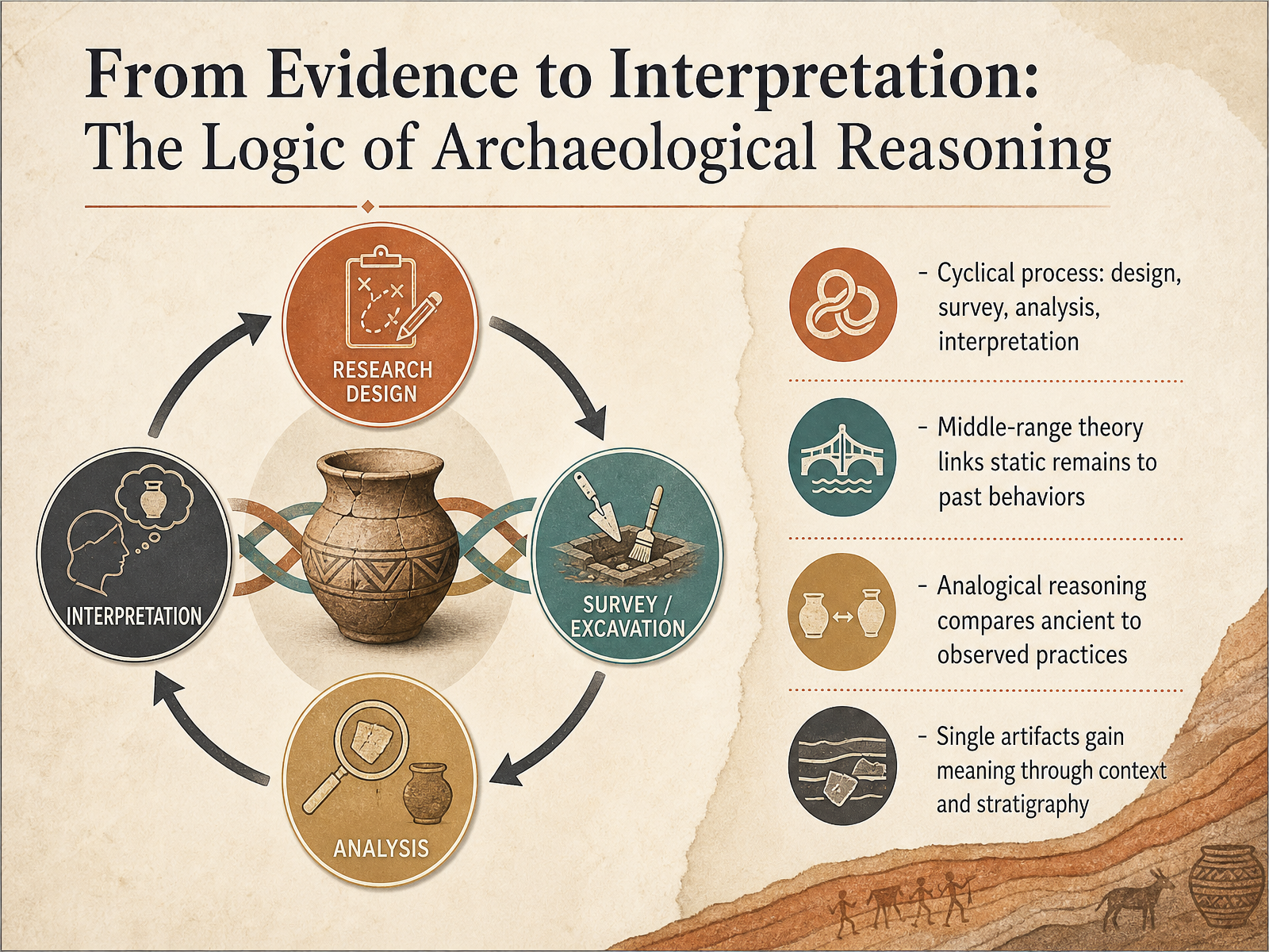
 - 08From Evidence to Interpretation: The Logic of Archaeological ReasoningWe have talked about finding and mapping sites. Now let us ask: how do archaeologists actually reason from what they see to what they can say about the past? The process is not a straight line. Instead, it loops: we design a research question, survey for evidence, analyze what we recover, and build an interpretation. Then that interpretation often sparks a new question, and the cycle begins again. At the center of this loop is something called middle-range theory. This is the bridge that links static remains, things that do not move or change, to the dynamic behaviors that created them. For example, the distribution of stone flakes on a floor is linked, through experimental knapping, to where a person sat and how they moved their hands. Archaeologists also use analogical reasoning. They carefully compare an ancient tool mark to marks made by observed butchering practices today, always aware that the past may not be a perfect mirror of the present. Most importantly, a single object gains its meaning only through context and stratigraphy. A broken pot on a hearth tells a different story than the same pot in a grave, and its position in the layered soil tells us when that story took place. In short, archaeological reasoning turns careful observation into testable, logical narratives about human life. Next, we will apply this reasoning directly as we explore the Maya city of Minanbé, integrating multiple lines of evidence.
 2 min
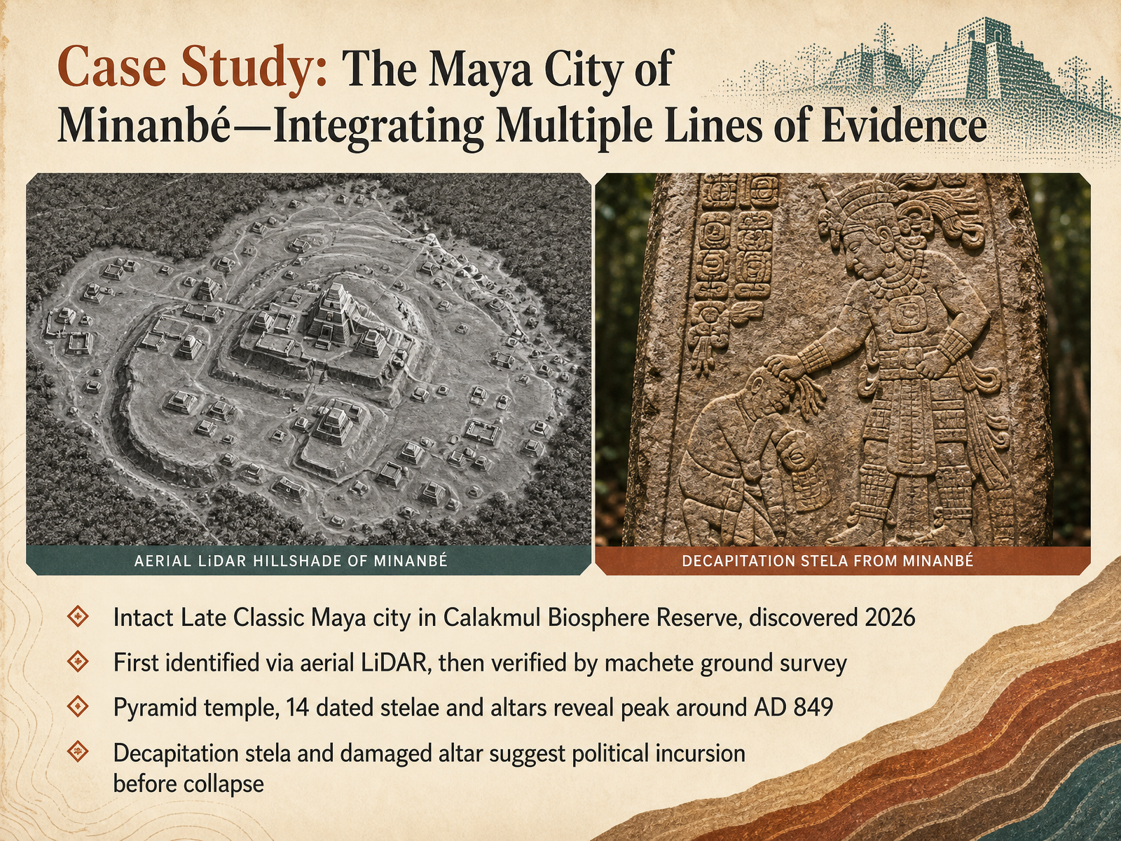
2 min - 09Case Study: The Maya City of Minanbé—Integrating Multiple Lines of EvidenceNow let's bring together the types of evidence we have been discussing by looking at a single remarkable case study: the Maya city of Minanbé. Its name means "there is no road" in Yucatec Maya, and that tells you a lot. This intact Late Classic city sits deep inside the Calakmul Biosphere Reserve and was only discovered in 2026. The first clue came not from the ground, but from the air. Aerial LiDAR scans revealed the outlines of plazas, palaces, and a pyramid temple hidden beneath the dense canopy. Researchers then verified those findings the hard way, hacking a three-mile path with machetes to reach the site on foot. What they found was extraordinary. A temple pyramid over forty feet tall, built in the Río Bec style, and fourteen dated stone stelae and altars. Epigraphers deciphered dates pointing to a peak around the year 849 AD. But the carved stones also pose a troubling question. One stela depicts a figure decapitating another, and a carved altar appears to have been intentionally damaged. These features suggest a political incursion or violent conflict just before the city's collapse. Notice how the interpretation weaves together remote sensing, careful excavation, and epigraphic analysis. No single line of evidence tells the whole story. The next slide moves from this ancient city to the modern settings where archaeology happens today: fieldwork, labs, and digital tools.
 smithsonianmag.comtheartnewspaper.comspacedaily.com+22 min
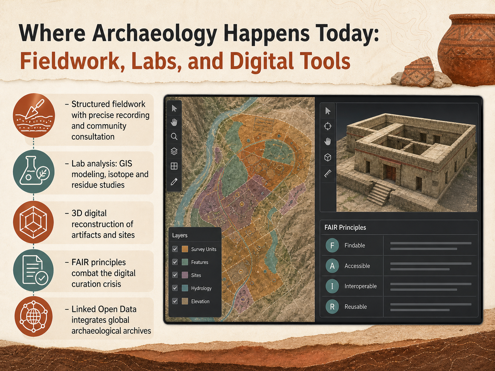
 - 10Where Archaeology Happens Today: Fieldwork, Labs, and Digital ToolsSo where does archaeology actually happen today? It is not only about digging in remote places. Modern archaeology is a blend of structured fieldwork, laboratory science, and digital reconstruction. In the field, every find is precisely recorded with its exact location and depth, and work proceeds with community consultation to ensure local knowledge shapes the investigation. Back in the lab, we analyze data using GIS modeling to map site distributions, and we apply isotope and residue studies to understand ancient diets and trade. We also create three-dimensional digital reconstructions of artifacts and sites, which lets researchers and the public examine fragile objects without touching the originals. To manage all this data, we follow FAIR principles—making data Findable, Accessible, Interoperable, and Reusable—which helps combat the digital curation crisis. Technologies like Linked Open Data further integrate global archaeological archives, connecting separate datasets into a broader research network. Up next, we will explore the ethical responsibilities that guide this work, including data sovereignty, community collaboration, and informed consent.
 2 min
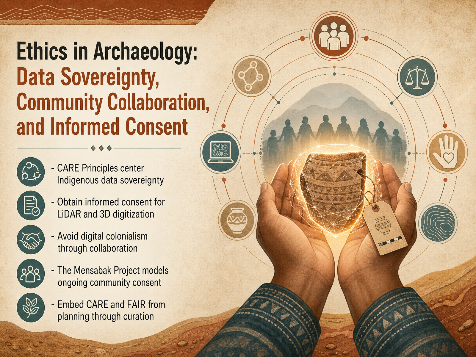
2 min - 11Ethics in Archaeology: Data Sovereignty, Community Collaboration, and Informed ConsentNow let’s turn to the ethical responsibilities that guide archaeological practice today. This slide introduces the CARE Principles, which focus on Indigenous data sovereignty. That means Indigenous communities have the right to control how data about their cultural heritage is collected, used, and shared. When we use tools like LiDAR or create digital three-dimensional models of sites, we must first obtain informed consent from the communities connected to those places. Without that consent, digital documentation can become a form of digital colonialism—taking and circulating knowledge without permission. The Mensabak Project in Mexico offers a strong model. There, researchers work with the local Maya community to secure ongoing consent at every stage, not just at the start. As we plan and manage archaeological data, we embed two sets of principles: CARE for collective benefit and authority, and FAIR for making data findable, accessible, interoperable, and reusable. Together, they keep our work responsible from planning through long-term curation. Up next, we’ll explore how artificial intelligence is opening new frontiers in archaeology, and the new responsibilities that come with it.
 2 min
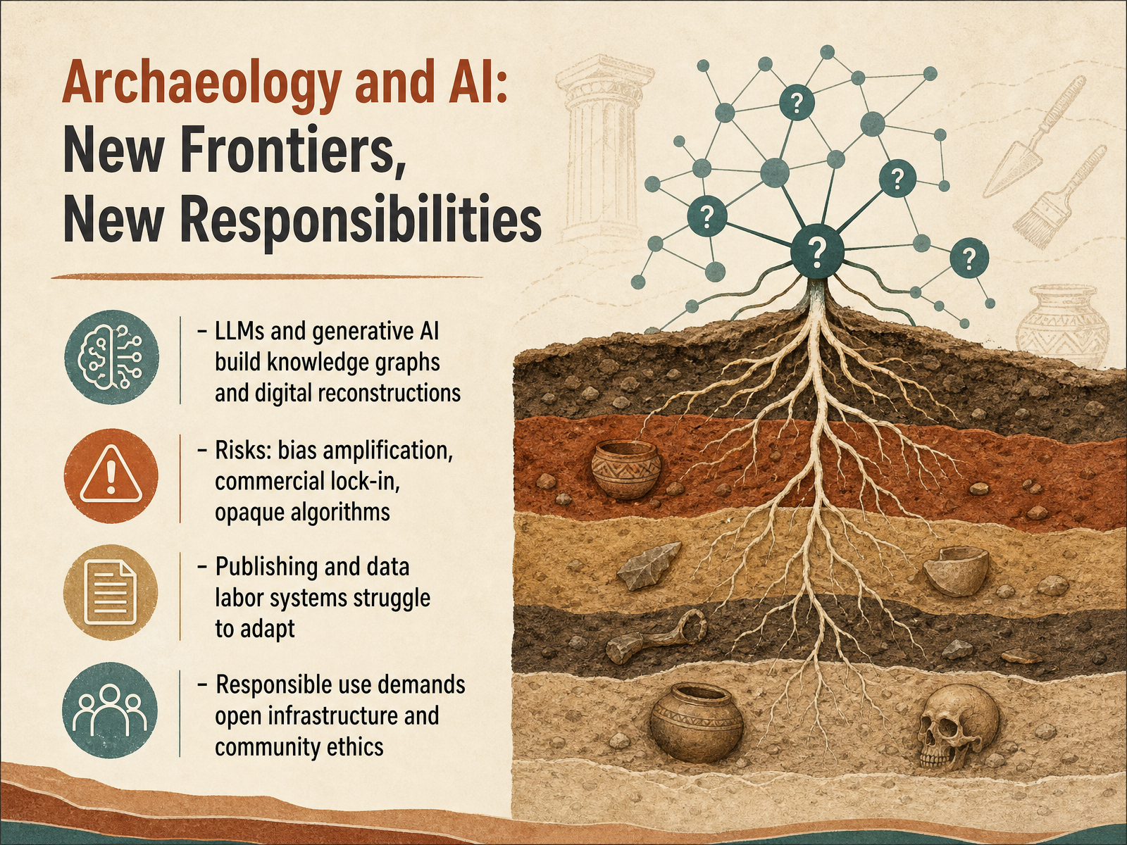
2 min - 12Archaeology and AI: New Frontiers, New ResponsibilitiesNow we turn to a powerful new chapter in archaeology: the intersection of artificial intelligence and our responsibility to use it wisely. Large language models and generative AI can build massive knowledge graphs, linking data from sites around the world, and create stunning digital reconstructions of ancient structures. But these tools bring serious risks. Bias can be amplified if training data is skewed, commercial lock-in can restrict access to our shared heritage, and opaque algorithms may produce results we cannot explain. The academic systems that publish findings and credit data labor are struggling to keep pace. Responsible use demands open infrastructure and a strong commitment to community ethics, ensuring technology serves transparency rather than obscures it. Next, we will explore how these principles apply beyond the university, moving into public archaeology and citizen science, where everyone can contribute.
 2 min
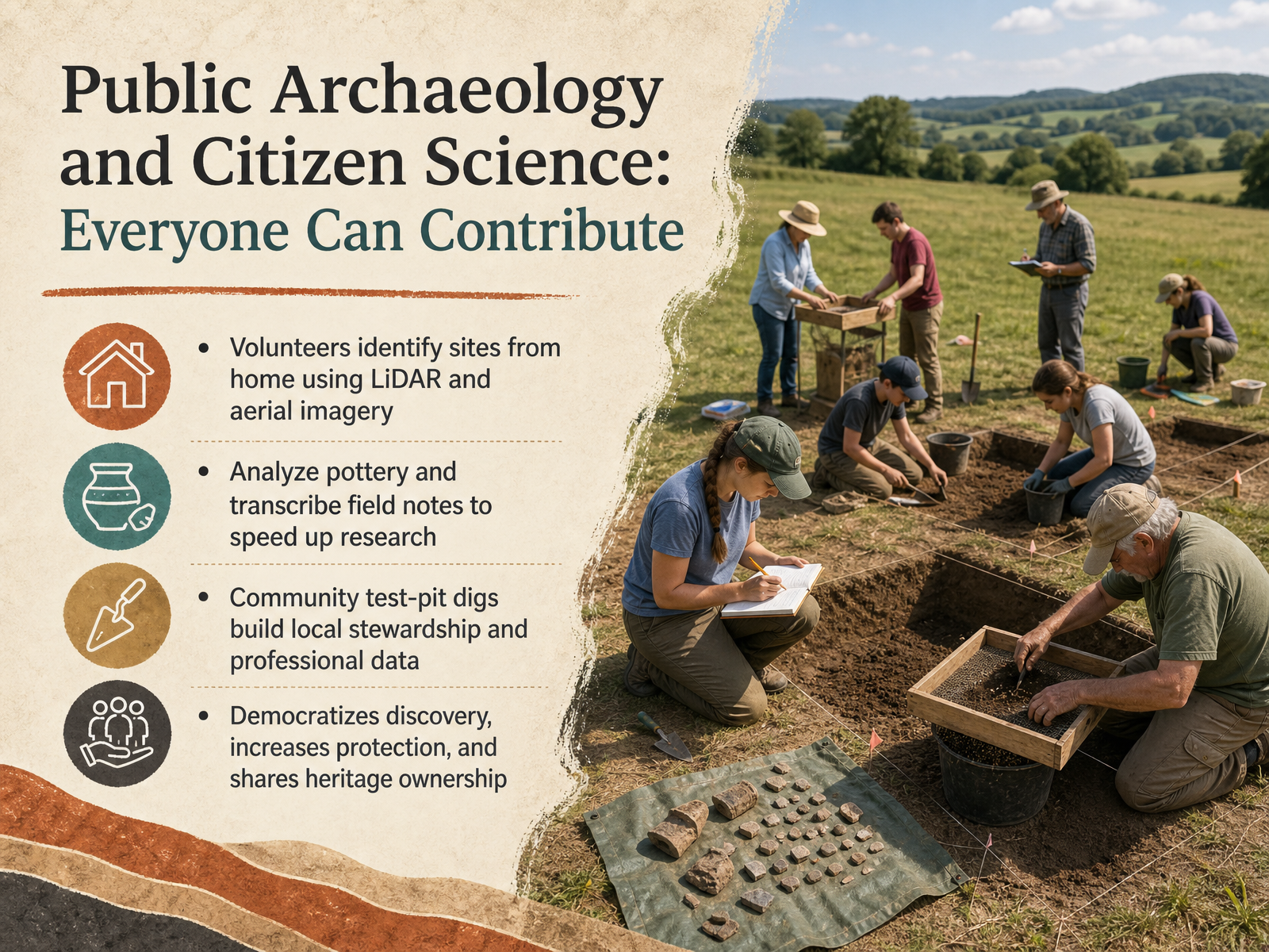
2 min - 13Public Archaeology and Citizen Science: Everyone Can ContributeNow let's look at how public archaeology and citizen science open the field to everyone. Volunteers can participate right from home, identifying potential sites by studying LiDAR and aerial imagery. Projects like Heritage Quest Luxembourg rely on thousands of people scanning landscapes for tumuli and other hidden features, covering far more ground than specialists could alone. Other digital tasks speed up research as well. For example, the Tell Qana project invites volunteers to analyze pottery sherds and transcribe field notes, while the Ness of Brodgar 'Sherd Nerds' program works through massive ceramics assemblages. Engagement also moves out into the field. Community test-pit digs, like the Charnwood Forest Uncovered project in England, let residents excavate their own gardens under professional supervision. This approach builds local stewardship and generates high-quality data about how entire villages developed over centuries. When communities help discover and document heritage, the process democratizes discovery, strengthens protection, and shares ownership of the past more broadly. Next, we turn to a different challenge: recognizing pseudoarchaeology, when claims lack material evidence.
 arcane-lab.orgdigventures.comuniversiteitleiden.nl+22 min
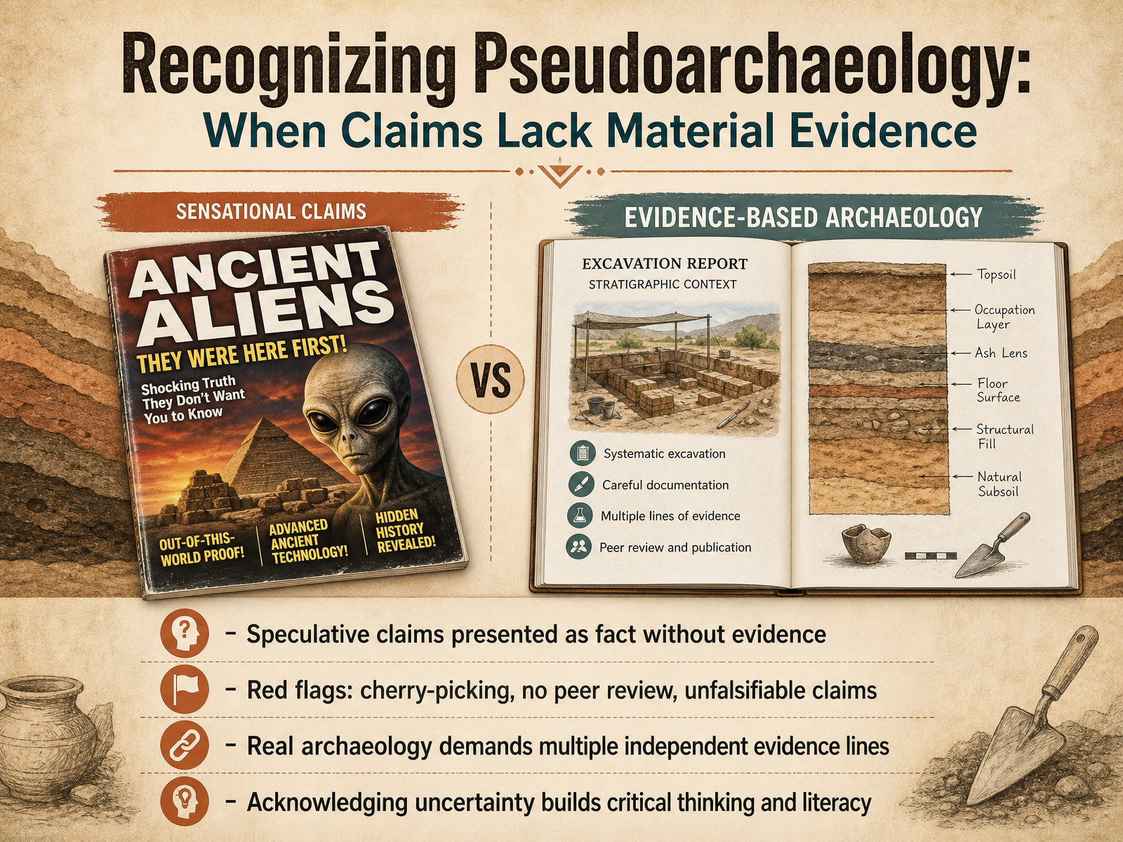
 - 14Recognizing Pseudoarchaeology: When Claims Lack Material EvidenceNow let's turn to a concept that is as important to archaeology as a sharp trowel: recognizing pseudoarchaeology. These are speculative claims presented as fact, but without material evidence to support them. Think of sensational stories about ancient aliens or lost continents. The red flags are predictable. You will see cherry-picked data that ignores contradictory finds, no peer review, and grand, unfalsifiable claims that can never truly be tested. Real archaeology, in contrast, demands multiple, independent lines of evidence before a conclusion is even considered. We also learn to embrace uncertainty. Acknowledging what we do not know is not a weakness. It is the very engine of critical thinking and scientific literacy. In our final slide, we will shift focus and explore a practical framework for asking your own questions and engaging with the past.
 2 min
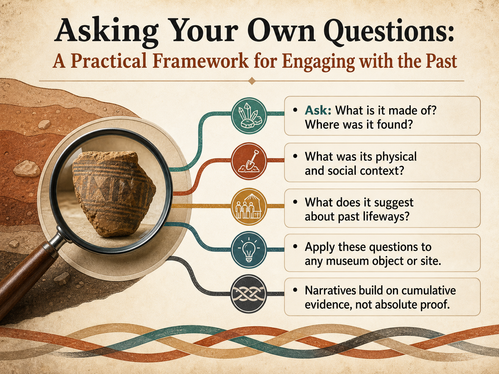
2 min - 15Asking Your Own Questions: A Practical Framework for Engaging with the PastNow that you have seen how archaeologists work, let's build a simple framework you can use yourself. The next time you encounter an artifact, whether in a museum or at a site, start with two foundational questions. Ask yourself: what is this object made of, and exactly where was it found? These details are never just trivia. Material tells you about available resources and technology, while location begins to reveal its context. From there, look deeper. Consider its physical surroundings and its social context. Was it found in a kitchen, a burial, or a workshop? This placement speaks volumes about how it was used and valued. Then, ask the larger question: what does this single object suggest about past lifeways, about how people lived, ate, or organized their community? Remember that narratives are built on cumulative evidence, not absolute proof. One object raises a question, and a pattern of objects begins to tell a story. Let's carry this practical mindset forward into our final summary and next steps in archaeological literacy.
 2 min
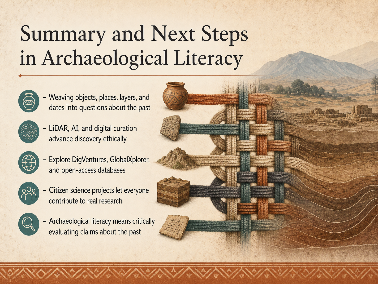
2 min - 16Summary and Next Steps in Archaeological LiteracyWe have reached the end of our introduction to archaeology. Let us briefly gather the threads. We began with objects, places, layers, and dates, and we saw how these simple clues are woven into powerful questions about the human past. We explored how new technologies, things like LiDAR, artificial intelligence, and digital curation, are advancing discovery in an ethical and thoughtful way. And we discovered that archaeology is not a closed door. Platforms like DigVentures, GlobalXplorer, and many open access databases invite everyone to participate. Citizen science projects, from mapping lost landscapes to sorting pottery sherds, let you contribute directly to real research. Ultimately, archaeological literacy is not just about knowing facts. It is about learning to critically evaluate claims about the past and understanding how we know what we know. Thank you for learning alongside me. Take this curiosity with you. The past is waiting to be questioned, and perhaps you will be the one to ask the next question.
 arcane-lab.orgdigventures.comuniversiteitleiden.nl+22 min
Take the deck with you
Download this course as a file — free, no sign-up needed.
- PDF handoutEvery slide page, ready to print or share.17 pages · 7.8 MBDownload
- Narrated PowerPointThe deck that presents itself — every slide carries the digital human's narration video.17 pages · 21.2 MBDownload
- PowerPoint slidesThe full deck as a .pptx — open it in PowerPoint, Keynote, or Google Slides.17 pages · 7.8 MBDownload
Free to use in your own training — please keep the PersonWise credit page at the end.
Have your own deck? Turn it into a course
Sources consulted
Web sources consulted while building this course.
- Deep in the Mexican Jungle, Archaeologists Discovered a Lost Maya City That May Yield Clues About the Civilization Just Before It Collapsed — smithsonianmag.com
- Undisturbed ancient Maya city discovered in Mexican jungle - The Art Newspaper - International art news and events — theartnewspaper.com
- The map of a lost Mayan megacity, with more than 6,000 buildings and a peak population of 50,000 people, had been hiding in plain sight for ten years inside a government survey of the Mexican rainforest — until a PhD student at Tulane University scrolled past page 16 of a Google search in 2024 and r — spacedaily.com
- Lidar Reveals Silk Road City in Uzbekistan - Lidar News — lidarnews.com
- Lidar Maya City Discovery Reveals Hidden Ruins - Lidar News — lidarnews.com
- rintcal: Radiocarbon Calibration Curves — maarten14c.r-universe.dev
- The IntCal20 Northern Hemisphere Radiocarbon Age Calibration Curve (0–55 cal kBP) | Radiocarbon | Cambridge Core — cambridge.org
- Testing and Improving the IntCal20 Calibration Curve with Independent Records | Radiocarbon | Cambridge Core — cambridge.org
- Marine20—The Marine Radiocarbon Age Calibration Curve (0–55,000 cal BP) | Radiocarbon | Cambridge Core — cambridge.org
- A marine radiocarbon calibration curve for the Norwegian North Atlantic coast, from Bølling to the Early Holocene (14.4–11.0 ka BP) | Radiocarbon | Cambridge Core — cambridge.org
- Heritage Quest Luxembourg – ARCANE Lab — arcane-lab.org
- Deep Time | DigVentures — digventures.com
- About the project - Leiden University — universiteitleiden.nl
- About Us | Tell Qana Archaeological Project — tellqana.com
- 'Sherd Nerds' back for a second season of pottery triage project - The Ness of Brodgar Project — nessofbrodgar.co.uk